Green Lane, Holbeach, PE12 7BZ
- SIZE AVAILABLE
1,400 sq ft
130 sq m
- SECTOR
Land for sale
Description
LOCATION
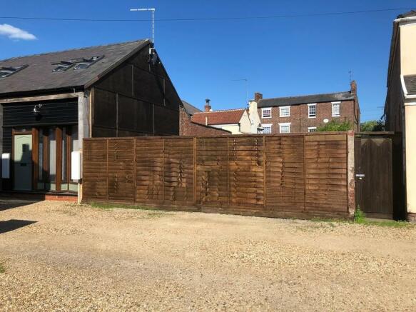
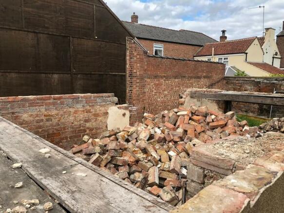
* Full Planning Consent granted for a pair of 2 bedroom cottages * Demolition work has been started and some materials are being offered/included with the site sale *
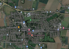
The site is situated off Victoria Street, a side street running between Albert Street and Barrington Gate, leading to High Street. It is within easy walking distance of all local amenities including Primary and Secondary Schools, Shops, Doctors, Pubs, and it lies close to the All Saints Church. Further facilities and secondary schools are located in the nearby towns of Spalding (7 miles). The population for Spalding is approximately 29,000 and the District of South Holland has a population of around 96,000 people (2020 figures from SHDC website).
Holbeach lies on the A151, and is just off the A17, giving good access to Kings Lynn (31 miles) and beyond to the North Norfolk coastal resorts.
DESCRIPTION
The whole site extends to approximately 130m², and the site offered for sale is shown edged red on the plan included in these Particulars (for identification purposes only). At the present time the building that existed on the site has been partly demolished, which we understand has enacted the planning consent. We are advised that an application has also been submitted for Building Control, although this is now out of date. The vendor renovated the adjacent properties in recent years, and is including some excess building materials from that development within this sale.
SERVICES
It is believed all mains services are available in the roadway. However, the Vendor nor the Agents make any guarantees as to the availability of services and interested parties must make their own enquiries direct with the service providers concerned as to the availability, practicality and cost of providing all necessary services to the site as required.
VAT
Not applicable.
PLANNING
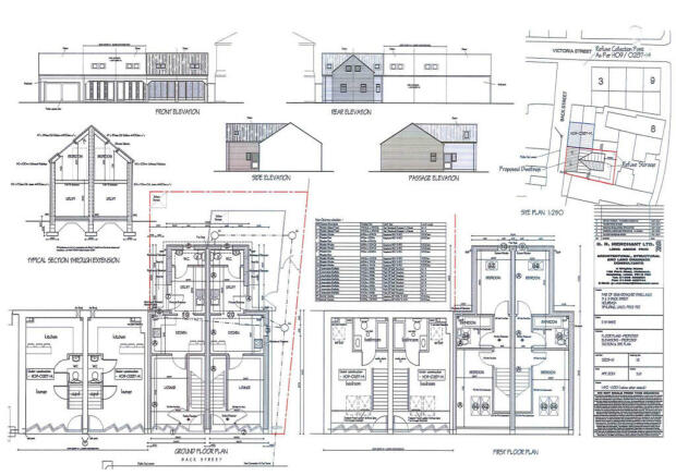
Full Planning Consent has been granted by South Holland District Council - Reference No. H09-0061-20 dated 26 March 2020 for the demolition of the existing cottage and its replacement with a pair of 2 bedroom cottages. The properties will each have a rear yard, accessed via a shared gate to the right hand side of the proposed cottages.
Prospective purchasers´ attention is drawn to the various conditions attached to the Planning Consent, and the purchaser will be responsible for all costs associated with fulfilling the Planning consent conditions.
A copy of the formal Planning Consent is available from the Council´s website: or from the Agent´s Spalding Office. Included in these Particulars is a copy of the plan determined on the Planning Applications which show the consented design of the dwellings. Any queries in respect of planning matters should be addressed direct to the Planning Department at South Holland District Council - CALL: .
VIEWING
By appointment only.
NB: The site is fenced off because it is uneven in part with differing ground levels and parties view the site at their own risk. Neither the Vendor nor the Agents accept any liability for any damage to persons or property by virtue of viewing the site.
Brochures
Green Lane, Holbeach, PE12 7BZ
NEAREST STATIONS
Distances are straight line measurements from the centre of the postcode- Spalding Station7.3 miles
Notes
Disclaimer - Property reference 101505013055. The information displayed about this property comprises a property advertisement. Rightmove.co.uk makes no warranty as to the accuracy or completeness of the advertisement or any linked or associated information, and Rightmove has no control over the content. This property advertisement does not constitute property particulars. The information is provided and maintained by Longstaff Chartered Surveyors, Spalding. Please contact the selling agent or developer directly to obtain any information which may be available under the terms of The Energy Performance of Buildings (Certificates and Inspections) (England and Wales) Regulations 2007 or the Home Report if in relation to a residential property in Scotland.
Map data ©OpenStreetMap contributors.


