Bourne Road, West Pinchbeck; PE10 0BD
- SIZE
Ask agent
- SECTOR
Farm land for sale
Description
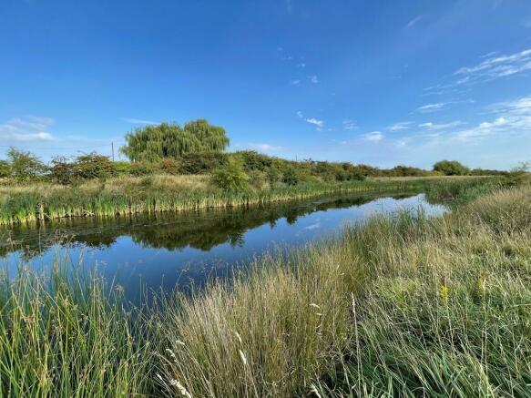
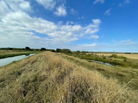
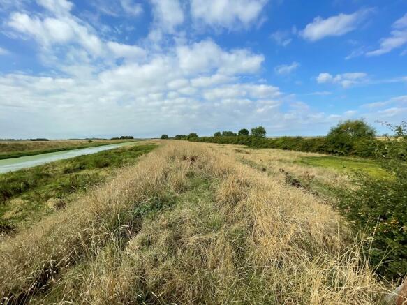
The land has been permanent grass for many years and includes the River Glen bank. It has the additional benefit of a number of ponds, an extensive and long river frontage to the River Glen and is fenced partially for stock. The total length of the road frontage is some 1.1 miles, running south westwards along the A151 parallel with the River Glen and ends a short distance east of Guthram Bridge.
The sale provides the opportunity to acquire mature grass which is very well sheltered from Bourne Road with a mixture of mature
hardwood trees including ash, birch and alder along with extensive mature roadside frontage with additional screening hedging. The environment created within the area of land for sale provides an ideal opportunity for those seeking an environmentally friendly property which offers considerable scope for a wide variety of compatible uses from traditional livestock grazing to other environmentally friendly pursuits subject of course to any necessary regulatory or other planning consent being obtained.
WAYLEAVES AND EASEMENTS
There is a single electricity pole with overhead wires which cross the south western end of Lot No. 2.
PUBLIC RIGHT OF WAY
We understand that there is a public right of way along the full length on top of the River Glen bank (of both Lots).
SPALDING FISHING CLUB
Spalding Fishing Club have certain prescribed access points from Bourne Road to access their fishing rights on the River Glen.
SOILS
The soils are of the Wallasea 2 series which are described as deep stoneless clayey soils, calcareous in places and some deep calcareous silty soils. The land is currently down to permanent grass and has been for many years.
LAND GRADE
According to the Land Classification Map of England and Wales, the majority of the land is Grade 2.
TENURE
The land is For Sale with the benefit of freehold tenure and vacant possession.
DRAINAGE RATES
Drainage Rates are payable to the Black Sluice IDB.
UPLIFT/OVERAGE CLAUSE
A previous Vendor reserved a right of overage/clawback/uplift payment of 30% of any increase in value that occurs as a consequence of planning consent being granted for a non-agricultural or non-equestrian use of any part of the land. The commencement is 21st February 2022 and therefore the 30 year term for this uplift clause runs to 22nd February 2052. A copy of the uplift clause provision is available and can be forwarded upon request from the Vendor´s Agents.
PLANS, AREAS AND SCHEDULE
The plans and areas have been prepared as accurately as reasonably possible and are based on the Ordnance Survey National Grid Plans 1 : 2500, 1 : 10000 and the Rural Land Registry 1 : 5000 scale plan. The plans included in these Particulars are published for convenience and / or identification only and although believed to be correct, the accuracy cannot be guaranteed. The purchaser(s) will be deemed to have satisfied himself / themselves as to the description and extent of the property and the ownership of the boundaries. Information regarding the areas of land are taken from computer based mapping system and reflect the Registered Title of the land. The plan contained within these Particulars is not to scale and is for identification purposes only. A copy of the Registered Title plan is also available for inspection subject to prior arrangement with the Vendor´s Agents.
Whilst all of this information is believed to be correct, the accuracy cannot be guaranteed. A purchaser/s will be deemed to have carried out such checks as they may wish to verify as to the description and the extent/area of the property now being offered for sale.
APPARATUS AND SERVICES
The Agents are not aware of any services connected to the land. If a purchaser/s requires services they should make their own specific enquiries direct to the relevant utility service providers as to the availability, cost and practicality of connection (if possible).
SCHEDULE
LOT No. 1. Area edged red on plan - 17.90 Acres, 7.2 Hectares
LOT No. 2. Area edged green on plan - 13.04 Acres, 5.27 Hectares
TOTAL: 30.94 Acres - 12.47 Hectares
GUIDE PRICE
Lot No. 1 £ 85,000 (Eighty-Five Thousand Pounds)
Lot No. 2 £ 62,000 (Sixty-Two Thousand Pounds)
VIEWING
Viewing may take place at any time with a set of these Sale Particulars to hand. However, it is vitally important that the following matters are strictly adhered to:-
The land is stocked from time to time, particularly with cattle (although not at present). Livestock can be dangerous and you are advised to take great care when entering any parts of the land - you enter entirely at your own risk. Please do not take any dogs with you as these can aggravate cattle and cause significant problems
The A151 (Bourne Road) is a busy road and you should exercise extreme care upon parking and leaving the various gateways.
Brochures
Bourne Road, West Pinchbeck; PE10 0BD
NEAREST STATIONS
Distances are straight line measurements from the centre of the postcode- Spalding Station4.3 miles
Notes
Disclaimer - Property reference 101505014232. The information displayed about this property comprises a property advertisement. Rightmove.co.uk makes no warranty as to the accuracy or completeness of the advertisement or any linked or associated information, and Rightmove has no control over the content. This property advertisement does not constitute property particulars. The information is provided and maintained by Longstaff Chartered Surveyors, Spalding. Please contact the selling agent or developer directly to obtain any information which may be available under the terms of The Energy Performance of Buildings (Certificates and Inspections) (England and Wales) Regulations 2007 or the Home Report if in relation to a residential property in Scotland.
Map data ©OpenStreetMap contributors.


