Marshes at Haddiscoe Island
- PROPERTY TYPE
Land
- SIZE
3,702,600 sq ft
343,983 sq m
Key features
- 34.40 Ha (85.00 Acres) Grazing Marshes
- For Sale by private treaty as a whole
- 6 interconnecting grazing marshes
- River wall and reedbeds
- Access track & a handling facility
Description
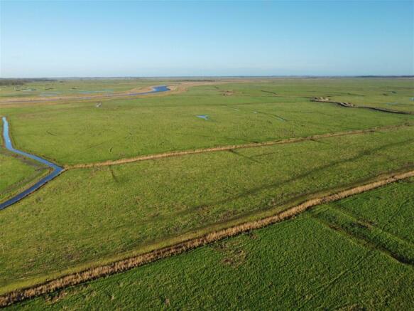
34.40 Ha (85.00 Acres) Grazing Marshes
Situation
The land is situated on the renowned Haddiscoe Island in Norfolk on the edge of the Norfolk Broads.
The Land
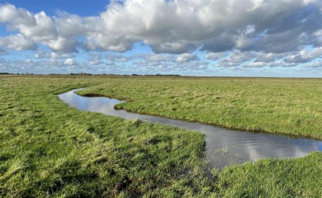
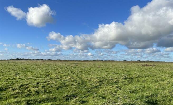
6 interconnecting grazing marshes extending to 29.88 Ha (73.83 Acres) together with 4.15 Ha (10.25 Acres) of river wall and reedbeds, with the balance being the access track. This block of marshes has its own access from the main access road at the south of the Island, and a handling facility. The marshes have a long frontage onto the river wall against the River Yare and with full sporting rights being included, the reedbeds create an exciting wildfowling opportunity with the marshes generating income from grazing and Countryside Stewardship. The grazing has been let on seasonal grazing agreements for a number of years and is always highly sought after.
For Sale
By private treaty as a whole.
Access
The land is accessed from New Cut Bank Road off the A143. Follow New Cut Bank Road and turn right under the bridge and follow the concrete road (owned and maintained by the Internal Drainage Board (IDB)). Drive past the farmhouse and the land will be found on the right hand side at the end of the concrete road.
Location
Closest postcode (Marsh Farmhouse): NR31 9HY
Exit A143 at ///opened.remembers.belief
Entrance to marshes ///pointed.joyously.drilled
Environmental Schemes
The land is within a Countryside Stewardship agreement which commenced on 1st January 2022 for 5 years. The management options are GS10 and GS2. The agreement benefitted in changes to payment rates announced on 1st January 2024 and the annual payment is £14,281. The agreement will be transferred to the purchaser upon completion. Further details are available upon request.
BPS and Entitlements
The Vendor claimed, and will retain, the 2023 BPS payment, as well as the de-linked payments.
Assessments
A land drainage charge is payable to IDB.
Sporting, Mineral and Timber Rights
All sporting and timber rights are included within the sale of the freehold, as are the mineral rights insofar as they are owned.
Wayleaves, Easements and Rights of Way
The property is offered subject to and with the benefit of all Rights of Way, whether public or private, all wayleaves, easements and other rights whether specifically referred to herein or not. A public footpath runs along the river wall. The adjoining marshes to the south and east have rights of access over the track.
Services
No services are connected.
Tenure
Freehold with vacant possession upon completion.
VAT
Should any sale of the land or any right attached to it become a chargeable supply for the purposes of VAT, such tax shall be payable by the purchaser in addition to any other sums.
Viewing
With particulars in hand during daylight hours.
Selling Agent
Rachael Hipperson
Vendor’s Solicitor
Hansells Solicitors - Yvonne Benner
Brochures
Brochure 1Marshes at Haddiscoe Island
NEAREST STATIONS
Distances are straight line measurements from the centre of the postcode- Haddiscoe Station1.9 miles
- Reedham (Norfolk) Station1.6 miles
- Somerleyton Station3.9 miles
Notes
Disclaimer - Property reference S755695. The information displayed about this property comprises a property advertisement. Rightmove.co.uk makes no warranty as to the accuracy or completeness of the advertisement or any linked or associated information, and Rightmove has no control over the content. This property advertisement does not constitute property particulars. The information is provided and maintained by TW Gaze, Wymondham. Please contact the selling agent or developer directly to obtain any information which may be available under the terms of The Energy Performance of Buildings (Certificates and Inspections) (England and Wales) Regulations 2007 or the Home Report if in relation to a residential property in Scotland.
Map data ©OpenStreetMap contributors.


