Land at, Redberth, Tenby
- PROPERTY TYPE
Land
- SIZE
4,138,200 sq ft
384,452 sq m
Description
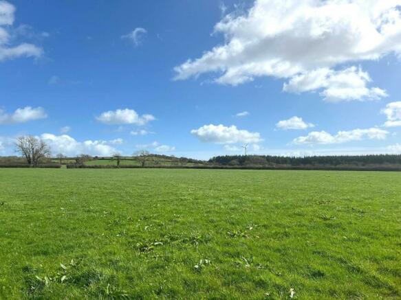
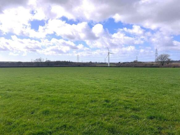
Ideally suited for grazing and cropping, being within a belt of early, productive land.
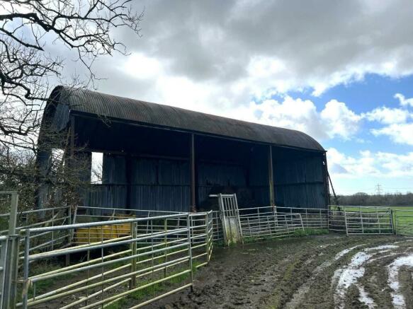
Well fenced and gated. Includes a small hayshed.
Situation: - This parcel of land occupies a most convenient location in the heart of the south Pembrokeshire countryside, between the villages of Sageston and Redberth and within easy reach of the coastal resorts of Tenby and Saundersfoot, and the towns of Pembroke, Pembroke Dock and Kilgetty, which between them offer an extensive range of services and facilities.
Agriculturally this is a belt of land renowned for its capacity and productivity with land use in the locality, including livestock, dairy and arable farms.
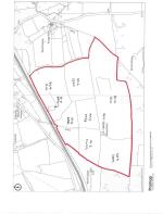
Description: - A plan of the land is attached for identification purposes only.
The land extends in total to some 95 acres or thereabouts, being accessed off the A477 by an inset gateway that provides off road parking for several vehicles. The gateway opens into a compacted stone track that provides access to several of the fields.
The land is all level, clean and productive pasture capable of growing good grass crops and has most recently being used for grazing and cropping. It is also equally suited for arable use being relatively free draining and is located within a belt of early land.
The land is well fenced both internally and around the boundary and is divided into easily worked enclosures with gates at strategic points that enable the land to be effectively managed. At the centre of the land is a small area that includes a 3 bay steel portal frame CGI and open fronted shed. This shed has been used for general storage and a handling area. Please note: Some of the equipment may be removed and is not included in the sale.
Services: - Mains water is connected. A meter is located on the opposite side of the A477 and a right of way to this will be reserved.
TENURE: The land is Freehold of tenure and vacant possession will be available upon completion.
Basic Payments - There are no Basic Payments included within the sale.
Local Authority - Pembrokeshire County Council, County Hall, Haverfordwest, Pembrokeshire
Tel:
Website:
General Remarks: - This is an opportunity to acquire a conveniently located block of highly productive agricultural land with access off the A477 and being suitable for all agricultural purposes, being within an early belt of land. In recent years, this is a block of land that has been used for grazing and cropping, but it could also be used for arable purposes if required.
The access off the A477 will no doubt be of interest to some potential purchasers as this may offer the potential for alternative use on the land, particularly as there is an existing building on site. The access is inset on compacted stone and has excellent visibility onto the main road, although any alternative use would be subject to the necessary consents being obtained.
The Land: - Schedule of Areas
Field No.Area
78593.41
66443.10
60274.89
74350.06
87452.66
013113.18
09534.66
01716.35
91600.13
38.44 x 2.47 = 94.94 acres of thereabouts
Brochures
Land at, Redberth, TenbyBrochureLand at, Redberth, Tenby
NEAREST STATIONS
Distances are straight line measurements from the centre of the postcode- Manorbier Station2.9 miles
- Saundersfoot Station3.0 miles
- Kilgetty Station3.5 miles
Notes
Disclaimer - Property reference 33061456. The information displayed about this property comprises a property advertisement. Rightmove.co.uk makes no warranty as to the accuracy or completeness of the advertisement or any linked or associated information, and Rightmove has no control over the content. This property advertisement does not constitute property particulars. The information is provided and maintained by JJ Morris, Haverfordwest. Please contact the selling agent or developer directly to obtain any information which may be available under the terms of The Energy Performance of Buildings (Certificates and Inspections) (England and Wales) Regulations 2007 or the Home Report if in relation to a residential property in Scotland.
Map data ©OpenStreetMap contributors.


