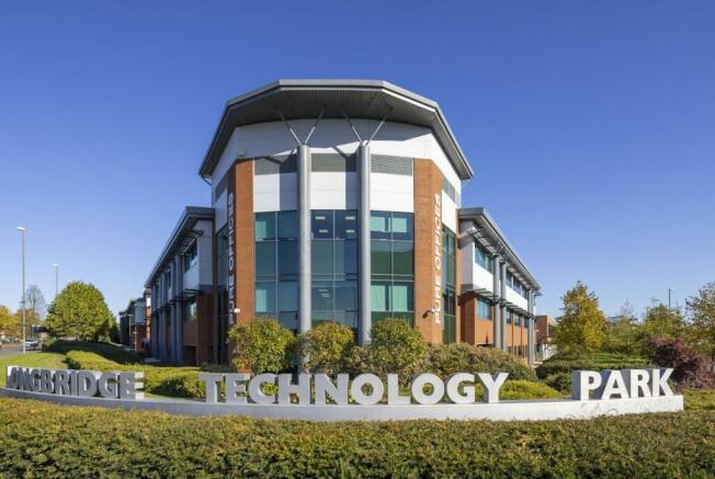
Longbridge Business Park, Longbridge, Birmingham, B31 2TS
- SIZE AVAILABLE
30,000-190,000 sq ft
2,787-17,652 sq m
- SECTOR
Light industrial facility for sale
Key features
- Leasehold or Freehold Opportunities
- Land Plots up to 8 acres available
- Build to Suit Buildings up to 190,000 sq ft
- Direct access to A38
- Excellent public transport links
Description
With a £20million investment in infrastructure, and a brand new multi-million-pound public realm, Longbridge Business Park offers unrivalled freehold
and leasehold opportunities to businesses of all sizes across the manufacturing, R&D, healthcare and medical sectors.
There is huge scope for investment for headquarter-style statement buildings, high-tech manufacturing hubs, R&D labs and multi-purpose office blocks and with global businesses such as AllSee Technologies, IVC-Evidensia, Sterling Pharma and Waters Corporation having already purchased, and with a sustainable neighbourhood in development, there’s never been a better time to invest in Longbridge.
Brochures
Longbridge Business Park, Longbridge, Birmingham, B31 2TS
NEAREST STATIONS
Distances are straight line measurements from the centre of the postcode- Longbridge Station0.3 miles
- Northfield Station1.2 miles
- Kings Norton Station2.5 miles
Notes
Disclaimer - Property reference 75414-1. The information displayed about this property comprises a property advertisement. Rightmove.co.uk makes no warranty as to the accuracy or completeness of the advertisement or any linked or associated information, and Rightmove has no control over the content. This property advertisement does not constitute property particulars. The information is provided and maintained by Avison Young (UK) Limited, Avison Young Industrial 2. Please contact the selling agent or developer directly to obtain any information which may be available under the terms of The Energy Performance of Buildings (Certificates and Inspections) (England and Wales) Regulations 2007 or the Home Report if in relation to a residential property in Scotland.
Map data ©OpenStreetMap contributors.


