Santon Bridge, Holmrook, Cumbria
- PROPERTY TYPE
Land
- SIZE
2,370,100 sq ft
220,190 sq m
Description
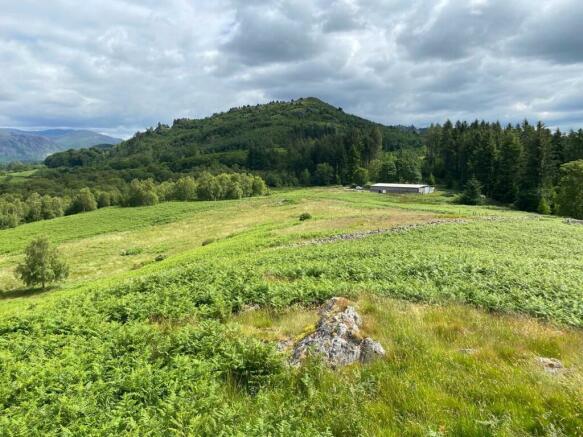
The land is divided by dry-stone walling and internal post and netting fencing providing easy access for a vehicle to all field enclosures. This parcel has stock proof boundaries and natural water supplied from various watercourses and Stony Beck. The land enjoys a right of access leading from Bowerhouse Bank Road via the hardcore track to two double gated access points.
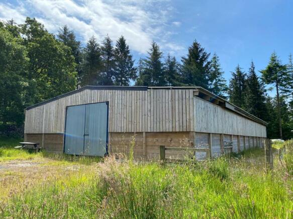
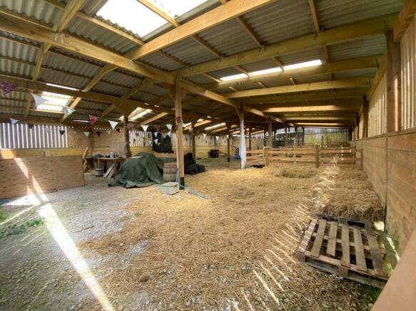
The land benefits from a substantial timber framed agricultural building with fibre cement roof and Yorkshire board cladding to timber panels to the sides. Internally the building had been divided by timber railings and has part earth and concrete floor.
Given the excellent location this block of land is ideal for a wide range of purchasers including local land owners, agricultural purchasers, investors and those with lifestyle and amenity interests looking to purchase a unique piece of land.
What3words: ///units.motels.riverbank
Brochures
ParticularsSanton Bridge, Holmrook, Cumbria
NEAREST STATIONS
Distances are straight line measurements from the centre of the postcode- Drigg Station3.4 miles
- Ravenglass for Eskdale Station3.4 miles
- Seascale Station4.8 miles
Our aim is to provide bespoke and pro-active advice. We not only have traditional values and working methods available to us, but also our up-to-date technology and forward thinking which allows us to provide a truly tailored service to our clients through a good understanding of their needs.
Our Clients vary from private individuals through to large corporate companies and as an independent practice of Property Consultants we are full members of the Royal Institution of Chartered Surveyors (RICS) and the Central Association of Agricultural Valuers (CAAV).
The company has exceptionally strong agricultural connections which have grown from the original business and now exist throughout the Rural Property sector within North West of England, working from offices in Kendal, Garstang and Burscough. In addition to this highly visible agricultural connection, Armitstead Barnett now operates throughout the entire rural property sector which itself is a niche market.
Our HistoryArmitstead Barnett has roots dating back to 1890 and we are exceptionally proud of our rich heritage. Over the years we have learned to adapt and change with the times. We are a multi-disciplinary business working with land and property in the rural and village sector.
1890 is when Thomas Armitstead (the great grandfather of Mr Geoffrey Armitstead) purchased a business then known as Corbishley.
Notes
Disclaimer - Property reference KEN240115. The information displayed about this property comprises a property advertisement. Rightmove.co.uk makes no warranty as to the accuracy or completeness of the advertisement or any linked or associated information, and Rightmove has no control over the content. This property advertisement does not constitute property particulars. The information is provided and maintained by Armitstead Barnett, Cumbria. Please contact the selling agent or developer directly to obtain any information which may be available under the terms of The Energy Performance of Buildings (Certificates and Inspections) (England and Wales) Regulations 2007 or the Home Report if in relation to a residential property in Scotland.
Map data ©OpenStreetMap contributors.


