Hempstead Road, CB9
- SIZE
Ask agent
- SECTOR
Land for sale
Key features
- Outline planning permission granted for 5 market dwellings (with matters of appearance, layout and landscaping reserved)
- Located to the south of Steeple Bumpstead village
- Approximately 4 miles to Haverhill, 10 miles to Saffron Walden, 19 miles to Cambridge and 58 miles to London
Description
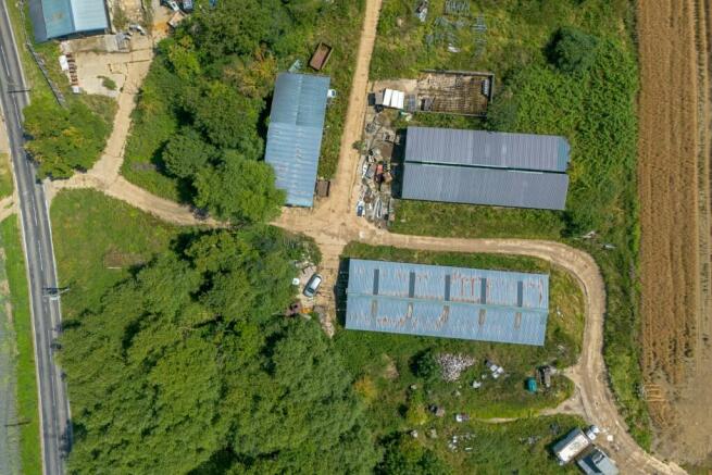
The land extends to approximately 0.49 hectares/ 1.20 acres and is located to the southwest of Steeple Bumpstead, Haverhill, Essex. Outline planning permission has been granted for 5 market residential dwellings and the demolition of redundant agricultural buildings, with matters of appearance, layout and landscaping reserved.
LOCATION
The site is located southeast of the village of Steeple Bumpstead, on the B1054, just a
mile to the village centre.
The thriving village of Steeple Bumpstead is set in a picturesque rural location but within close proximity to larger towns of Saffron Walden, Sudbury and Cambridge. There are several local services all within reasonable walking distance of the site and also two village pubs, post office, convenience store, a pre-school, primary school, a library, and an antiques shop. The market town of Haverhill is nearby and can provide a range of wider facilities and services.
The site is located approximately 4 miles south of Haverhill, 10 miles east of Saffron Walden and 24 miles from Bury St Edmunds. There are bus links within the village offering connections to nearby Towns. Audley End train station has direct rail services to Cambridge, Stansted Airport and London Liverpool Street. Additionally, Braintree and Stansted Airport Train Stations are both commutable.
THE SITE
The site is accessed from the B1054 and forms part of a larger agricultural farm. The site
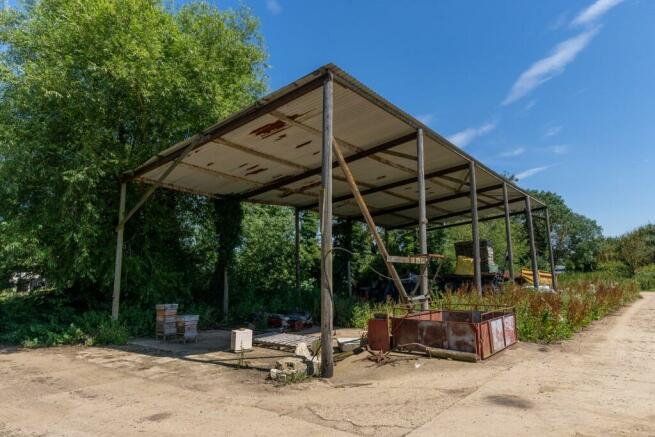
comprises former agricultural buildings that are no longer utilised by the farm, along with a farm track. The site is surrounded by farmland, with the B1054 on the northern boundary and the existing farmyard and farmhouse on the eastern boundary. The access to the site sits within Braintree District Council and the remainder of the site is within Uttlesford District Council.
PLANNING
As the site is cross border between Uttlesford and Braintree District Councils, applications were made to both Councils. Outline planning permission was granted by Uttlesford on 3rd May and Braintree on 14th May. The Braintree application includes full approval for the access and scale. Both decision notices grant outline planning permission with all matters reserved, apart from access and scale for the erection of 5 dwellings and associated work and the demolition of the redundant agricultural buildings. The Uttlesford and Braintree District Council planning application reference numbers are UTT/23//2576/OP and 23/02580/OUT respectively.
The planning permission includes pre-implementation and pre-occupation conditions. Please see the additional information pack for details of the planning permission and drawings.
The proposed combined floor area across all 5 properties is 668.60 sq m GIA (7,194 sq ft). Externally, the individual plots have their own front and rear gardens and car parking in the form of new cart lodges for all units. The proposed cart lodges have a combined floor area of 249 sqm (2,679 sqft). The application proposes to utilise the existing access from the B1054, although with minor improvements.
ACCESS
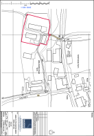
Access to the land will be via the existing access off the B1054 as proposed by the approved highways drawings. The Vendor will retain the accessway hatched in brown, although will grant a right of access for the Purchaser for all purposes and the right to upgrade.
TECHNICAL INFORMATION
Full details on technical aspects regarding the site are contained in the additional information pack. We advise that all interested parties make themselves fully aware of the reports and the content therein.
TENURE AND OCCUPATION
The land is available freehold with vacant possession.
OVERAGE
Offers are invited to include overage provisions for any enhanced planning permission in excess of the 5 dwellings secured. The particulars terms of which are to be negotiated.
Brochures
Hempstead Road, CB9
NEAREST STATIONS
Distances are straight line measurements from the centre of the postcode- Audley End Station9.9 miles
Notes
Disclaimer - Property reference RVC-RAN2529-224286. The information displayed about this property comprises a property advertisement. Rightmove.co.uk makes no warranty as to the accuracy or completeness of the advertisement or any linked or associated information, and Rightmove has no control over the content. This property advertisement does not constitute property particulars. The information is provided and maintained by Sworders, Hertfordshire. Please contact the selling agent or developer directly to obtain any information which may be available under the terms of The Energy Performance of Buildings (Certificates and Inspections) (England and Wales) Regulations 2007 or the Home Report if in relation to a residential property in Scotland.
Map data ©OpenStreetMap contributors.


