Zoar, St Keverne, Helston
- PROPERTY TYPE
Land
- SIZE
Ask agent
Key features
- Lot 2 - 15.68 acres
- Lot 1 - Former chapel site available separately
Description
Lot 1: Former chapel site, extending to approximately 0.16 acres.
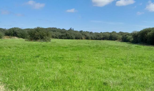
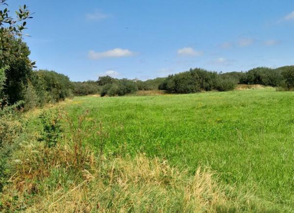
Lot 2: Approximately 15.68 acres (1½ acres of grassland and the remainder being unspoilt natural habitat and moorland.
The Land
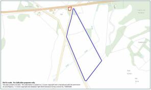
Lot 1 - (edged red) Guide Price £20,000
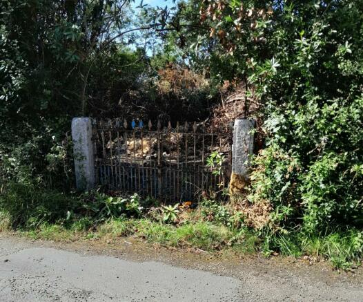
The site of the former Zoar Chapel extending to approximately 0.16 acres. The site directly adjoins the main Helston to St Keverne road and is surrounded by maturing shrubs and trees.
Lot 2 - (edged blue) Guide Price £70,000
The land extends in all to approximately 15.68 acres divided into three enclosures. The two most southerly enclosures comprise unspoilt moorland and are designated Site of Special Scientific Interest. The remaining enclosure to the north is a mixture of pasture land extending to approximately 1.5 acres, the remainder being a mixture of natural habitat and maturing trees.
Property Information
Agent's Note: We hereby disclose in accordance with the 1979 Estate Agents Act that the owners of this property are related to a member of Lodge & Thomas staff.
Special Condition: Lot 1 is subject to an Uplift or Overage Clause whereby, if for a period of 20 years, planning permission is obtained on the land for residential development, the vendors or their successors are to receive 30% of the uplift in value resulting from the planning permission. The vendors' solicitors to provide the necessary Clause within the Sale Contract. For the avoidance of doubt, planning for any agricultural building will not trigger the overage.
Services: None connected to either lot. Interested parties are advised to make their own enquiries of the appropriate statutory undertakers: National Grid: ; South West Water: ; Wales and West Utilities:
Wayleaves, Easements & Rights of Way: The sale will be subject to and with the benefit of all wayleaves, easements and rights of way as may exist.
Particulars & Plan
Whilst every care is taken in the preparation of these particulars, their accuracy is not guaranteed and they do not constitute any part of an offer or contract. Any intending purchaser/s must satisfy themselves by inspection or otherwise as to the correctness of these particulars.
Location
The former chapel and land are located between Goonhilly Downs and St Keverne adjoinging the B3293 and approximately 9 miles from Helston. The village of St Keverne lies approximately 3 miles to the east and has a good range of facilities including shops, church, public houses, junior schooling and doctors surgery. The surrounding area is predominantly open, unspoilt farm and moorlands. Approximately 2½ miles to the south-east lies the picturesque coastal village of Coverack with its harbour and beach and access to the South West Coast Path.
Viewing & Directions
Viewers may access the land for viewing purposes with sale particulars in hand, during daylight hours adhering to the Countryside Code. Please notify the agents Lodge & Thomas of your intended visit. Tel: Email:
Directions
Lot 1 - what3words///launched.players.crusaders
Lot 2 - what3words///harshest.tweeted.chill
Brochures
Brochure 1Zoar, St Keverne, Helston
NEAREST STATIONS
Distances are straight line measurements from the centre of the postcode- Penmere Station8.1 miles
Notes
Disclaimer - Property reference LAT221357b. The information displayed about this property comprises a property advertisement. Rightmove.co.uk makes no warranty as to the accuracy or completeness of the advertisement or any linked or associated information, and Rightmove has no control over the content. This property advertisement does not constitute property particulars. The information is provided and maintained by Lodge & Thomas, Truro. Please contact the selling agent or developer directly to obtain any information which may be available under the terms of The Energy Performance of Buildings (Certificates and Inspections) (England and Wales) Regulations 2007 or the Home Report if in relation to a residential property in Scotland.
Map data ©OpenStreetMap contributors.


