Greening Road, Rothwell
- PROPERTY TYPE
Land
- SIZE
2,022 sq ft
188 sq m
Key features
- Building Plot
- Planning Approved for 1 no. three bedroom detached dwelling house
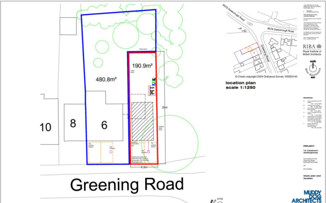
- Total site area c.190.9 sq.m (2055 sq.ft)
- Popular and established part of town
- All planning information available on request
- Drop Kerb already in place
Description
- Reference NK/2024/0191
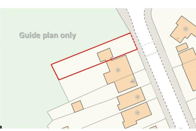
Total site area c.190.9 sq.m (2055 sq.ft)
Garage currently located on the site will be cleared by the seller and DROP KERB already in place
Documents available on request;
1. NNC Environmental Health Response 25/06/2024 2. NNC Highways Response 27/06/2024 3.NNC Waste Response 24/06/2024 4. Nature Space Partnership Response 03/07/2024 5 . NNC Archaeology Response 09/07/2024 6. Application Form 24/07/2024 7. Location Plan & Block Plan (A00268-001F) 29/07/2024 8. Nature Space Partnership Response 12/08/2024 9. NNC Waste Response 12/08/2024 10. NNC Highways Response 15/08/202 11. Proposed Elevations (A00268-013E) 29/08/2024 12. Proposed Floor Plans (A00268-012E) 29/08/2024 13. Officer's Report 14. Notice of Approval 18/09/2024
Brochures
Greening Road, RothwellBrochureGreening Road, Rothwell
NEAREST STATIONS
Distances are straight line measurements from the centre of the postcode- Kettering Station4.0 miles
- Market Harborough Station5.6 miles
Notes
Disclaimer - Property reference 33417709. The information displayed about this property comprises a property advertisement. Rightmove.co.uk makes no warranty as to the accuracy or completeness of the advertisement or any linked or associated information, and Rightmove has no control over the content. This property advertisement does not constitute property particulars. The information is provided and maintained by Simon & Co, Rothwell. Please contact the selling agent or developer directly to obtain any information which may be available under the terms of The Energy Performance of Buildings (Certificates and Inspections) (England and Wales) Regulations 2007 or the Home Report if in relation to a residential property in Scotland.
Map data ©OpenStreetMap contributors.


