Rural Peasmarsh, East Sussex TN31

- PROPERTY TYPE
Equestrian Facility
- SIZE
196,020 sq ft
18,211 sq m
- TENUREDescribes how you own a property. There are different types of tenure - freehold, leasehold, and commonhold.Read more about tenure in our glossary page.
Freehold
Key features
- 4.5 Acre (tbv) Equestrian Property
- Superb Facilities Including 7 Stables & Associated Stores
- Floodlit Fibre Mat Manege.
- Ample Parking & Storage
- Tucked Away Location, Outskirts Of The Village
- Further 6.6 Acres Of Land By Separate Negotiation
Description
* 4.5 Acres (approx.) of Paddocks.
* Several individual Timber Stable Blocks
* Tack Room, Feed Store & Field Shelters
* Quiet Lane Location
* Floodlit manege
* Private Gated Access from a quiet lane with CCTV & alarm system
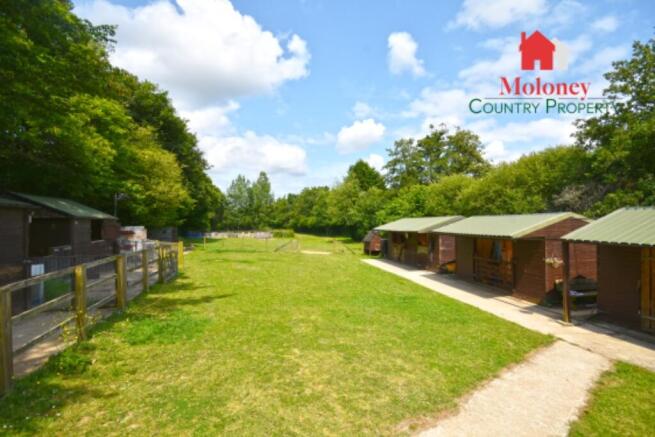
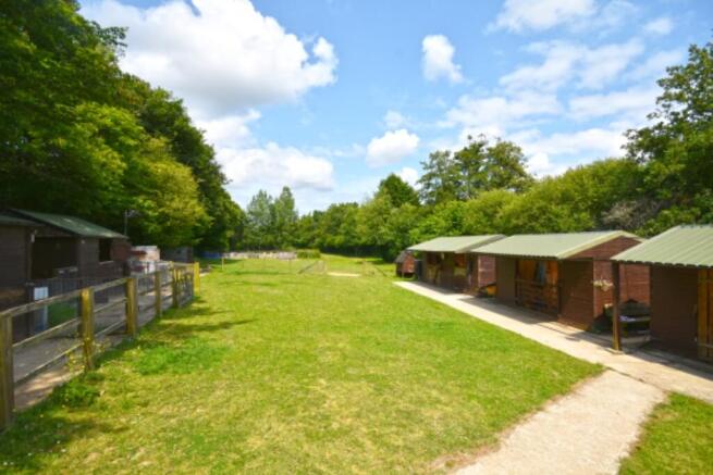
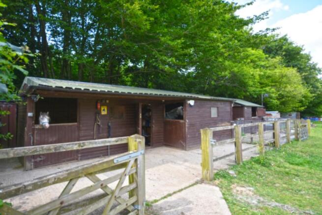
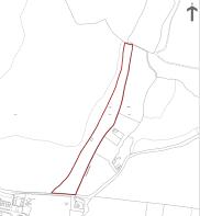
Accessed by an unmade track off a single track country lane, the property comprises just under 4.5 acres (1.82ha.) of grazing land, divided into several paddocks accessed via a five-bar gate, comprising 7 stables, tack room, feed and hay stores and field shelters providing further stabling if required, along with a floodlit 40m x 20m (44 x 22 yds) manege and open fronted 5 bay barn.
The land is approached via a five-bar gate
Paddock One: A five-bar gate opens to:
PADDOCK TWO: Timber field shelter, 3.65m x 2.44m (12' x 8') which can be used as additional stabling. Ample parking and trailer/box storage area. A further gate leads to the:
Main Stable Area: Comprising a gated yard, with 2 stables, 3.65m x 3.65m (12'0 x 12'0) & 4.35m x 3.65m (14'0 x 12'0), tack room & separate stable 3.65m x 3.65m (12'0 x12'0).
Access to a starvation paddock with shelter
Metal feed store
Water Storage
Caravan - used as kitchen & seating area
Second Stable Area: Two 3.65m x 3.65m (12'0 x 12'0) stables, a gated box with internal storage, 4.88m x 3.65m (16'0 x 12'0).
Separate Store/ Stabling: 7.31m x 3.65m (24'0 x 12'0).
manege: Floodlit 40m x 20m (44 x 22 yds) Fibre mat manege.
Gate giving access to a further paddock, with a 5 bay open fronted barn - 15m x 5m, which can be easily divided.
Available by separate negotiation: A further 6.6 acres (2.67 ha.), located along the lane, divided into paddocks, currently providing a hay crop with 2 lockable containers, one providing kitchen and seating area, with a central covered store. This land also provides extra grazing and has amenity use potential (stp) It also enjoys a 'right of way' to Stream Lane.
Services: Mains water and electricity connected.
Area: 4.5 acres (1.82 ha.) Approx.
EPC Rating: 'N/A'
Local Authority: Rother District Council.
Business RAteable value: 'TBC'
Tenure: Freehold
Transport Links: For the commuter, Staplehurst and Headcorn stations provide services via Tonbridge to London Charing Cross, whilst Ashford International provides a fast service to St. Pancras and Europe. The Motorway network (M20) can be easily accessed at Junction 8 via the A274/B2163 (at Leeds Castle).
Directions: Travelling south on the A268 towards Rye through Peasmarsh turn left into The Maltings. At the junction take the single track lane to the left of the business park. Continue along this lane, Woodside Stables will be found on the left, through the metal gate.
What3Words (Location): ///diner.impeached.stables
- COUNCIL TAXA payment made to your local authority in order to pay for local services like schools, libraries, and refuse collection. The amount you pay depends on the value of the property.Read more about council Tax in our glossary page.
- Ask agent
- PARKINGDetails of how and where vehicles can be parked, and any associated costs.Read more about parking in our glossary page.
- Yes
- GARDENA property has access to an outdoor space, which could be private or shared.
- Yes
- ACCESSIBILITYHow a property has been adapted to meet the needs of vulnerable or disabled individuals.Read more about accessibility in our glossary page.
- Ask agent
Energy performance certificate - ask agent
Rural Peasmarsh, East Sussex TN31
Add your favourite places to see how long it takes you to get there.
__mins driving to your place
About Moloney Country Property, Northiam
Estate Office, The Village Green, Main Street, Northiam, TN31 6ND


Your mortgage
Notes
Staying secure when looking for property
Ensure you're up to date with our latest advice on how to avoid fraud or scams when looking for property online.
Visit our security centre to find out moreDisclaimer - Property reference 011357. The information displayed about this property comprises a property advertisement. Rightmove.co.uk makes no warranty as to the accuracy or completeness of the advertisement or any linked or associated information, and Rightmove has no control over the content. This property advertisement does not constitute property particulars. The information is provided and maintained by Moloney Country Property, Northiam. Please contact the selling agent or developer directly to obtain any information which may be available under the terms of The Energy Performance of Buildings (Certificates and Inspections) (England and Wales) Regulations 2007 or the Home Report if in relation to a residential property in Scotland.
*This is the average speed from the provider with the fastest broadband package available at this postcode. The average speed displayed is based on the download speeds of at least 50% of customers at peak time (8pm to 10pm). Fibre/cable services at the postcode are subject to availability and may differ between properties within a postcode. Speeds can be affected by a range of technical and environmental factors. The speed at the property may be lower than that listed above. You can check the estimated speed and confirm availability to a property prior to purchasing on the broadband provider's website. Providers may increase charges. The information is provided and maintained by Decision Technologies Limited. **This is indicative only and based on a 2-person household with multiple devices and simultaneous usage. Broadband performance is affected by multiple factors including number of occupants and devices, simultaneous usage, router range etc. For more information speak to your broadband provider.
Map data ©OpenStreetMap contributors.


