Chalk Lane, Narborough
Business rates & charges may apply

- SIZE
Ask agent
- SECTOR
Land for sale
Key features
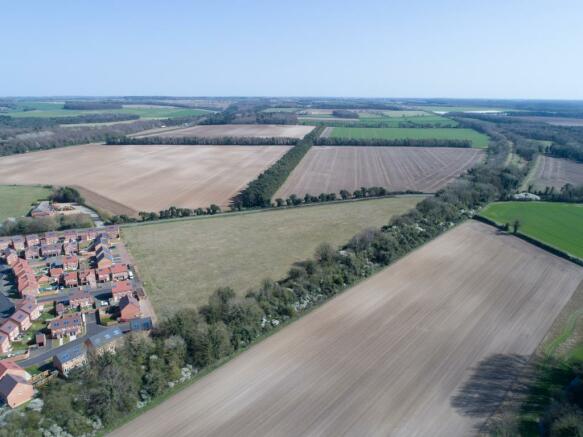
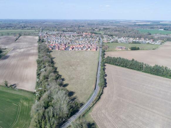
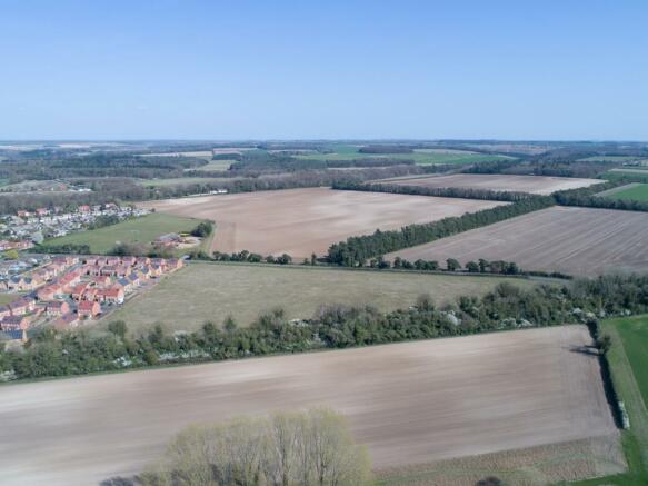
- The land extends in all to 1.91 hectares (4.72 acres) and is currently used for arable cropping. It is bordered to the south by arable farmland; a railway embankment on the western boundary with Chalk
- The land has the benefit of Outline Planning Consent for the erection of 40 residential dwellings; Breckland Planning Reference Number 3PL/2015/1180/O.
Description
The land has the benefit of Outline Planning Consent for the erection of 40 residential dwellings; Breckland Planning Reference Number 3PL/2015/1180/O.
Brochures
Chalk Lane, Narborough

NEAREST STATIONS
Distances are straight line measurements from the centre of the postcode- Watlington Station8.5 miles
About Cruso & Wilkin, Land & Commercial
The Estate Office, Church Farm, Station Road, Hillington, PE31 6DH
We have been advising on the purchase, sale and management of commercial property since 1756. We work very closely with our clients to meet their business requirements, whether they are looking to buy, sell, rent or manage commercial property. As a local agent, we operate across West Norfolk, Cambridgeshire, South Lincolnshire, as well as across other areas of Norfolk and East Anglia.
Our team are highly experienced in dealing with commercial property of all types and can adapt t
Notes
Disclaimer - Property reference 12385323_8705188. The information displayed about this property comprises a property advertisement. Rightmove.co.uk makes no warranty as to the accuracy or completeness of the advertisement or any linked or associated information, and Rightmove has no control over the content. This property advertisement does not constitute property particulars. The information is provided and maintained by Cruso & Wilkin, Land & Commercial. Please contact the selling agent or developer directly to obtain any information which may be available under the terms of The Energy Performance of Buildings (Certificates and Inspections) (England and Wales) Regulations 2007 or the Home Report if in relation to a residential property in Scotland.
Map data ©OpenStreetMap contributors.