
Wellgate, Kirriemuir, Angus, DD8

- PROPERTY TYPE
Land
- BEDROOMS
1
- SIZE
Ask agent
Key features
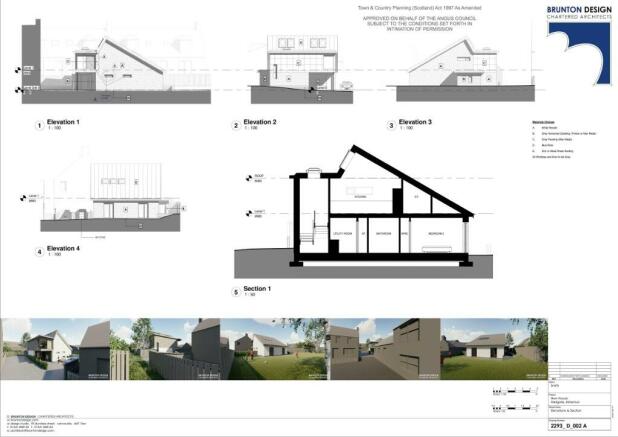
- Ideal Development opportunity
- Full planning for 1 Dwelling
- Quiet Location
Description
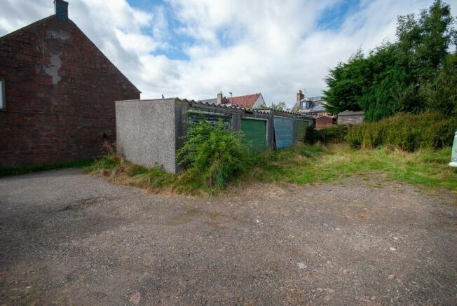
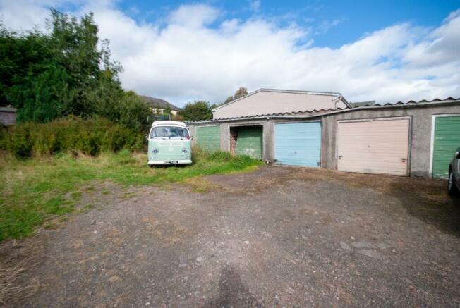
Development site with full planning for construction of one dwelling house. The site currently has 10 single lockups which would require demolition prior to construction . Alternatively the lock ups could be reinstated to provide a substantial rental income. The Architects drawings are available on our website or though Angus Council Planning ref. 19/00730/Full.
The site is accessed from Glengate in Kirriemuir which is within walking distance to the Town centre and all amenities .
EPC rating: D.Wellgate, Kirriemuir, Angus, DD8

NEAREST STATIONS
Distances are straight line measurements from the centre of the postcode- Dundee Station15.1 miles

About the agent
Wardhaugh Property, Arbroath
155 High Street, Arbroath, DD11 1DR
With over 50 years experience and extensive local knowledge, we help residential and commercial clients across the region, and we'd like to do the same for you. Why not request a free consultation now?
You wouldn't use an unlicensed dentist, electrician or doctor - so why use an unlicensed letting agent? For your complete peace of mind, Wardhaugh Property is a fully approved member of ARLA, the Property Ombudsman, and the Council of Letting Agents
Notes
Disclaimer - Property reference P1515. The information displayed about this property comprises a property advertisement. Rightmove.co.uk makes no warranty as to the accuracy or completeness of the advertisement or any linked or associated information, and Rightmove has no control over the content. This property advertisement does not constitute property particulars. The information is provided and maintained by Wardhaugh Property, Arbroath. Please contact the selling agent or developer directly to obtain any information which may be available under the terms of The Energy Performance of Buildings (Certificates and Inspections) (England and Wales) Regulations 2007 or the Home Report if in relation to a residential property in Scotland.
Map data ©OpenStreetMap contributors.