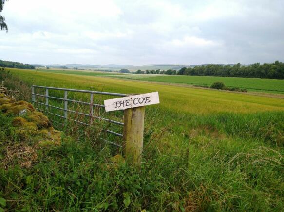
Land at The Coe, The Coe, Menmuir, Brechin, Scotland, DD9
- PROPERTY TYPE
Land
- SIZE
3,528,360 sq ft
327,796 sq m
Description
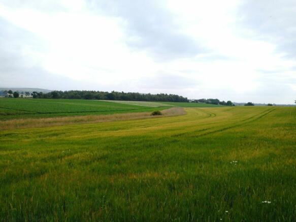
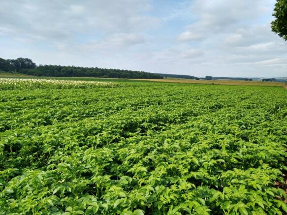
The land at The Coe lies within the renowned angus farming area and extends to 81 acres or thereby.
**Closing Date - Thursday 22nd February 2024 at Noon**
The land at The Coe lies within the renowned angus farming area and extends to 81 acres or thereby. The James Hutton institute for
soil research has classified the land as class 2 and 3(1). The land is relatively flat and lies between 80m and 85m above sea level.
The Coe is a good growing unit which consistently grows good yields of barley, potatoes, oil seed and wheat. The land has been farmed as part of an arable farming enterprise and has benefitted from being part of a rotation with dung and lime regularly applied. The land is in good heart.
A stockproof fence shall be erected between points A,B and C as shown on the site plan
Land at The Coe, The Coe, Menmuir, Brechin, Scotland, DD9

NEAREST STATIONS
Distances are straight line measurements from the centre of the postcode- Montrose Station8.5 miles
About the agent
Davidson & Robertson, Edinburgh
The Rural Centre West Mains Ingliston Edinburgh EH28 8LT
Industry affiliations


Notes
Disclaimer - Property reference EDI230042. The information displayed about this property comprises a property advertisement. Rightmove.co.uk makes no warranty as to the accuracy or completeness of the advertisement or any linked or associated information, and Rightmove has no control over the content. This property advertisement does not constitute property particulars. The information is provided and maintained by Davidson & Robertson, Edinburgh. Please contact the selling agent or developer directly to obtain any information which may be available under the terms of The Energy Performance of Buildings (Certificates and Inspections) (England and Wales) Regulations 2007 or the Home Report if in relation to a residential property in Scotland.
Map data ©OpenStreetMap contributors.