
West Hill, Wadebridge, PL27
- PROPERTY TYPE
Land
- SIZE
Ask agent
Description
A rare and exciting chance to buy some development land on the outskirts of Wadebridge together with the benefit of conditional planning permission for 3 residential dwellings. Freehold.
A rare opportunity to purchase a development site with conditional planning permission, Application No. PA20/06800. This is a Hybrid - full application for 1 x detached residential dwelling (plot 4) and access road off West Hill and an outline application for 2 x detached residential dwellings (plots 2 & 3) on land off West Hill, Wadebridge with all matters reserved.
We have a copy of the said consent within our Wadebridge office or alternatively applicants can look on the Cornwall Council Planning Portal under the application no. as above.
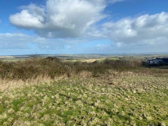
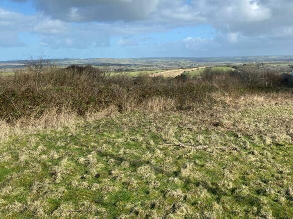
NB Photographs are for illustrative purposes only and do not show the definitive boundary plan.
Wadebridge is an extremely popular former market town with the River Camel running through the town. The town has fantastic educational, recreational and shopping facilities with a wide range of independent shops, eateries and popular public houses. The Camel Trail runs through the town with a direct route into the fantastic harbour town of Padstow. Some of the country's most wonderful beaches are just within a short drive as are miles and miles of beautiful North Cornish coastline and cliff walks.
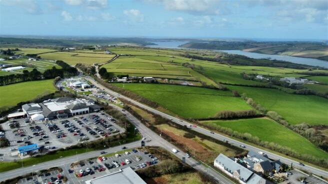
The site is situated on the outskirts of Wadebridge town almost directly opposite the Tesco supermarket and as such will afford superb views over literally miles of open Cornish countryside and of course the River Camel.
Services
We are advised by the vendor that foul and service water drainage, mains water and electricity are all available together with gas. Interested parties however are advised to contact the relevant utility companies to confirm the nearest connection points and suitable capacity prior to making any offer.
Planning and CIL
Planning Application Reference No. PA20/06800 was approved by Cornwall Council on the 22nd September 2021, the application is liable for CIL (Community Infrastructure Levy) and details of this are all available on the planning portal with the amount of liability calculated when the related reserve matters application is determined.
Please contact our Wadebridge office for further details.
West Hill, Wadebridge, PL27

NEAREST STATIONS
Distances are straight line measurements from the centre of the postcode- Roche Station7.0 miles

About the agent
Cole Rayment & White, Wadebridge
20 Molesworth Street, Wadebridge, PL27 7DG
Cole Rayment & White are independent Estate Agents with offices in Wadebridge, Rock, Padstow and Camelford providing a unique level of coverage throughout North Cornwall. We offer high quality Estate Agency service from cosy cottages to large country estates and consider ourselves experts in our field.
Industry affiliations


Notes
Disclaimer - Property reference S819591. The information displayed about this property comprises a property advertisement. Rightmove.co.uk makes no warranty as to the accuracy or completeness of the advertisement or any linked or associated information, and Rightmove has no control over the content. This property advertisement does not constitute property particulars. The information is provided and maintained by Cole Rayment & White, Wadebridge. Please contact the selling agent or developer directly to obtain any information which may be available under the terms of The Energy Performance of Buildings (Certificates and Inspections) (England and Wales) Regulations 2007 or the Home Report if in relation to a residential property in Scotland.
Map data ©OpenStreetMap contributors.