
Castle Lane, Garstang, Preston

- PROPERTY TYPE
Plot
- SIZE
Ask agent
Key features
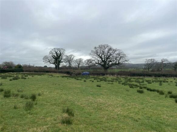
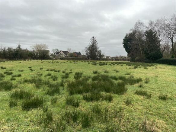
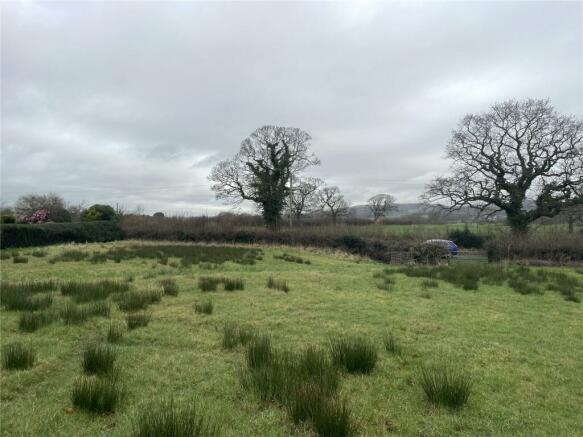
- Land extending to 1.66 acres (0.67 hectares) or thereabouts
- Designated residential development land, part of a wider application with planning consent granted as at the 5th April 2023—reference 22/00669/OUT
- Greenfield site in a sought after location close to the edge of Garstang.
- Would suit a small scale bespoke residential development
- Unconditional offers
Description
Garstang benefits from a number of well attended primary schools, including St Mary’s and Michael Catholic Primary School which its playing fields immediately adjoin the property to the west. A thriving Garstang Community Academy secondary school and within travel catchments for various other independent schools. Various well run sports clubs and lovely market town with many independent shops making it an ideal and sought after development site.
The land in total extends to 1.66 acres (0.67 hectares) with gated access off Castle Lane, The site is part of a wider plot of land which was contained in the original planning approval, Reference 22/00669/OUT which related to “an outline application for the erection of up to 9 dwellings with access off Castle Lane (all other matters reserved)”.
Outline planning consent for the overall site was granted dated 5th April 2023. Therefore, the land has the benefit of residential approval by virtue of a valid outline application. (The land to the north west of the site adjacent to Kirkfield is retained by 3rd party owners and excluded from this sale).
The approved schematic drawing illustrated how the site could to be developed with 9 houses accommodating various constraints however interested parties would need to submit their own planning applications to develop the land in accordance with their own design and specifications with access onto Castle Lane having regard to the reduced area and the constraints of the site, of which includes partially within Flood Zone 2.
All the planning documentation is located on Wyre Borough Council’s planning portal. Details of the land are identified in the original planning application reference 22/00669/OUT. The planning documentation also included a full Flood Risk Assessment and Drainage Strategy.
Brochures
ParticularsCastle Lane, Garstang, Preston

NEAREST STATIONS
Distances are straight line measurements from the centre of the postcode- Salwick Station8.3 miles

About the agent
Armitstead Barnett, Covering Lancashire and Cumbria
Market Place, Garstang, PR3 1ZA
Every client has a different property portfolio and will seek to achieve unique aims and set specific objectives from their assets.
Armitstead Barnett provides a range of services that may be individually tailored to suit these requirements.
Armitstead Barnett Chartered Surveyors and Estate Agents in Lancashire has roots dating back to 1890 and had predominantly operated under the name T. Armitstead & Son. The company has
Industry affiliations


Notes
Disclaimer - Property reference GAR240044. The information displayed about this property comprises a property advertisement. Rightmove.co.uk makes no warranty as to the accuracy or completeness of the advertisement or any linked or associated information, and Rightmove has no control over the content. This property advertisement does not constitute property particulars. The information is provided and maintained by Armitstead Barnett, Covering Lancashire and Cumbria. Please contact the selling agent or developer directly to obtain any information which may be available under the terms of The Energy Performance of Buildings (Certificates and Inspections) (England and Wales) Regulations 2007 or the Home Report if in relation to a residential property in Scotland.
Map data ©OpenStreetMap contributors.