Woods Meadow, Lime Avenue, Oulton, Lowestoft, Suffolk, NR32
- SIZE AVAILABLE
54,450 sq ft
5,059 sq m
- SECTOR
Land for sale
Key features
- Prominent and accessible position opposite the new school.
- Part of a popular and rapidly expanding residential location.
- 244 new homes already built and occupied. A further 367 in the scheme's pipeline.
- 204 other new homes in the area.
- Prime opportunity for neighbourhood retail (including food) development.
Description
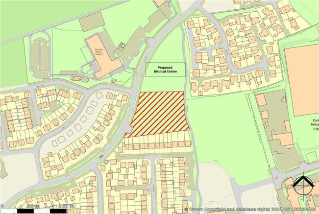
The property comprises a development site forming part of the wider Woods Meadow residential scheme being undertaken by Persimmon. The site is allocated in the development masterplan as a neighbourhood shopping centre and has the following benefits:
Location
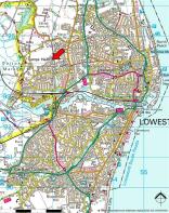
Lowestoft is a busy coastal town and a centre for excellence for offshore and renewable energy. It is located approximately 30 miles south-east of Norwich and 40 miles north of Ipswich via the A47 and A12 trunk roads respectively. The built-up area of Lowestoft has a population in the region of 73,500, including areas such as Carlton Colville, Oulton and Corton.
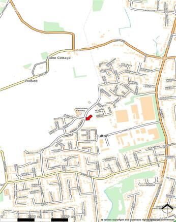
The subject property is located in Oulton Broad area, some 3 miles west of Lowestoft town centre. It sits within a large housing development and opposite The Limes Nursery and Primary Academy School.
Accommodation Description
The site has a gross area of approximately 1.25 acres (0.51 hectares). The allocation permits the development of up to 1,000 sq m (10,764 sq ft) of retail floor space.
Terms
The site is being offered for sale on a freehold basis. Both conditional and unconditional offers will be considered. The vendors will require that evidence of due diligence and planning enquiries is submitted prior to accepting any offer.
In accordance with the latest Anti Money Laundering (AML) legislation, the purchaser will be required to provide proof of identity and address to the selling agents prior to solicitors being instructed.
Rates
The property does not currently have a rating assessment.
Brochures
Woods Meadow, Lime Avenue, Oulton, Lowestoft, Suffolk, NR32
NEAREST STATIONS
Distances are straight line measurements from the centre of the postcode- Oulton Broad North Station0.7 miles
- Oulton Broad South Station1.2 miles
- Lowestoft Station1.9 miles
Notes
Disclaimer - Property reference 165655FH. The information displayed about this property comprises a property advertisement. Rightmove.co.uk makes no warranty as to the accuracy or completeness of the advertisement or any linked or associated information, and Rightmove has no control over the content. This property advertisement does not constitute property particulars. The information is provided and maintained by Roche Chartered Surveyors, Norfolk. Please contact the selling agent or developer directly to obtain any information which may be available under the terms of The Energy Performance of Buildings (Certificates and Inspections) (England and Wales) Regulations 2007 or the Home Report if in relation to a residential property in Scotland.
Map data ©OpenStreetMap contributors.


