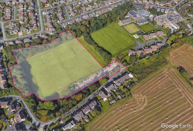
Carr Mill Road, Billinge, WN5
£15.81 per sq ft
Business rates & charges may apply

- SIZE AVAILABLE
252,952 sq ft
23,500 sq m
- SECTOR
Land for sale
- USE CLASSUse class orders: C3 Dwelling Houses
C3
Key features
- Sold subject to obtaining Residential Planning Consent
- Within well established housing area close to local shops and schools
- Site allocated for housing / urban green space
- Close to Carr Mill Dam recreational park area
- Good links to East Lancashire A580
- Within a short drive to Garwood train station
Description
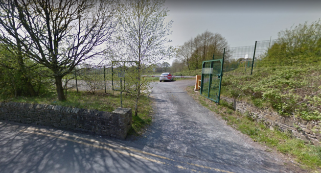
Please note the access to the site will be a shared entrance with the car park running parallel which is excluded from the demised sale area of the site as shown on the plans.
The property is accessed off Carr Mill Road in Billinge, a well established residential area close to shops including the Co-op, Billinge Medical Practice, Carr Mill Dam Recreational Park. There is local schooling from Chapel End Primary and Nursery and St Aiden's C of E Primary School close by. The site has excellent transport links accessed of Carr Mill Road, which in turn interconnects to Birchley Road, (A571), which links with the East Lancs Road (A580) and the M6 motorway network.
.
Brochures
Carr Mill Road, Billinge, WN5

NEAREST STATIONS
Distances are straight line measurements from the centre of the postcode- Garswood Station1.5 miles
- Bryn Station2.6 miles
- St. Helens Central Station2.7 miles
About Jo Real Estate, Liverpool
85 - 87 Vauxhall Road, Liverpool, L3 6BN
Notes
Disclaimer - Property reference carrmillroad. The information displayed about this property comprises a property advertisement. Rightmove.co.uk makes no warranty as to the accuracy or completeness of the advertisement or any linked or associated information, and Rightmove has no control over the content. This property advertisement does not constitute property particulars. The information is provided and maintained by Jo Real Estate, Liverpool. Please contact the selling agent or developer directly to obtain any information which may be available under the terms of The Energy Performance of Buildings (Certificates and Inspections) (England and Wales) Regulations 2007 or the Home Report if in relation to a residential property in Scotland.
Map data ©OpenStreetMap contributors.