Cumbrian Way, Bransholme, Hull
- PROPERTY TYPE
Land
- SIZE
Ask agent
Key features
- c.94.60 Acres (38.28 Hectares)
- Land on the Urban Fringe
- Potential Long Term 'Hope Value'
- Available as a Whole
- Freehold with Vacant Possession
- Excellent Opportunity
Description
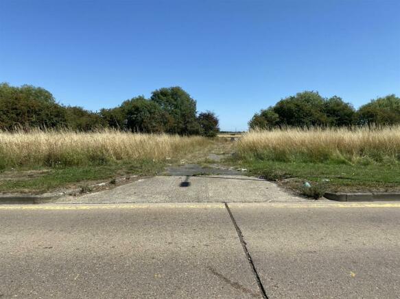
Location - The land parcel is situated towards the north eastern fringe, approximately 5 miles north of the city centre and a short distance south west from the village of Wawne, with access leading from Cumbrian Way.
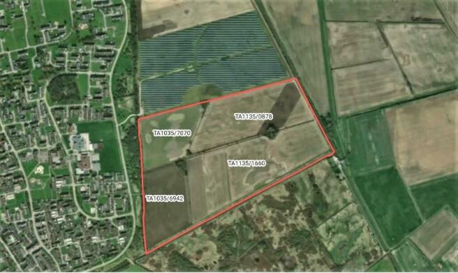
Land - The land is in a single block divided up into several land parcels and includes a number of woodland copses. To the north, the land borders an established solar park, to the east it is bounded by the Holderness Drain and to the south by Bransholme Nature Reserve.
Under the Agricultural Land Classification Map, the land is identified as being Grade 3, the Soil Association being 'Wallasea 1', a marine alluvium.
Designations Etc. - The land is located within a surface water Nitrate Vulnerable Zone (NVZ).
The land is identified under the Hull Local Plan as part of its Green Network, but shown as 'agricultural land', which is covered by Policy 43 'Green infrastructure and the Green Network' in the Hull Local Plan. Further enquiries as to alternative uses should be directed to the Local Authority, The Hull City Council , or advice should be sought from an appropriately qualified independent Town Planner.
A 12 Month Exclusivity Agreement has been entered into with a third party Energy Developer over part of the land (c.37 acres) as from 13th April 2023.
Basic Payment Scheme - The land is registered with the Rural Payments Agency for the Basic Payment Scheme (BPS). Areas quoted in these particulars have been taken from the Rural Land Register.
Wayleaves, Easements & Rights Of Way - The land is sold subject to and with the benefits of all rights of way, water, drainage, watercourses and other easements and rights of adjoining property owners affecting the same and all existing and proposed wayleaves and other matters registered by any competent authority subject to statute.
There is understood to be a 180mm diameter foul water drain along the western boundary of the land. An as built plan is available, however it is believed no formal easement was entered into with the water authority when the drain was laid.
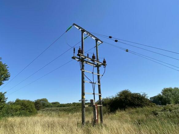
There is an electric transmission line running along the southern boundary of the land, a copy of the easement is been sought form the owners, there is believed to also be a 600mm water main main pipe under the land. Again further details are being sought.
Method Of Sale - The property is offered for sale by private treaty as a whole.
Tenure & Possession - The land is owned freehold subject to a 3 year Farm Business Tenancies (FBT), granted 1st September 2020. There is an early resumption clause to gain possession of the land for any 'non-agricultural' purpose.
Sporting, Timber & Minerals - The sporting rights are included in the sale, together with the mineral rights so far as these are owned.
Contaminated Land - The vendors and their agents are not aware of any of the land being filled with any contaminated matter referred to in the Environmental Protection Act 1990, however you should satisfy yourself on this aspect.
Valuations & Deductions - Dependent upon the time of year possession is taken and the 'early resumption' clause is triggered, the purchaser will be responsible for paying an ingoing valuation as is stipulated in the farm business tenancy. The purchaser(s) shall not make any claim for deductions or dilapidations of any kind what so ever.
Plans & Measurements - Any plans forming part of these particulars are included for identification purposes and do not form part of the contract for sale. Areas or measurements are stated and given as a guide only and should be checked by you or your own agent(s).
Viewing - As the land is occupied, we ask that viewings are undertaken after firstly speaking with the sole agents on
Brochures
Cumbrian Way, Bransholme, HullCumbrian Way, Bransholme, Hull
NEAREST STATIONS
Distances are straight line measurements from the centre of the postcode- Cottingham Station3.7 miles
- Hull Station4.4 miles
- Beverley Station4.7 miles
Notes
Disclaimer - Property reference 31794510. The information displayed about this property comprises a property advertisement. Rightmove.co.uk makes no warranty as to the accuracy or completeness of the advertisement or any linked or associated information, and Rightmove has no control over the content. This property advertisement does not constitute property particulars. The information is provided and maintained by Leonards, Hull. Please contact the selling agent or developer directly to obtain any information which may be available under the terms of The Energy Performance of Buildings (Certificates and Inspections) (England and Wales) Regulations 2007 or the Home Report if in relation to a residential property in Scotland.
Map data ©OpenStreetMap contributors.


