Pollard Lane, Leeds, West Yorkshire, LS13
- PROPERTY TYPE
Land
- SIZE
Ask agent
Description
Approximately 4 acres (1.62 hectares).
Development potential subject to the necessary permissions. We understand planning permission has not been applied for previously
WYK623659
PROPERTY DESCRIPTION
Excellent and strategically important parcel of land off Pollard Lane and close to Kirkstall Forge train station Approximately 4 acres (1.62 hectares). Development potential subject to the necessary permissions. We understand planning permission has not been applied for previously We also believe that the site may have other useful and versatile potential, from car parking to storage. Buyers should satisfy themselves of any necessary permissions required.
SPECIFICATION
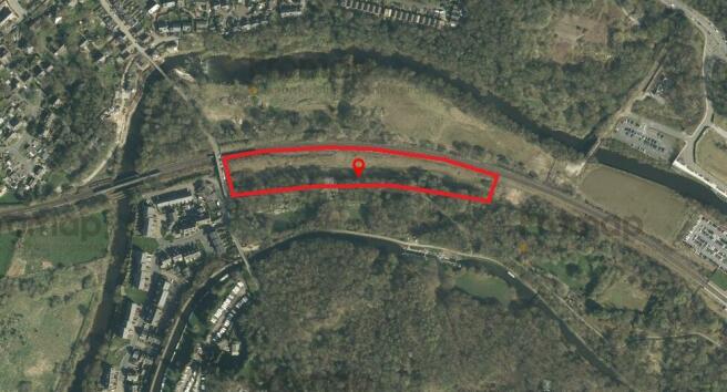
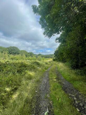
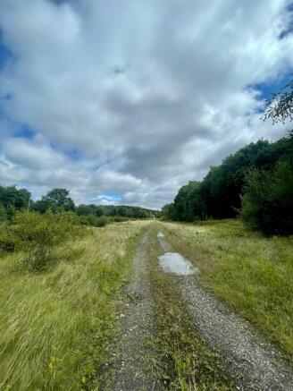
The site extends to approximately 4 acres (1.62 ha) and the boundaries are identified by the red boundaries on the plan. The site has gate access and arrangements to view should be made via our office.
SERVICES & PLANNING
Close to other recent developments down Pollard Lane and whilst on the opposite side of the track to Kirkstall Forge Train station this an area with clear potential.
Pollard Lane, Leeds, West Yorkshire, LS13
NEAREST STATIONS
Distances are straight line measurements from the centre of the postcode- Kirkstall Forge Station0.7 miles
- Bramley Station1.5 miles
- Horsforth Station1.5 miles
Notes
Disclaimer - Property reference HAP230066. The information displayed about this property comprises a property advertisement. Rightmove.co.uk makes no warranty as to the accuracy or completeness of the advertisement or any linked or associated information, and Rightmove has no control over the content. This property advertisement does not constitute property particulars. The information is provided and maintained by Hardisty & Co, Horsforth. Please contact the selling agent or developer directly to obtain any information which may be available under the terms of The Energy Performance of Buildings (Certificates and Inspections) (England and Wales) Regulations 2007 or the Home Report if in relation to a residential property in Scotland.
Map data ©OpenStreetMap contributors.


