Polgooth, St Austell
- PROPERTY TYPE
Plot
- SIZE
Ask agent
Key features
- Development site for 2 dwellings
- Level site
- Popular village location
Description
Location
The pretty village of Polgooth is located in a sheltered valley setting two miles west of St Austell, 1.1 mile off the A390 St Austell to Truro road. The village is popular for its location, central as it is for St Austell's many and varied shopping, schooling, recreational and health amenities, together with a the sandy beach at Pentewan, easily accessed by nearby cycle track and walk, and the picturesque and historic fishing port of Mevagissey. The local village amenities are within a short walk and include a village shop/Post Office, a hairdressers and a public house. Listed amongst the many local attractions in the area are Charlestown harbour and the Eden Project, whilst an even greater array of facilities are just 12 miles away in Truro.
The Property
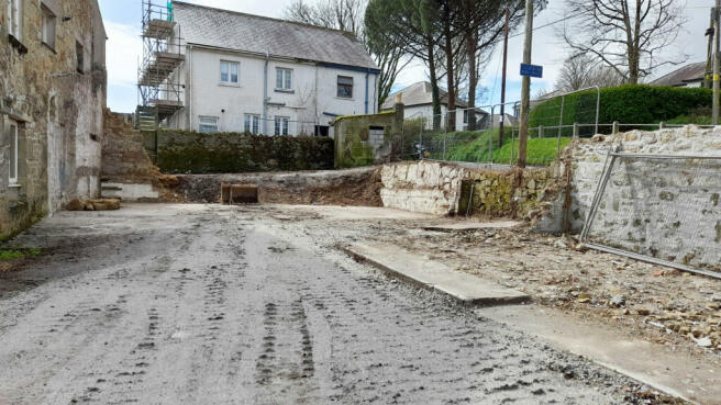
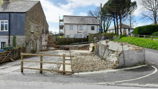
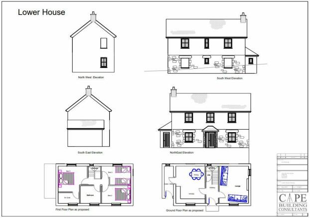
The site is located on the corner of Trelowth Road and Tregonjeeves Lane. Planning permission was granted on the 14/07/2021 under Application No. PA20/07939 for the demolition of the existing buildings and the building of a three bedroom detached house and a two bedroom detached bungalow.
Further proposed plans will be included with the sale which, using the same footprint, would provide additional accommodation in the roof space for the bungalow, but this will require planning consent at a later date. Each property would have its own allocated parking areas and the bungalow would have a particularly nice garden.
At the time of receiving instructions, the vendors are intending to start the process of clearing the site, so as to secure the planning consent for perpetuity.
Property Information
Services: Mains electricity, mains water and drainage are available on site. Interested parties are advised to make their own enquiries of the appropriate statutory undertakers: National Grid: ; South West Water: ; Wales and West Utilities:
CIL Payment: In granting the planning consent, Cornwall Council have deemed the site will be subject to a £6,492.46 CIL payment - details on request.
Wayleaves, Easements & Rights of Way: The sale will be subject to and with the benefit of all wayleaves, easements and rights of way as may exist.
Particulars & Plan: Whilst every care is taken in the preparation of these particulars, their accuracy is not guaranteed and they do not constitute any part of an offer or contract. Any intending purchaser/s must satisfy themselves by inspection or otherwise as to the correctness of these particulars.
Viewing & Directions
Viewing: Viewers may access the land for viewing purposes with sale particulars in hand, during daylight hours adhering to the Countryside Code. Please notify the agents Lodge & Thomas of your intended visit. Tel: Email:
Directions: Exit the A30 Truro to St Austell road signposted Sticker and Polgooth onto Coliza Hill and follow the road to the next junction where turn right onto Trelowth Road by the former chapel. Follow this road down the hill where towards the bottom look out for the Lodge & Thomas for sale board on the right hand side.
what3words///meals.bleak.sometimes
Brochures
Brochure 1Polgooth, St Austell
NEAREST STATIONS
Distances are straight line measurements from the centre of the postcode- St. Austell Station1.9 miles
- Luxulyan Station5.8 miles
Notes
Disclaimer - Property reference LAT221241. The information displayed about this property comprises a property advertisement. Rightmove.co.uk makes no warranty as to the accuracy or completeness of the advertisement or any linked or associated information, and Rightmove has no control over the content. This property advertisement does not constitute property particulars. The information is provided and maintained by Lodge & Thomas, Truro. Please contact the selling agent or developer directly to obtain any information which may be available under the terms of The Energy Performance of Buildings (Certificates and Inspections) (England and Wales) Regulations 2007 or the Home Report if in relation to a residential property in Scotland.
Map data ©OpenStreetMap contributors.


