Ashburton, Devon

- PROPERTY TYPE
Equestrian Facility
- SIZE
Ask agent
- TENUREDescribes how you own a property. There are different types of tenure - freehold, leasehold, and commonhold.Read more about tenure in our glossary page.
Freehold
Key features
- Versatile modern farm building
- Concrete yard
- Mains water supply
- Fenced pasture farmland
- Equestrian use potential (subject to planning)
- Accessible location
Description
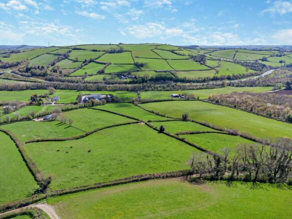
A useful farm building and 17 acres of land in a highly accessible location on the edge of Dartmoor National Park.
Ashburton 0.5 miles; Totnes 7 miles; Exeter 22 miles; Plymouth 23 miles
About 16.92 acres (6.85 ha) in total
For sale as a whole
Guide Price £300,000
The property offers an excellent balance of farmland and livestock housing in a highly accessible location and on the edge of Dartmoor National Park.
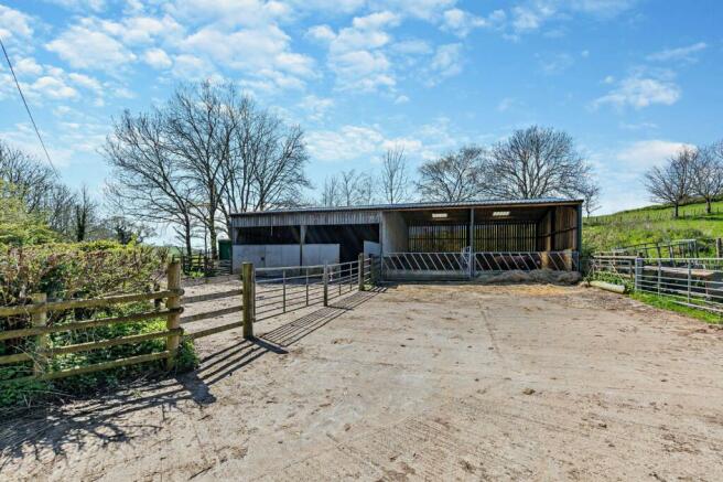
The concrete yard and useful farm building are set back away from the road, accessed along a short track. There are a series of gates and
fences around the yard creating ease of stock handling, and access into the adjoining fields.
Mains water is connected to a series of field troughs and at the yard. The property is surrounded by farmland and yet is within touching distance of Ashburton and the A38 Devon expressway and a short drive from Totnes, Exeter & Plymouth. Ashburton is a charming market town with a range of local amenities including a primary school, health centre, Post Office, newsagent and supermarket along with a variety of cafes, shops, and pubs, whilst wider facilities are available in nearby Totnes (including mainline railway station), Exeter & Plymouth.
Farm building
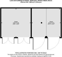
An extended farm building, sub-divided internally to create two useful areas for livestock housing and general storage. The original building is 2 bays wide by 1 bay deep and is timber framed with a single pitched roof covered with corrugated sheeting. The extension has added 2 more bays to the side and is of similar, but steel framed, construction with timber stock walling and timber cladding. Both have a concrete base and front onto the concrete yard, with metal sheet and feed barrier gates.
The farm building is located in a concrete yard, accessed via a pair of field gates off the unmade track (public byway) which borders the land and leads to the roadside.
The land
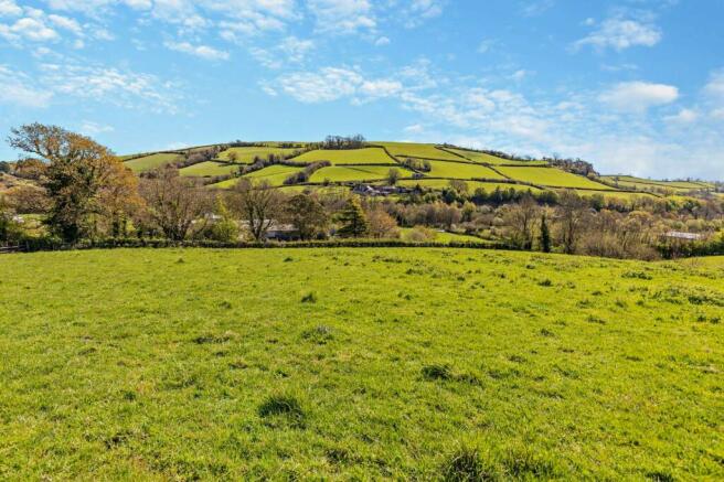
Six field parcels in total covering around 17 acres. The land undulates and provides flexible grazing and stock management for cattle, sheep
or horses (subject to planning). The land is all laid to permanent pasture and is identified on the Cranfield University soil maps as Soilscape 6 – ‘Freely draining loamy soils’ with a long grazing season.
General
Method of sale
The property is for sale as a whole by private treaty.
Tenure
The property is sold freehold with vacant possession on completion.
Services
Mains water (metered).
Basic Payment
The de-linked payments relating to the Basic Payment Scheme are not included in the sale.
Wayleaves, easements and rights of way
The property is being sold subject to and with the benefit of all rights including; rights of way, whether public or private, light, support, drainage, water and electricity supplies and other rights and obligations, easements andquasi-easements and restrictive covenants and
all existing and proposed wayleaves for masts, pylons, stays, cables, drains, water and gas and other pipes whether referred to in these
particulars or not.
There are no public rights of way over the property. The track leading to the yard is a public byway.
Schemes
The land is in a mid-tier Countryside Stewardship scheme ending 31/12/27. The purchaser will be deemed to have full knowledge of the scheme and will take it on and comply with the scheme from completion if necessary. The vendor will retain any payments received up to completion. Further details are available from the selling agent.
Sporting, timber and mineral rights
All sporting timber and mineral rights are included in the freehold sale, in so far as they are owned.
Planning
Prospective purchasers are to make their own enquiries of the local planning authority for alternative uses.
Plans, Areas and Boundaries
Any representation by the owner or agent is indicative only and should not be relied upon without clarification from a legal advisor.
Covenants and/or restrictions
There are restrictions / covenants listed on the Land Registry Title deed, details of which will be made available by the vendors solicitors on
request.
Local authority
South Hams District Council / Dartmoor National Park Authority.
Brochures
Web DetailsParticulars- COUNCIL TAXA payment made to your local authority in order to pay for local services like schools, libraries, and refuse collection. The amount you pay depends on the value of the property.Read more about council Tax in our glossary page.
- Band: TBC
- PARKINGDetails of how and where vehicles can be parked, and any associated costs.Read more about parking in our glossary page.
- Ask agent
- GARDENA property has access to an outdoor space, which could be private or shared.
- Yes
- ACCESSIBILITYHow a property has been adapted to meet the needs of vulnerable or disabled individuals.Read more about accessibility in our glossary page.
- Ask agent
Energy performance certificate - ask agent
Ashburton, Devon
Add your favourite places to see how long it takes you to get there.
__mins driving to your place
Your mortgage
Notes
Staying secure when looking for property
Ensure you're up to date with our latest advice on how to avoid fraud or scams when looking for property online.
Visit our security centre to find out moreDisclaimer - Property reference SWE240012. The information displayed about this property comprises a property advertisement. Rightmove.co.uk makes no warranty as to the accuracy or completeness of the advertisement or any linked or associated information, and Rightmove has no control over the content. This property advertisement does not constitute property particulars. The information is provided and maintained by Strutt & Parker, South West Estates & Farm Agency - Exeter. Please contact the selling agent or developer directly to obtain any information which may be available under the terms of The Energy Performance of Buildings (Certificates and Inspections) (England and Wales) Regulations 2007 or the Home Report if in relation to a residential property in Scotland.
*This is the average speed from the provider with the fastest broadband package available at this postcode. The average speed displayed is based on the download speeds of at least 50% of customers at peak time (8pm to 10pm). Fibre/cable services at the postcode are subject to availability and may differ between properties within a postcode. Speeds can be affected by a range of technical and environmental factors. The speed at the property may be lower than that listed above. You can check the estimated speed and confirm availability to a property prior to purchasing on the broadband provider's website. Providers may increase charges. The information is provided and maintained by Decision Technologies Limited. **This is indicative only and based on a 2-person household with multiple devices and simultaneous usage. Broadband performance is affected by multiple factors including number of occupants and devices, simultaneous usage, router range etc. For more information speak to your broadband provider.
Map data ©OpenStreetMap contributors.


