Clayton Avenue, Rossendale, Lancashire, BB4
- PROPERTY TYPE
Land
- SIZE
Ask agent
Description
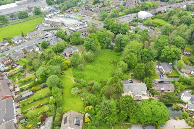
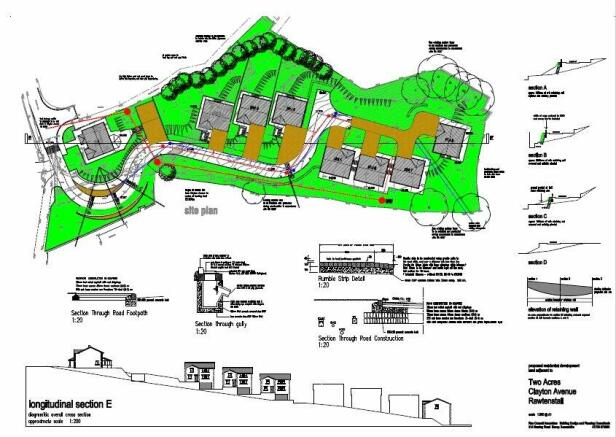
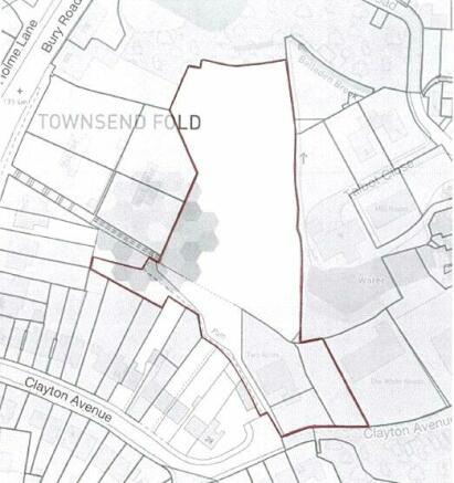
The two acre site has planning for 8 luxury detached properties with 4 x four bedroom homes and a further 4 x five bedroom homes making this an unparalleled opportunity to develop a high specification site of exceptional properties in a desirable location. The planning reference for the approved scheme, at Rossendale Borough Council, is 2002/532. A Lawful Development Certificate confirming a material start was made, was produced as a result of planning reference 2016/0273.
Located within easy reach of a great range of local amenities, the site also offers excellent transport links via M66/M60/M65/M62 motorway links to Manchester and beyond. Open countryside is within easy reach as well as local schools, shops, Golf Course, pubs and restaurants making this a desirable area for families. Housing demand for family homes in this area is strong making this an impressive development opportunity.
Call Entwistle Green for more information.
Brochures
ParticularsClayton Avenue, Rossendale, Lancashire, BB4
NEAREST STATIONS
Distances are straight line measurements from the centre of the postcode- Accrington Station5.2 miles
- Entwistle Station5.4 miles
- Church & Ostwaldwistle Station5.6 miles
Notes
Disclaimer - Property reference BUU210087. The information displayed about this property comprises a property advertisement. Rightmove.co.uk makes no warranty as to the accuracy or completeness of the advertisement or any linked or associated information, and Rightmove has no control over the content. This property advertisement does not constitute property particulars. The information is provided and maintained by Entwistle Green, Bury. Please contact the selling agent or developer directly to obtain any information which may be available under the terms of The Energy Performance of Buildings (Certificates and Inspections) (England and Wales) Regulations 2007 or the Home Report if in relation to a residential property in Scotland.
Map data ©OpenStreetMap contributors.


