Residential Development Site, Tanhouse Lane, Cradley, Malvern
- SIZE
Ask agent
- SECTOR
Residential development for sale
Description
LOCATION
The property is located on the Herefordshire / Worcestershire border, a few miles directly west of Great Malvern. The property is close to the village amenities of Cradley to include, a village shop, Doctors Surgery, Church and a Royal British Legion Social Club. More extensive amenities are provided by the two popular Towns of Malvern and Ledbury. The Towns having train stations, good shopping, restaurants and the highly regarded Malvern theatre. Malvern, together with neighbouring Colwall offers a selection of private schooling.
DESCRIPTION
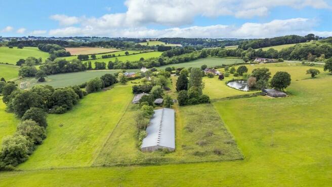
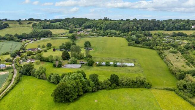
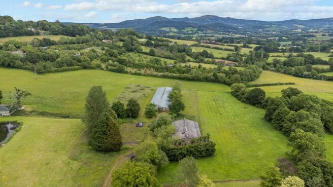
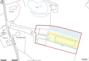
The development site is of roughly rectangular dimensions, as per the below Land Registry Title Plan and occupies an area of approx. 2.95 Acres (11,950m2). The property is accessed via a shared drive. Currently, it is occupied by two principle buildings.
Building One
This has a floor area of approx. 14,200ft2 (1320m2). It is a former chicken shed of low rise timber portal framed construction, having since been granted consent for office use, a further consent for conversion into a motel and most recently (as below) for conversion into 7 x residential dwellings. The site area for which planning is granted is shown on the below plan coloured in yellow.
Building Two
Has a floor area of approx. 5,830ft2 (542m2). This agricultural building is known to have previously been used for storage of car parts, antiques and also cider making. This building is not part of the current residential consent.
SERVICES
Mains water, three phase electricity and Telecoms are understood to be available to the site.
PLANNING
Determination for Prior Use Approval (Change Of Use) for one commercial building (Class E) to 7 x dwelling houses (C3) and associated operational development has been granted, planning ref: 231899. Since the grant of this consent the Rural Planning Co., acting on behalf of the Seller, have received in writing an acceptance of the principle of replacing the current building with purpose-built dwellings, from Herefordshire Council. This is currently subject to ongoing planning investigations.
Within this further application, the opportunity to build 9 plots is being investigated and therefore subject to planning permission. The discussional site layout is available via agents, with a proposed floor area of 1746m2 including both the light blue hatched and yellow areas of land in the below plan.
OTHER
Offers are sought for a conditional purchase of the property, subject to planning. On the Basis planning for 9 plots is granted the price is £1,450,000.
VIEWING
Strictly via prior appointment, via the Sole Agent´s Great Witley Office
Tel: .
Contact: Nick Jethwa
Maxine Holder-Davies mh-
Brochures
Residential Development Site, Tanhouse Lane, Cradley, Malvern
NEAREST STATIONS
Distances are straight line measurements from the centre of the postcode- Colwall Station4.0 miles
- Malvern Link Station4.2 miles
- Great Malvern Station4.4 miles
Notes
Disclaimer - Property reference 100243004316. The information displayed about this property comprises a property advertisement. Rightmove.co.uk makes no warranty as to the accuracy or completeness of the advertisement or any linked or associated information, and Rightmove has no control over the content. This property advertisement does not constitute property particulars. The information is provided and maintained by G HERBERT BANKS COMMERCIAL, Worcester. Please contact the selling agent or developer directly to obtain any information which may be available under the terms of The Energy Performance of Buildings (Certificates and Inspections) (England and Wales) Regulations 2007 or the Home Report if in relation to a residential property in Scotland.
Map data ©OpenStreetMap contributors.


