Oldbury Naite, BS35
- PROPERTY TYPE
Farm Land
- SIZE
Ask agent
Key features
- FOR SALE BY INFORMAL TENDER - TENDER DATE – 12 NOON ON 23RD OCTOBER 2024
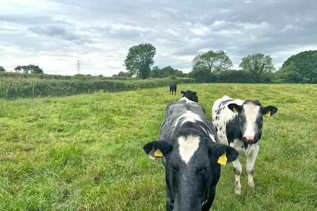
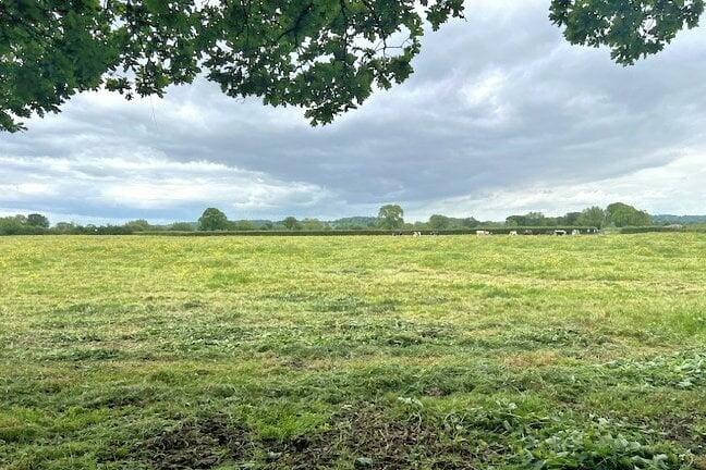
- A well located and attractive block of pasture land
- Situated to the east of Hill Lane with access directly off the highway
- The land is available as a whole, or two lots
- It comprises of three field parcels of productive grass land
- The Property extends to approximately 17.86 acres (7.23 hectares)
Description
FOR SALE BY INFORMAL TENDER - TENDER DATE – 12 NOON ON 23RD OCTOBER 2024 A well located and attractive block of pasture land situated to the east of Hill Lane with access directly off the highway. The land is available as a whole, or two lots. It comprises of three field parcels of productive grass land surrounded by mature well established hedges. The Property extends to approximately 17.86 acres (7.23 hectares).
SERVICES Mains water is connected to Lots 1 and 2. Should the property be sold in separate lots, the water supply will need to be subdivided. The cost of subdivision (including installation of a submeter) would be due to the purchaser(s) of Lot 2, together with the payment of the water consumed. RIGHTS OF WAY, EASEMENTS AND COVENANTS The property is sold subject to all rights of way whether public or private, light, support, drainage, water and electricity supplies and other rights, covenants, agreements and all existing and proposed wayleaves, masts, pylons, stays, cables, drains and water, gas or other pipes whether referred to in these particulars or not and to the provisions of any planning scheme of the County or Local Authorities.
JOINT AGENTS North Letherby, Brick Cottage, Bilsham Lane, Olveston, Bristol BS35 4HD T: E:
SPORTING, TIMBER, & MINERAL RIGHTS Manorial rights are reserved for part of Lot 1 – further information regarding such rights are available from Richard Hill at Shakespeare Martineau.
VIEWING At any reasonable daylight hour by people in possession of these particulars.
PLANNING Potential purchasers are free to make their own enquiries to the Local Planning Authority.
PLANS, AREAS AND SCHEDULES The sale plan has been prepared for guidance only and no guarantee or warranty as to its accuracy is given or implied.
AGENT NOTES No Basic Payment Scheme de-linked payments are included in the sale. There are no live stewardship schemes associated with the Property. Drainage rates are payable to the Lower Severn Internal Drainage Board. Details of which are below. Payment for the period 1/4/2024 to 31/3/2025 is set out below.
• ST6294 7421 8.5 acres = £34.62
• ST6294 9222 2.5 acres =£10.88
• ST6294 8415 6.7 acres = £27.62
The Property is sold subject to a development overage clause (uplift) if planning consent is granted for non-agricultural use (note change of use to private equestrian use shall not trigger the overage clause). The vendor and their successors in title will be entitled to 30% of the net increase in market value for each and every trigger event. The term of the overage clause shall be for a period of 25 years. Payment will be due upon implementation.
JOINT AGENTS North Letherby, Brick Cottage, Bilsham Lane, Olveston, Bristol BS35 4HD T: E:
Brochures
Brochure 1Oldbury Naite, BS35
NEAREST STATIONS
Distances are straight line measurements from the centre of the postcode- Lydney Station4.3 miles
Notes
Disclaimer - Property reference 28207503. The information displayed about this property comprises a property advertisement. Rightmove.co.uk makes no warranty as to the accuracy or completeness of the advertisement or any linked or associated information, and Rightmove has no control over the content. This property advertisement does not constitute property particulars. The information is provided and maintained by Milburys, Thornbury. Please contact the selling agent or developer directly to obtain any information which may be available under the terms of The Energy Performance of Buildings (Certificates and Inspections) (England and Wales) Regulations 2007 or the Home Report if in relation to a residential property in Scotland.
Map data ©OpenStreetMap contributors.


