Cwmdu CARMARTHENSHIRE
- PROPERTY TYPE
Land
- SIZE
Ask agent
Key features
- LAND FOR SALE
- Young Broadleaf Woodland
- Wildlife Ponds
- Nature Haven
- Small Stream
Description
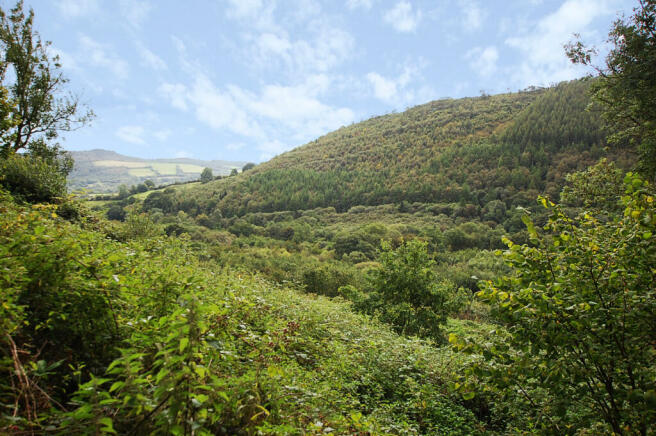
APPROX. 55 ACRES OF YOUNG BROADLEAF WOODLAND ON A SOUTH FACING BANK WITH FOUR WILDLIFE PONDS
Approx. 55 Acres of Broadleaf Young Woodland
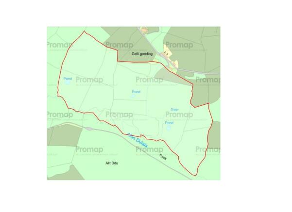
Four Wildlife Ponds
Approx. 37,000 Trees Planted
South Facing
Approx. 55 acres of young broadleaf woodland on a south facing bank with four wildlife ponds
We understand there are approx. 37,000 trees which were planted in 2004/5. The trees are a mix of willow, cherry, sycamore, oak, ash, rowan, birch and sweet chestnut with occasional naturally established mature trees.
A small stream (The Afon Dulais) flows along the southern boundary.
The current owners intend to place a number of restrictive covenants on the land, further details are available from the agents.
Access is off a council lane opposite Gelligoediog Farmhouse and there are a number of rides through the woodland although they are currently overgrown with bramble and bracken.
IN ALL APPROX. 55 ACRES
(About 22 Hectares)
Brochures
Brochure 1Cwmdu CARMARTHENSHIRE
NEAREST STATIONS
Distances are straight line measurements from the centre of the postcode- Llangadog Station5.3 miles
Notes
Disclaimer - Property reference 37899_13434. The information displayed about this property comprises a property advertisement. Rightmove.co.uk makes no warranty as to the accuracy or completeness of the advertisement or any linked or associated information, and Rightmove has no control over the content. This property advertisement does not constitute property particulars. The information is provided and maintained by Rural Scene, Covering England, Wales and Scotland. Please contact the selling agent or developer directly to obtain any information which may be available under the terms of The Energy Performance of Buildings (Certificates and Inspections) (England and Wales) Regulations 2007 or the Home Report if in relation to a residential property in Scotland.
Map data ©OpenStreetMap contributors.


