78.78acres Low Wood, Smelthouses
- SIZE AVAILABLE
3,431,657 sq ft
318,812 sq m
- SECTOR
Farm land for sale
Key features
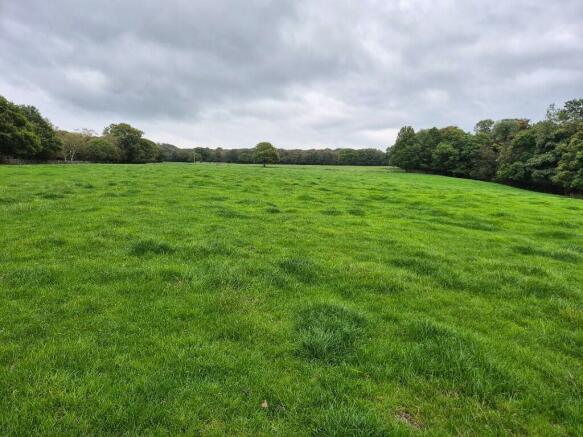
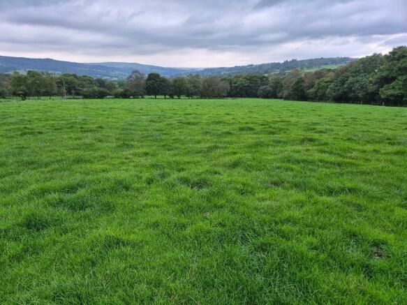
- Productive Farmland
- Secluded woodland
- Potential amenity uses
- Desirable location
Description
The woodland comprises a mix of native deciduous trees of varying ages and includes birch, oak, rowan, and holly. The woodland is centred around High Wood and Horse Wood with various smaller parcels across the land.
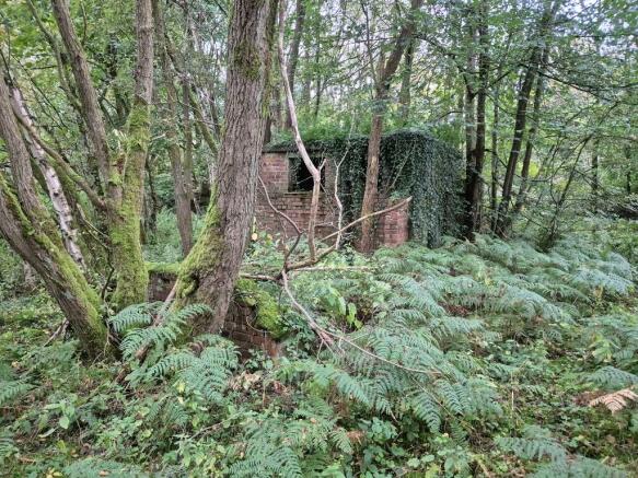
Upon the property is a range of former mining and industrial buildings including brick stores and timber and corrugated metal building. These offer scope for re-development or alternative use.
The property includes sheep gaits on the adjoining Brimham Common with the right to turn out 48 sheep on the moor.
Location
The land lies within the Nidderdale valley to the north west of the spa town of Harrogate, west of Ripon. The land lies between 150 and 250m above sea level.
Further Details
DIRECTIONS
From Pateley Bridge, proceed east on the B6165 towards Summerbridge. And continue for 1.5 miles. On leaving the village of Wilsill, bear left signed Smelthouses and Brimham rocks. Proceed for approximately 1 mile, turn left at the cross roads and proceed up the hill and the land is on the left-hand side marked by a For Sale board.
RESTRICTIVE COVENANTS
The property is sold subject to and with the benefit of all restrictive covenants, both public and private, whether mentioned in these particulars or not.
WAYLEAVES, EASEMENTS & RIGHTS OF WAY
The property is sold subject to all Rights of Way, public and private, which may affect the property.
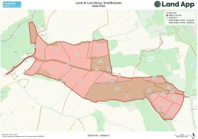
Notwithstanding the above, the property benefits from a Right of Way over the moor across the route shown brown on the attached plan.
Electricity lines cross the site on above ground poles, these are believed to be covered on appropriate wayleave agreements.
The land is crossed by foot paths and bridal paths as indicated on the sale plan.
SPORTING, TIMBER & MINERAL RIGHTS
The sporting, timber and mineral rights are included in the sale so far as they are owned.
TENURE AND OCCUPATION
The tenure of the property is understood to be freehold. Vacant possession will be available upon completion.
SERVICES
The land benefits from natural water supplies cross the land. Mains electricity crosses the site on above ground poles.
PLANNING MATTER
No planning consents exist for the site. There may be scope to achieve planning for structures upon the land, interested parties should take their own advice on this.
BASIC PAYMENT SCHEME
The eligible farmland has been registered with the Rural Payments Agency. BPS Entitlements are being de-linked and any payments retained by the seller.
ENVIRONMENTAL STEWARDSHIP SCHEME
The land has been entered into two Countryside Stewardship Scheme agreements detailed below:
CSS Higher Tier Scheme 2023-2027
Option UP2 & SP6 on field 7827, 8337 & 9937
Option HS5 on 0216 & 1719
CSS Mid-Tier Scheme 2024-2028
Option SW9 on 6726, 7140, 1440, 6299, 7195 & 7103
The vendor will seek to transfer the agreements and the purchasers will undertake to comply with the scheme rules for the remainder of the term.
Brochures
78.78acres Low Wood, Smelthouses
NEAREST STATIONS
Distances are straight line measurements from the centre of the postcode- Harrogate Station8.4 miles
Notes
Disclaimer - Property reference HRS100. The information displayed about this property comprises a property advertisement. Rightmove.co.uk makes no warranty as to the accuracy or completeness of the advertisement or any linked or associated information, and Rightmove has no control over the content. This property advertisement does not constitute property particulars. The information is provided and maintained by Hardcastle Rural Surveyors Ltd, Ripon. Please contact the selling agent or developer directly to obtain any information which may be available under the terms of The Energy Performance of Buildings (Certificates and Inspections) (England and Wales) Regulations 2007 or the Home Report if in relation to a residential property in Scotland.
Map data ©OpenStreetMap contributors.


