HIgh Auchenlarie & Holecroft Farms
- PROPERTY TYPE
Farm Land
- BEDROOMS
4
- SIZE
Ask agent
Key features
- BRIGHT AND SPACIOUS FOUR BEDROOM FARMHOUSE SET ON A STUNNING ELEVATED SITE
- RANGE OF TRADITIONAL & MODERN FARM BUILDINGS
- PRODUCTIVE GRAZING AND MOWING LAND
- BASIC PAYMENT ENTITLEMENTS
- LOT 1: HIGH AUCHENLARIE FARM (95.55 ACRES)
- LOT 2: LAND AT HOLECROFT FARM (91.25 ACRES)
- IN ALL ABOUT 186.80 ACRES (75.60 HA)
- FOR SALE PRIVATELY AS A WHOLE OR IN TWO LOTS
Description
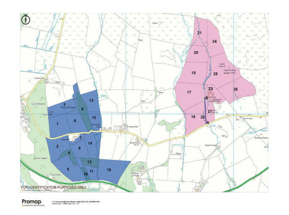
LOT 1 - HIGH AUCHENLARIE FARM (coloured pink on the sale plan)
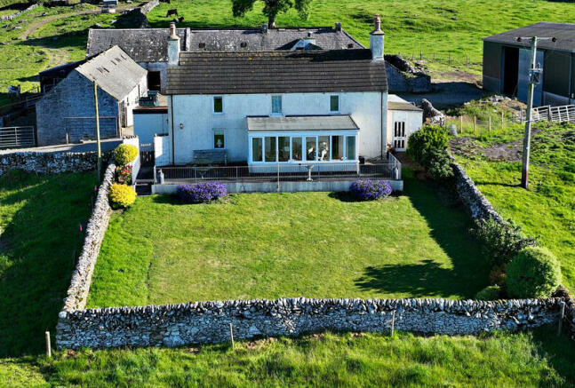
High Auchenlarie Farm is a highly productive stock rearing farm benefitting from an extremely well-presented traditional farmhouse, traditional courtyard steading, a more modern agricultural building and about 95 acres of agricultural land.
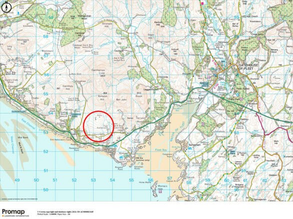
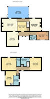
The farmhouse at High Auchenlarie sits on an enviable elevated site overlooking Wigtown Bay and on a clear day, the Isle of Man and the Isle of Fleets are visible to the naked eye. The farmhouse has been a wonderful family home for many years which has been well-maintained offering comfortable four-bedroom accommodation over two floors.
The agricultural land is down to grass for grazing and conservation (silage or hay), however is capable of growing a narrow range of cereal and other forage crops. In more recent years, the land has been let on a seasonal grazing basis. The traditional courtyard steading is well maintained and mainly utilised for storage of feed and machinery. Offers in excess of: £820,000
LOT 2 - LAND AT HOLECROFT FARM (coloured blue on the sale plan)
Holecroft Farm sits about 1 mile away from High Auchenlarie. The agricultural land at Holecroft amounts to about 91.25 acres and is currently utilised for the grazing of cattle and sheep or for mowing for forage. The land spans a minor public road and is in 16 clearly defined field enclosures, which include four areas of semi-mature woodland. These areas also act as shelter belts for grazing livestock. The land is naturally watered and has good road frontage to the minor public road. Offers in excess of: £380,000
Brochures
Sales ParticularsEnergy Performance Certificates
EPC 1HIgh Auchenlarie & Holecroft Farms
NEAREST STATIONS
Distances are straight line measurements from the centre of the postcode- Barrhill Station26.2 miles

Notes
Disclaimer - Property reference HighAuchenlarie. The information displayed about this property comprises a property advertisement. Rightmove.co.uk makes no warranty as to the accuracy or completeness of the advertisement or any linked or associated information, and Rightmove has no control over the content. This property advertisement does not constitute property particulars. The information is provided and maintained by Threave Rural, Castle Douglas. Please contact the selling agent or developer directly to obtain any information which may be available under the terms of The Energy Performance of Buildings (Certificates and Inspections) (England and Wales) Regulations 2007 or the Home Report if in relation to a residential property in Scotland.
Map data ©OpenStreetMap contributors.


