Glanarberth, Llechryd, SA43
- PROPERTY TYPE
Land
- SIZE
Ask agent
Description
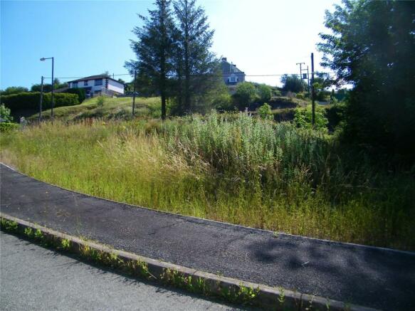
The plot is situated on a good size level plot located on a popular cul-de-sac location within the village of Llechryd. The village has a good range of basic amenities to include a convenience shop and petrol station, public house, village hall, primary school and church. The large nearby town of Cardigan is approx 2 miles away and is served by public bus transportation, offering a range of shops and amenities to include supermarkets, doctors, leisure facilities, theatre etc. The spectacular Pembrokeshire and Ceredigion coastline is approx 3 miles from the property with beaches and walks to enjoy, Poppit Sands and Gwbert being the nearest.
Plot Dimension Approx
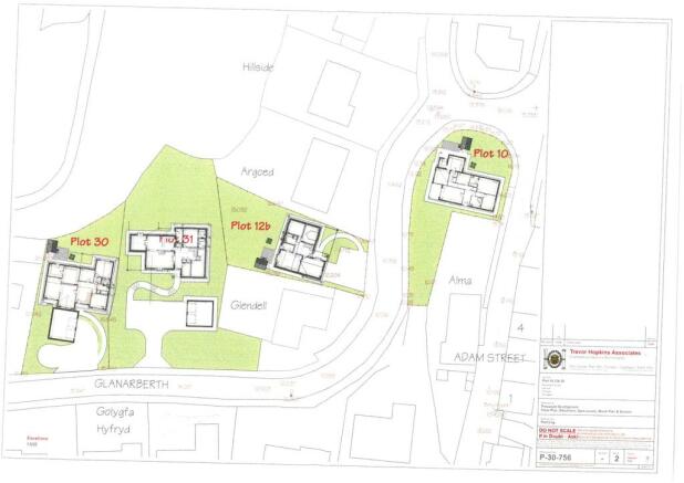
24.38m x 18.3m
The plot is a corner plot on the first phase of the Glanarberth Site a popular and attractive development of modern dwellings.
Planning
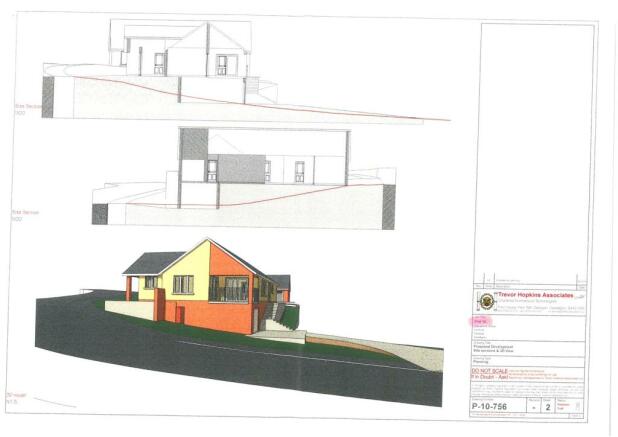
Application number: A020247. Copy In Branch. Certificate of Lawful Development Application number: A140648. Copy In Branch.
Services
Buyers should make there own enquiries as to the costs involved for connection to services before making an offer.
Glanarberth, Llechryd, SA43
NEAREST STATIONS
Distances are straight line measurements from the centre of the postcode- Clunderwen Station16.5 miles
Notes
Disclaimer - Property reference CRD220058. The information displayed about this property comprises a property advertisement. Rightmove.co.uk makes no warranty as to the accuracy or completeness of the advertisement or any linked or associated information, and Rightmove has no control over the content. This property advertisement does not constitute property particulars. The information is provided and maintained by John Francis, Cardigan. Please contact the selling agent or developer directly to obtain any information which may be available under the terms of The Energy Performance of Buildings (Certificates and Inspections) (England and Wales) Regulations 2007 or the Home Report if in relation to a residential property in Scotland.
Map data ©OpenStreetMap contributors.


