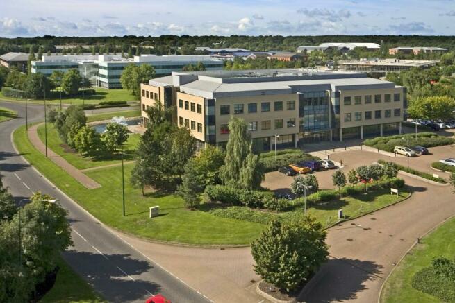
1 Tower View, Kings Hill, West Malling, Kent, ME19
- SIZE AVAILABLE
15,023-32,921 sq ft
1,396-3,058 sq m
- SECTOR
Business park to lease
Lease details
- Lease available date:
- Ask agent
Key features
- Air Conditioning
- Raised access flooring
- Suspended ceilings
- Parking
Description
1 Tower View is a 3-storey, air conditioned, office building in a gateway location close to the entrance to the business park.
Kings Hill is 2 miles from Junction 4 of the M20 which leads to the M26 / M25 and from there to Heathrow, Gatwick, Stansted and City airports. Ebbsfleet International is just 25 minutes by road. Free parking, plus car share scheme and shuttle bus link to West Malling for Kings Hill railway station, with services into London, are welcomed by visitors and staff alike.
With c. 9,000 people living in Kings Hill, business occupiers benefit from a doorstep pool of labour. Employees enjoy the village centre shops, pub, restaurants, day nurseries, golf course, cricket ground, sports park and David Lloyd fitness centre.
Brochures
1 Tower View, Kings Hill, West Malling, Kent, ME19
NEAREST STATIONS
Distances are straight line measurements from the centre of the postcode- West Malling Station1.2 miles
- East Malling Station1.7 miles
- Wateringbury Station2.2 miles
Notes
Disclaimer - Property reference NOC012323127. The information displayed about this property comprises a property advertisement. Rightmove.co.uk makes no warranty as to the accuracy or completeness of the advertisement or any linked or associated information, and Rightmove has no control over the content. This property advertisement does not constitute property particulars. The information is provided and maintained by Knight Frank, South East and Greater London Offices. Please contact the selling agent or developer directly to obtain any information which may be available under the terms of The Energy Performance of Buildings (Certificates and Inspections) (England and Wales) Regulations 2007 or the Home Report if in relation to a residential property in Scotland.
Map data ©OpenStreetMap contributors.


