SkyPark, Exeter, EX5 2FL
- SIZE AVAILABLE
1,000-100,000 sq ft
93-9,290 sq m
- SECTOR
Leisure facility to lease
Lease details
- Lease available date:
- Ask agent
Key features
- District Heating
- BREEAM Excellent
- Sustainable Transport
Description
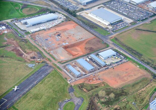
SkyPark is a partnership between St. Modwen, the UK’s leading regeneration specialist, and Devon County Council.
As the cornerstone of the Exeter and East Devon New Growth Point, SkyPark is the South West’s most significant business park development.
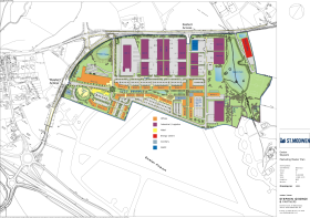
It will combine environmentally sustainable office and industrial space with a hotel, local facilities and a combined heat and power plant providing district heating, all in a landscaped environment of more than 100 acres. SkyPark is a cutting edge business park development sitting in a prime location adjacent to Exeter International Airport and is accessed via the new Clyst Honiton Bypass which provides a direct link onto the A30 and to Junction 29 of the M5.
Location
SkyPark is located adjacent to Exeter International Airport and is accessed viathe new Clyst Honiton Bypass which provides a direct link onto the A30 and to
Junction 29 of the M5.
Close by is the new Cranbrook railway station offering links to Exeter citycentre and London Waterloo. There is also a regular bus service serving the
park from Exeter to Cranbrook.
SkyPark Sustainability and Amenities
At SkyPark, there is an integrated approach to sustainability – embracing every aspect of social, economic and urban design as integral
elements of sustainable places, together with consideration of environmental sustainability in relation to renewable energy and energy
efficiency to minimise the carbon footprint of the development. At SkyPark, you can expect more than just electric car charging points.
SkyPark will incorporate on-site facilities including a hotel, pub, crèche and retail, as well as an on-site trim trail and central car park.
Close by is the new Cranbrook development which has a good selection of new housing, schools and local amenities.
Brochures
SkyPark, Exeter, EX5 2FL
NEAREST STATIONS
Distances are straight line measurements from the centre of the postcode- Cranbrook Station0.8 miles
- Pinhoe Station1.9 miles
- Digby & Sowton Station2.7 miles
Notes
Disclaimer - Property reference 87060-2. The information displayed about this property comprises a property advertisement. Rightmove.co.uk makes no warranty as to the accuracy or completeness of the advertisement or any linked or associated information, and Rightmove has no control over the content. This property advertisement does not constitute property particulars. The information is provided and maintained by Jones Lang Lasalle, Exeter - Industrial. Please contact the selling agent or developer directly to obtain any information which may be available under the terms of The Energy Performance of Buildings (Certificates and Inspections) (England and Wales) Regulations 2007 or the Home Report if in relation to a residential property in Scotland.
Map data ©OpenStreetMap contributors.


