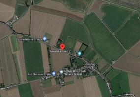
Gedney Drove End, PE12 9PN
- PROPERTY TYPE
Land
- SIZE
Ask agent
Key features
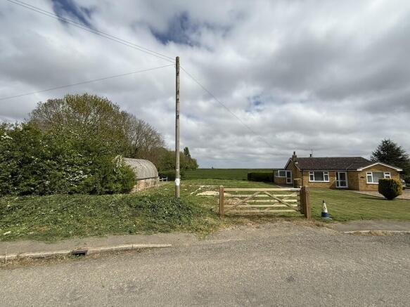
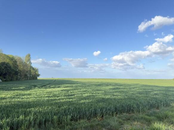
- Building Plot in a Rural village location, having open field views to the east.
- Total Site Area Approximately 360m²
- Full Planning Consent granted for a large 2 Bedroom House with integral garage
- Existing Access on Dawsmere Road
- Planning ‘started’. Foundations are in and signed off by Building Control
Description
The plot has a frontage of approximately 13.6m and a depth on the north boundary of approximately 32.5m.The rear width is 13.55m.
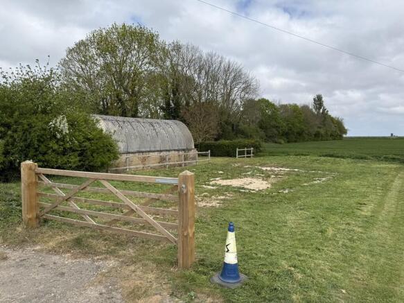
SITE FEATURES The site is flat and level and extends to approximately 360m². it is shown edged red on the plan included in these Particulars (for identification purposes only). Red topped marker posts have been positioned in the 4 corners of the plot.
The plot has a frontage of approximately 13.6m and a depth on the north boundary of approximately 32.5m. The rear width is 13.55m.
TENURE
Freehold with vacant possession upon completion. The current use of the site to provide access to adjacent land will cease on completion of a sale.
SERVICES
It is believed that mains electric and water are available in the road. However, neither the Vendor nor the Agents make any guarantees as to the availability of services and interested parties must make their own enquiries direct with the service providers concerned as to the availability, practicality and cost of providing all necessary services to the site as required.
A new Private treatment plant is required to provide foul drainage to the proposed new dwelling, with soakaways dealing with surface water.
The Telegraph pole in the front of the site is intended to remain in situ. The fences/hedge to the north and south belong to the neighbouring properties, and the purchaser will be required to fence the rear (east) boundary with a new Lincolnshire post and rail fence within 3 months of completion of a sale.
PLANNING CONSIDERATIONS
Full Planning Consent was granted by South Holland District Council - Reference No. H06-0134-22 dated 01/04/22 for the development of the site. The plans included in the Planning Consent are for a large 2 bedroom detached house with integral garage. Of particular note is the requirement for only 'non' habitable living space to be on the ground floor of the proposed dwelling. Planning has been 'started' on this site, Foundations are in and signed off by Building Control.
Prospective purchasers' attention is drawn to the various conditions attached to the Planning Consent and the purchaser will be responsible for all costs associated with fulfilling such conditions. A copy of the formal Planning Consent is available from the Council's website: or from the Agent's Spalding Office. Included in these Particulars are copies of the plans determined in the Planning Application which show the consented design of the dwelling. Any queries in respect of planning matters should be addressed direct to the Planning Department at South Holland District Council - CALL: .
INFORMATION PACK
Details of the following documents are available upon request: CALL:
Email:
- Plans associated with the Planning Application
- Planning Consent
- Flood Risk Assessment
Brochures
BrochureGedney Drove End, PE12 9PN

NEAREST STATIONS
Distances are straight line measurements from the centre of the postcode- Kings Lynn Station11.6 miles


Notes
Disclaimer - Property reference 101505013753. The information displayed about this property comprises a property advertisement. Rightmove.co.uk makes no warranty as to the accuracy or completeness of the advertisement or any linked or associated information, and Rightmove has no control over the content. This property advertisement does not constitute property particulars. The information is provided and maintained by Longstaff, Spalding. Please contact the selling agent or developer directly to obtain any information which may be available under the terms of The Energy Performance of Buildings (Certificates and Inspections) (England and Wales) Regulations 2007 or the Home Report if in relation to a residential property in Scotland.