The Burning House, Ilsington

- BATHROOMS
1
- SIZE
Ask agent
- TENUREDescribes how you own a property. There are different types of tenure - freehold, leasehold, and commonhold.Read more about tenure in our glossary page.
Freehold
Key features
- 10 Acre historic site in idyllic location
- Wildflower Meadow and Woodland
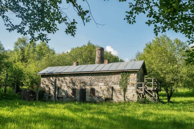
- Excellent Grade II listed Stone Burning House
- Former Mine Workings
- Ideal personal get-away
- Dartmoor Location
- Ponds and streams
Description
Situation
Located only a short distance from the open moor the site offers a secluded and idyllic get-away surrounded by farmland and some woodland yet accessible via the country lanes which connect with Bovey Tracey and the A38 which are located approximately 5 miles to the East. Ilsington, a pretty Dartmoor village, is less than a mile away with is facilities whilst Haytor and the open expanse of Dartmoor offer walks and many other recreational activities.
Description
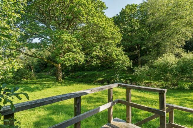
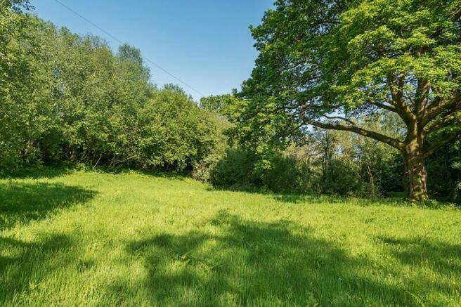
From the field gate the site leads into an open meadow and via a track onto mixed woodland and the Burning House itself. The meadow and woodland is a haven for wildlife and is considered to be an important niche habitat for many species of wild flowers including orchids. The woodland is known as Middlecott Wood and comprises a variety of trees including a number of large mature oaks which stand alongside the central flowing watercourse. The main woodland can be covered by a carpet of bluebells at the right time of year.
Land
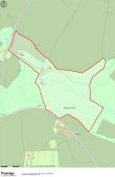
The land is comprised of pasture/grassland and mature deciduous woodland. The land to the North West of the property is predominately level and is wet grassland with some areas of rush. The remainder of the land is a mix of level areas, undulating and rising steeply in the woodland.
The land is partially divided by Liverton Brook with several crossing place. In addition to this there are several natural water crossings traversing the land and a pond to the eastern side of the Burning House.
Services
Mains electricity and mains water supply.
Local & Planning Authority
Dartmoor National Park, Parke , Bovey Tracey TQ13 9JQ—Tel
Planning Information
2016—Application No 0277/16—Repairs including repointing and repairing wall, works to the roof and new joinery. Granted conditionally
2016—Application No 0276/16—Construction of an earth house for holiday accommodation as enabling development and occasional welfare use by visiting groups, to support repair and restoration of Atlas Mine Burning House together with associated works. Application refused.
Environmental Information
As part of the 0276/16 planning application an extensive catalogue of documentation for the property including a historical survey as well as ecological, contamination, bat, meadow and water surveys were included. Due to the nature of the mining it is believed that the grounds have a high risk of contamination including arsenic.
Viewings
Strictly by appointment only through Rendells Estate Agents, Tel:
Directions
From Bovey Tracey take the B3387 towards Haytor & Widecombe. Follow this for approx 2 miles keeping left on the B3387 and take the sharp left hand turn signposted Greenlane. Follow this and take the first lane on the right hand side. Continue past a house called West Wing and down the hill. The gate to the property will be found on the left hand side with a Rendells board.
What3words Location
///zoos.uptake.tribes
Brochures
Property BrochureFull Details- COUNCIL TAXA payment made to your local authority in order to pay for local services like schools, libraries, and refuse collection. The amount you pay depends on the value of the property.Read more about council Tax in our glossary page.
- Ask agent
- PARKINGDetails of how and where vehicles can be parked, and any associated costs.Read more about parking in our glossary page.
- Ask agent
- GARDENA property has access to an outdoor space, which could be private or shared.
- Yes
- ACCESSIBILITYHow a property has been adapted to meet the needs of vulnerable or disabled individuals.Read more about accessibility in our glossary page.
- Ask agent
Energy performance certificate - ask agent
The Burning House, Ilsington
Add an important place to see how long it'd take to get there from our property listings.
__mins driving to your place
Get an instant, personalised result:
- Show sellers you’re serious
- Secure viewings faster with agents
- No impact on your credit score
Your mortgage
Notes
Staying secure when looking for property
Ensure you're up to date with our latest advice on how to avoid fraud or scams when looking for property online.
Visit our security centre to find out moreDisclaimer - Property reference 12387619. The information displayed about this property comprises a property advertisement. Rightmove.co.uk makes no warranty as to the accuracy or completeness of the advertisement or any linked or associated information, and Rightmove has no control over the content. This property advertisement does not constitute property particulars. The information is provided and maintained by Rendells, Chagford. Please contact the selling agent or developer directly to obtain any information which may be available under the terms of The Energy Performance of Buildings (Certificates and Inspections) (England and Wales) Regulations 2007 or the Home Report if in relation to a residential property in Scotland.
*This is the average speed from the provider with the fastest broadband package available at this postcode. The average speed displayed is based on the download speeds of at least 50% of customers at peak time (8pm to 10pm). Fibre/cable services at the postcode are subject to availability and may differ between properties within a postcode. Speeds can be affected by a range of technical and environmental factors. The speed at the property may be lower than that listed above. You can check the estimated speed and confirm availability to a property prior to purchasing on the broadband provider's website. Providers may increase charges. The information is provided and maintained by Decision Technologies Limited. **This is indicative only and based on a 2-person household with multiple devices and simultaneous usage. Broadband performance is affected by multiple factors including number of occupants and devices, simultaneous usage, router range etc. For more information speak to your broadband provider.
Map data ©OpenStreetMap contributors.


