Kirkhill Croft, Heights Of Fodderty, Strathpeffer, Highland, IV14
- PROPERTY TYPE
Land
- SIZE
249,599 sq ft
23,189 sq m
Key features
- Ideal income source for the potential purchaser
- Potential to decroft an area for a house site (subject to necessary consents)
Description
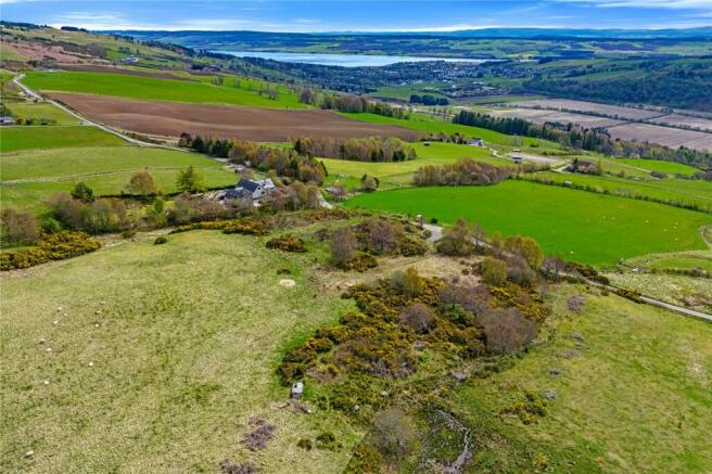
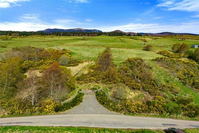
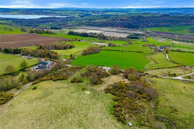
The farmland which is registered as a croft extends to 5.73acre (2.32ha) and comprises a single block of south facing land providing a mixture of permanent pasture and rough grazing for livestock. It is fenced for sheep and cattle. It is registered with SGRPID and eligible to receive agricultural support from the LFASS and BPS schemes as well as crofting grants where appropriate.
The successful buyer should be aware that they will need to satisfy the legal requirements of the Crofting Commission, including being ordinarily resident within 32km of the croft and having the intention of actively farming the land.
The croft has not been mapped with the Crofting Register and the transfer of the Tenancy will require this to be done as part of the Assignation process. The croft boundaries are as understood by the current tenant, but may be subject to change if there are objections from neighbouring crofters.
Opportunity as a productive small holding or as additional land to neighbouring farmers.
Notification to the planning authority would be required for an agricultural building, with potential for obtaining consent for a house site (subject to necessary consents).
Planning is currently in place under planning reference number 22/00308/FUL to erect two glamping pods which offers the purchaser the opportunity to create a holiday letting business.
Kirkhill Croft is located in a rural area at the Heights of Foddery which lies approximately 3.4 miles from the Victorian spa village of Strathpeffer and approximaltely 4 miles from the market town of Dingwall.
Strathpeffer village is famed for its Victorian spa waters and fine stone-built houses and villas. There is a small selection of local shops, a bistro, wine bar, a doctors surgery, hotels and the Spa Pavilion which regularly hosts performances from acclaimed artists. The village hosts the now legendary Strathpuffer Mounting Biking Challenge and has a popular 18 hole golf course. The area in a whole offers easy access to a variety of highland pursuits.
There is a well-respected local primary school and secondary school pupils are transported to the new Dingwall Academy.
Dingwall has a range of amenities including supermarkets, Doctors, Hospital and Leisure Centre. The City of Inverness - capital of the Highlands is also within easy commuting distance being only 20 miles away.
Services are available close by.
From Inverness take the A9 towards Ullapool. Follow the signs for Dingwall and Strathpeffer. Upon reaching Dingwall Strathpeffer is clearly sign posted. Drive through Blairninich and continue until you reach a right-hand turn for Achterneed. Turn right here and follow the road over the railway line and up the hill. The road levels out and continue on and the croft is on the left-hand side marked with a sale board. What3Words///importing.awkward.originate
Brochures
ParticularsKirkhill Croft, Heights Of Fodderty, Strathpeffer, Highland, IV14

NEAREST STATIONS
Distances are straight line measurements from the centre of the postcode- Dingwall Station2.8 miles
- Conon Bridge Station4.0 miles


Notes
Disclaimer - Property reference INE240031. The information displayed about this property comprises a property advertisement. Rightmove.co.uk makes no warranty as to the accuracy or completeness of the advertisement or any linked or associated information, and Rightmove has no control over the content. This property advertisement does not constitute property particulars. The information is provided and maintained by Bell Ingram, Highland. Please contact the selling agent or developer directly to obtain any information which may be available under the terms of The Energy Performance of Buildings (Certificates and Inspections) (England and Wales) Regulations 2007 or the Home Report if in relation to a residential property in Scotland.
Map data ©OpenStreetMap contributors.