GL6
£0.59 per sq ft
Business rates & charges may apply

- SIZE AVAILABLE
340,639 sq ft
31,646 sq m
- SECTOR
Land for sale
Description
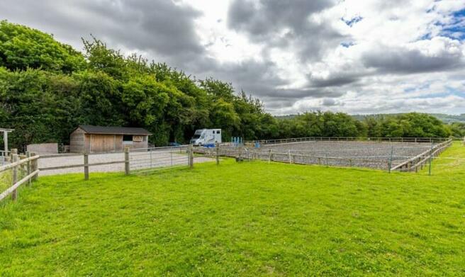
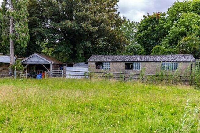
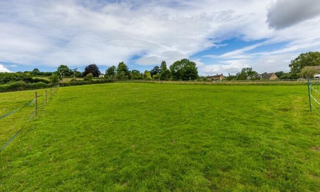
The equestrian facilities include a 20m x 32m all weather sand and rubber base Manège with temporary lighting, large hard standing parking area, a timber hay/feed store, a concrete lorry park (going for retrospective planning)/muck heap ramp, tack room, two loose boxes, lean-to store and a four bay field pole barn. The land extends to approximately 7.82 acres and is split into two parcels. The land is Grade 3 permanent pasture lying over base rich loamy and clayey soils.
The land has two access points, both with full rights of way over third party land and are marked brown on the plan in the attached brochure. There are no public footpaths or rights of way crossing the land.
The land is located off Edge Lane, a single track rural lane 4.0 miles north of Stroud, a market town in Gloucestershire. Painswick lies 1 mile to the East providing direct access to Stroud and Cheltenham via the A46. The land has access to a good wider road network with Junction 11A of M5 being 8 miles to the North, which provides links to Bristol and Birmingham.
CASH PURCHASERS ONLY PLEASE
Brochures

NEAREST STATIONS
Distances are straight line measurements from the centre of the postcode- Stroud Station2.9 miles
- Stonehouse Station4.1 miles
Notes
Disclaimer - Property reference 7046FH. The information displayed about this property comprises a property advertisement. Rightmove.co.uk makes no warranty as to the accuracy or completeness of the advertisement or any linked or associated information, and Rightmove has no control over the content. This property advertisement does not constitute property particulars. The information is provided and maintained by Bruton Knowles, Gloucester. Please contact the selling agent or developer directly to obtain any information which may be available under the terms of The Energy Performance of Buildings (Certificates and Inspections) (England and Wales) Regulations 2007 or the Home Report if in relation to a residential property in Scotland.
Map data ©OpenStreetMap contributors.