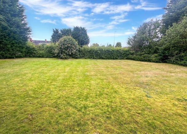
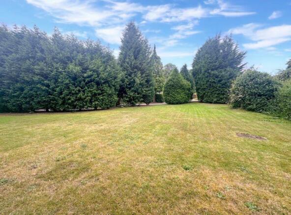
Land at Crewe Road, Alsager

- PROPERTY TYPE
Land
- SIZE
Ask agent
Key features
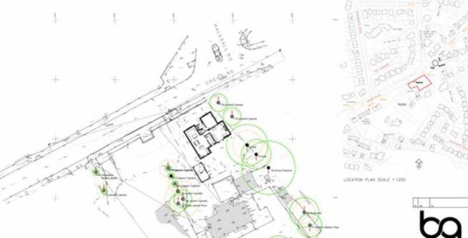
- Superb Size Building Plot For A Four Bedroom Detached Residence
- Full Planning Permission Granted 28/11/2022
- Planning Permission Number 22/3790C
- Separate Private Driveway
- Southerly Facing Lawned Gardens
Description
The plot has its own private access and is sat within a south facing position whilst being located in a highly sought after location of Alsager having nearby access to the town as well as good road links to Crewe, Sandbach and Congleton.
Location is perfect for those wishing to commute via the A50, A500 and the M6 Motorway. Travel into Manchester and London is easily accessible with the local train stations of Alsager and Kidsgrove, whilst Stoke and Congleton train stations are a short distance away.
Alsager benefits from highly regarded schools including Alsager High school which has been rated as one of the highest performing in Cheshire East.
The town of Alsager benefits from an array of eateries wine bars and a variety of shops to suit everyone's needs.
Brochures
Full DetailsLand at Crewe Road, Alsager

NEAREST STATIONS
Distances are straight line measurements from the centre of the postcode- Alsager Station0.9 miles
- Kidsgrove Station3.2 miles
- Crewe Station4.7 miles


Notes
Disclaimer - Property reference 12414463. The information displayed about this property comprises a property advertisement. Rightmove.co.uk makes no warranty as to the accuracy or completeness of the advertisement or any linked or associated information, and Rightmove has no control over the content. This property advertisement does not constitute property particulars. The information is provided and maintained by Whittaker & Biggs, Congleton. Please contact the selling agent or developer directly to obtain any information which may be available under the terms of The Energy Performance of Buildings (Certificates and Inspections) (England and Wales) Regulations 2007 or the Home Report if in relation to a residential property in Scotland.
Map data ©OpenStreetMap contributors.