
Upper Bourne Lane, Farnham, Surrey, GU10

- PROPERTY TYPE
Land
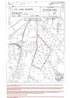
- SIZE
115,870 sq ft
10,765 sq m
Description
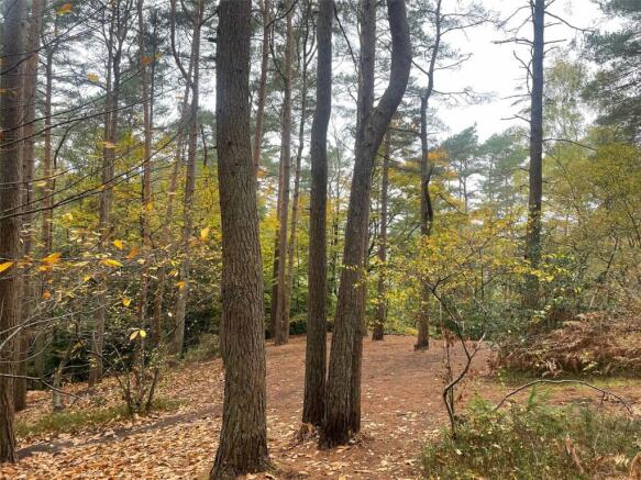
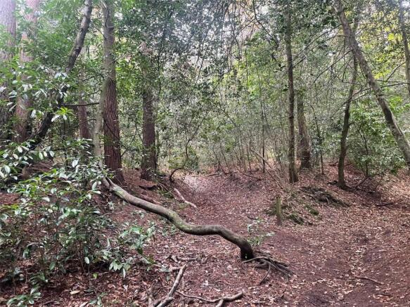
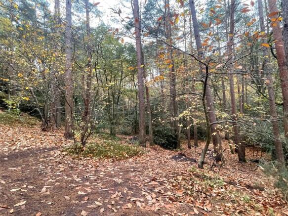
Description
An opportunity to acquire circa 2.66 acres of attractive woodland in a secluded setting with access onto Celery Lane leading to Burnt Hill Road.
Situation
The land lies about 2.25 miles south of central Farnham and about 0.5 of a mile from the Bourne villages, shops and facilities. The land is shown on the Waverley Borough Council Local Plan as part of the South Farnham Area of Special Environmental Quality and adjoins the residential area running from Shortheath to The Bourne.
Additional Information
No services are connected.
Local Authority
Waverley Borough Council, The Burys, Godalming GU7 1HR
Tenure
Freehold.
Directions
From Farnham centre proceed south on the A287 Frensham/Hindhead Road for approximately 1.5 miles. At the crossroads in the centre of The Bourne village turn right into Burnt Hill Road. Continue for about 0.6 of a mile and the unmade Celery Lane is on the left.
Brochures
ParticularsUpper Bourne Lane, Farnham, Surrey, GU10

NEAREST STATIONS
Distances are straight line measurements from the centre of the postcode- Farnham Station1.3 miles
- Bentley Station3.0 miles
- Aldershot Station4.1 miles


Notes
Disclaimer - Property reference AND240352. The information displayed about this property comprises a property advertisement. Rightmove.co.uk makes no warranty as to the accuracy or completeness of the advertisement or any linked or associated information, and Rightmove has no control over the content. This property advertisement does not constitute property particulars. The information is provided and maintained by Andrew Lodge, Farnham. Please contact the selling agent or developer directly to obtain any information which may be available under the terms of The Energy Performance of Buildings (Certificates and Inspections) (England and Wales) Regulations 2007 or the Home Report if in relation to a residential property in Scotland.
Map data ©OpenStreetMap contributors.