LOT 3 - Netherhill, SO32

- PROPERTY TYPE
Land
- SIZE
233,917 sq ft
21,732 sq m
Key features
- SEE AND PRINT PDF SALES PARTICULARS AVAILABLE BELOW
- SEE DRONE VIDEO FOOTAGE ON THE VIRTUAL TOUR TAB
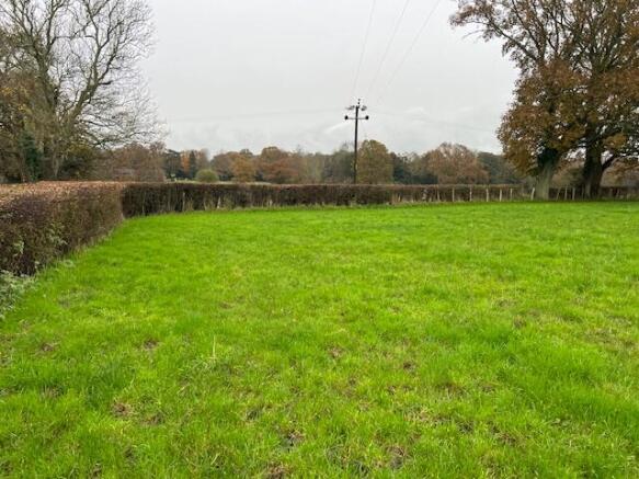
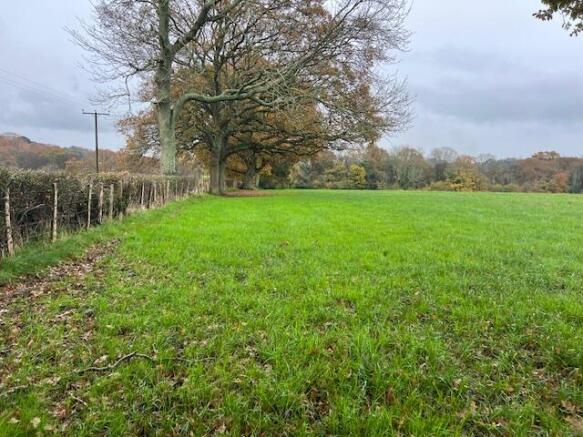
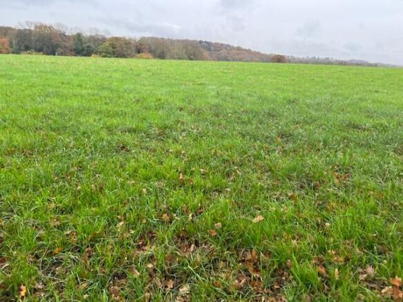
- Pasture land
- 5.37 acres
- Reasonably level
- Water supply available
- Unfenced boundary - See pegs
- Access gate and road frontage
- Some hedgerow boundaries
- Quiet narrow lanes
Description
VIDEO DRONE FOOTAGE: See the Giles Wheeler-Bennett website and further details, photographs and drone video footage is available showing the whole Property.
LOCATION: See Location Plan. The Property is located on the northern side of the highway known as Netherhill Lane, which is a single-track C class road. The property lies between the villages of Durley (to the north) and Boorley Green (to the southwest), with the market towns of Botley & Bishops Waltham some 2km to the south and 3km to the northeast respectively. The property falls outside of the South Downs National Park (SDNP). The main vehicular entrance to the property is (What3Words) paused.sour.presenter.
DIRECTIONS: See Location Plan. From Botley town centre, take the A334 eastwards towards Wickham. Immediately after the railway station bear left on to the B3035 heading northeasterly towards Bishops Waltham. Take the second left hand turn off of the B3035 along Wangfield Lane and after approx. 1 km turn right on to Netherhill Lane heading north. Travel along Netherhill Lane for approx. 1.5 km continuing past the turning to Durley and the main entrance to the land will be found right in front of you at the sharp righthand bend.
DESCRIPTION: See Lotting Plan. The Property extends in all to approx. 43.28 acres (17.51 Ha) which is all laid to permanent pasture. The pastureland is currently divided into 3 parcels by established hedgerows, and subject to how the property is sold, additional fences will be requested to be erected along in the position identified by the dotted lines on the attached Lotting Plan. Wooden Pegs (sprayed orange) identifying the location of these dotted lines have been placed on the land.
According to the Agricultural Land Classification, the majority of the land is classified as Grade 2 quality with the southern most tip of Lot 5 being classified as Grade 1.
The geological survey map of England and Wales, indicates the property to fall under two soil types. The northern portion is classified as the Wickham 3 Series, which is a slowly permeable seasonably water-logged fine loamy over clay soil, with the southern portion being classified as The Bursledon Series, which is a deep fine loamy soil with slowly permeable subsoils.
The land is located on the crest of a hill with the northern parcels falling north westwards and the southern parcels falling in a south easterly direction towards the River Hamble. The highest point of the property falls within Lot 2 at 37m above mean sea level with the lowest point being located at the southern tip of Lot 5 at approx. 15m above mean seal level.
LAND REGISTRY TITLE: The Property forms part of Land Registry Title HP873894. Please see Additional Documents for copies of Register and Plan.
PUBLIC FOOTPATH: A Public Footpath crosses Lot 1 as identified on the Lotting Plan. See extract of the Definitive Plan on which the routes of the Public Footpaths are shown by purple lines.
PRIVATE RIGHTS OF WAY: As identified above, access to Lot 1 is via an unrestricted Right of Way over the neighbouring property's land coloured yellow on the Lot Plan. Consequently, this access is shared with the adjoining landowner, as well as accommodating a Public Footpath.
PLANNING: All of the land is classified as agricultural land situated in the countryside to which the relevant countryside policies of the current Winchester City Council Local plan apply.
SOUTH DOWNS NATIONAL PARK AUTHORITY: The property falls outside of the South Downs National Park Authority.
WINCHESTER CITY COUNCIL: City Offices, Colebrook Street, Winchester,
Hampshire, SO23 9LJ.
BIODIVERSITY NET GAIN (BNG): There may be the potential for parts of the
Property to be managed in a way, or with new habitats established, to be suitable for use as part of the new requirement for development to provide a 10% biodiversity net gain. Such BNG Credits can then be sold to developers. See the RICS note for your interest - BNG.
SERVICES: Mains water is connected to a number of troughs on the property, which can be subdivided if the property is sold in Lots, with each Lot having rights to connect to its own independent water supply.
ACCESS: The property benefits from 5 access points (Gates) off Netherhill Lane with the entrance into Lot 1 being obtained over an unrestricted Right of Way over the track coloured yellow on the attached Lotting Plan. The right of way over this track is defined more particularly as "a right of way over and along the 12ft trackway".
VIEWING: Parties looking to view Lot 5 are advised to access the gate into Lot 4 and walk to Lot 5 (to avoid the barbed wire currently attached to the gate into Lot 5).
EASEMENTS AND WAYLEAVES: An Esso Pipeline crosses the property (Lot 1). Overhead 11kv and 33kv electricity lines cross the Property.
PROPOSED BOUNDARY FENCES: If Lots 2-5 are sold separately, then the new boundary fence required shall be erected by one of the adjoining Purchasers and this shall be subject to negotiation with the Selling Agent.
Brochures
Sales ParticularsLOT 3 - Netherhill, SO32

NEAREST STATIONS
Distances are straight line measurements from the centre of the postcode- Botley Station1.4 miles
- Hedge End Station1.6 miles
- Bursledon Station4.2 miles
About Giles Wheeler-Bennett, Southampton
West Court, Lower Basingwell Street, Bishop's Waltham, SO32 1AJ
Notes
Disclaimer - Property reference NetherhillLOT3. The information displayed about this property comprises a property advertisement. Rightmove.co.uk makes no warranty as to the accuracy or completeness of the advertisement or any linked or associated information, and Rightmove has no control over the content. This property advertisement does not constitute property particulars. The information is provided and maintained by Giles Wheeler-Bennett, Southampton. Please contact the selling agent or developer directly to obtain any information which may be available under the terms of The Energy Performance of Buildings (Certificates and Inspections) (England and Wales) Regulations 2007 or the Home Report if in relation to a residential property in Scotland.
Map data ©OpenStreetMap contributors.