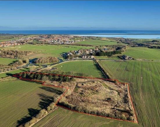
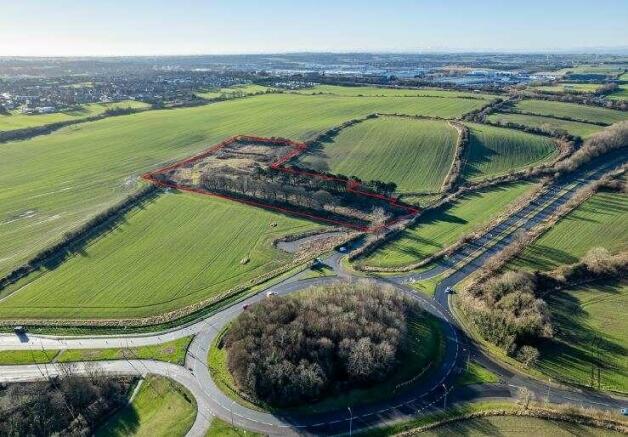
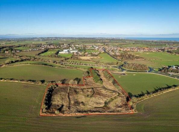
Land at St Andrew's Lane, Little Thorpe

- SIZE AVAILABLE
256,133 sq ft
23,796 sq m
- SECTOR
Land for sale
Key features
- Outline planning consent for the development of 32 self-build dwellings
- Informal sealed tenders sought by noon, Monday 27 January 2025
Description
The site is located on Andrew's Lane on the outskirts of Little Thorpe, a sought after village to the north east of County Durham. Little Thorpe is located approximately 10.5 miles south of Sunderland, 10 miles east of Durham and 20 miles south of Newcastle upon Tyne. County Durham's Heritage Coastline forms a natural geographical border to the east of the village, which comprises the nearby harbour town of Seaham, benefiting from a broad range of amenities, cafes and restaurants.
Road access to Little Thorpe is principally provided via the A19 directly to the west, which facilities access to the conurbations of Tyne & Wear and Teesside to the north and south respectively. The village is served by a number of nearby railway stations, including Seaham and Horden, which provide regular connections to various regional destinations including Newcastle upon Tyne, Sunderland and Middlesbrough.
Brochures
Land at St Andrew's Lane, Little Thorpe

NEAREST STATIONS
Distances are straight line measurements from the centre of the postcode- Horden Station1.6 miles
- Seaham Station4.5 miles
About Savills, Newcastle Upon Tyne
Savills, The Lumen, St. James Boulevard, Arthurs Hill, Newcastle Upon Tyne, NE4 5BZNotes
Disclaimer - Property reference 5CBAC44D-820E-48DA-B0B0-A0781D3C69CE. The information displayed about this property comprises a property advertisement. Rightmove.co.uk makes no warranty as to the accuracy or completeness of the advertisement or any linked or associated information, and Rightmove has no control over the content. This property advertisement does not constitute property particulars. The information is provided and maintained by Savills, Newcastle Upon Tyne. Please contact the selling agent or developer directly to obtain any information which may be available under the terms of The Energy Performance of Buildings (Certificates and Inspections) (England and Wales) Regulations 2007 or the Home Report if in relation to a residential property in Scotland.
Map data ©OpenStreetMap contributors.