
East Street, Rippingale, Bourne, Lincolnshire, PE10

- PROPERTY TYPE
Land
- SIZE
48,352 sq ft
4,492 sq m
Key features
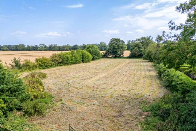
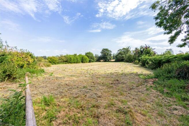
- Development Plot
- Land with Outline planning consent granted for up to six single storey residential dwellings
- Attractive edge of village setting
- Countryside views
- Bourne 5.3 miles; Stamford 17 miles; Peterborough 22 miles with trainline to London Kings Cross in about 50mins
Description
Description
South Kesteven District Council have granted outline planning consent for the erection of up to six single storey dwellings and associated access and infrastructure, dated May 2024. The plans are available on the Council planning portal ( ) under planning reference S24/0315, or from the agent.
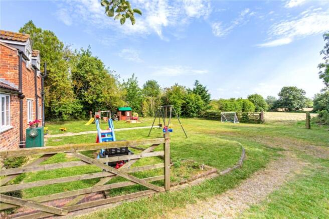
The dwellings are to be single storey in nature and vehicular access would be from the existing driveway to the paddock at the rear of the property. Access is existing and services will be brought from the road. Drainage Strategy Plans are available on the aforementioned South Kesteven District Council website.
The property lies on the edge of the village of Rippingale, five miles north of the market town of Bourne. The village has a village hall, a pub, and a parish church, while there is a local shop in nearby Morton. Bourne offers a variety of amenities, including a selection of shops, supermarkets, and leisure facilities.
Local secondary schools include Bourne Academy and the outstanding-rated Bourne Grammar School, while there are several independents locally, including Kirkstone House School and Witham Hall School.
The area is well connected by road, with the A15 providing access to the surrounding towns and the cathedral city of Peterborough. Mainline rail services are available in Spalding, services to London Kings Cross via Peterborough (approx. 50 mins) or Grantham.
Acreage: 1.11 Acres
Additional Info
All journey times and distances are approximate.
All viewings are to be made through Savills.
Brochures
Web DetailsParticularsEast Street, Rippingale, Bourne, Lincolnshire, PE10

NEAREST STATIONS
Distances are straight line measurements from the centre of the postcode- Spalding Station9.4 miles
Notes
Disclaimer - Property reference SSG250028. The information displayed about this property comprises a property advertisement. Rightmove.co.uk makes no warranty as to the accuracy or completeness of the advertisement or any linked or associated information, and Rightmove has no control over the content. This property advertisement does not constitute property particulars. The information is provided and maintained by Savills, Stamford. Please contact the selling agent or developer directly to obtain any information which may be available under the terms of The Energy Performance of Buildings (Certificates and Inspections) (England and Wales) Regulations 2007 or the Home Report if in relation to a residential property in Scotland.
Map data ©OpenStreetMap contributors.