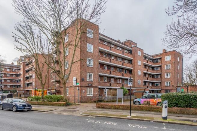
Mayville Estate, London, N16
- PROPERTY TYPE
Flat
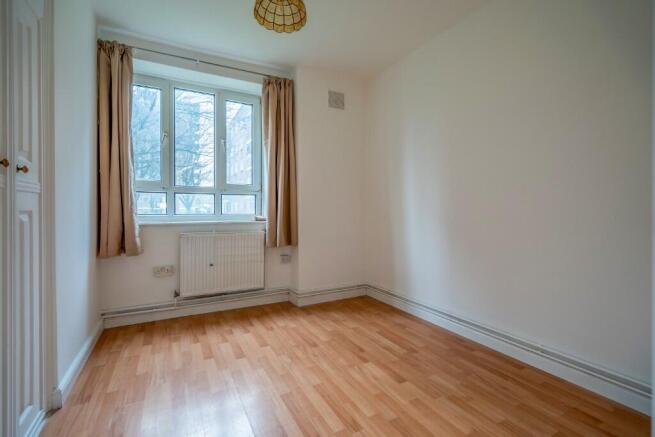
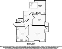
- BEDROOMS
2
- BATHROOMS
1
- SIZE
Ask agent
Key features
- 2 Bedroom Purpose-Built Flat
- Reception
- Fitted Kitchen
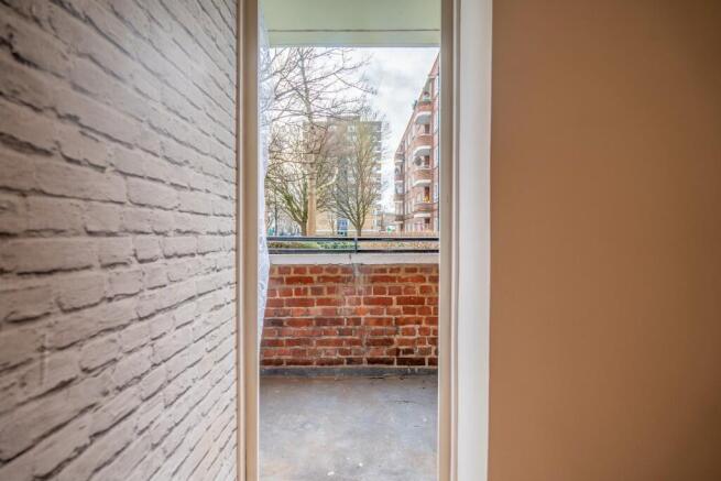
- Balcony
- Close to Shopping Facilities
- Excellent Transport Links
Description
Nearest railway stations
Dalston Kingsland 380 yards
Dalston Junction 780 yards
Canonbury 0.6 miles
rectory Road 0.7 miles
Haggerston 0.8 miles
Hackney Downs 0.8 miles
Essex Road 1 mile
Highbury and Islington 1 mile
Hackney Central 1 mile
Stoke Newington 1 mile
London Fields 1.1 miles
Drayton Park 1.2 miles
Clapton 1.2 miles
Hoxton 1.3 miles
Frisby Park 1.5 miles
Cambridge Heath 1.6 miles
Caledonian Road and Barnsbury 1.6 miles
Stanford Hill 1.7 miles
Holton 1.8 miles
Old Street 1.8 miles
Nearest tube/DLR stations
Dalston Kingsland overground station 400 yards
Dalston Junction overground station 630 yards
Canonbury overground station 0.6 miles
Rectory Road overground station 0 . 7 miles
Hackney Downs overground station 0 . 8 miles
Haggerston overground station 0 . 8 miles
Hackney Central overground station 1 mile
Stoke Newington overground station 1 mile
Hybrid in Islington tube station 1 . 1 miles
Hybrid and Islington overground station 1 . 1 miles
London Fields overground station 1 . 1 miles
Clapton overground station 1 . 2 miles
Hoxton overground station 1 . 3 miles
Arsenal tube station 1 . 3 miles
Holloway Road tube station 1 . 5 miles
Finsbury Park tube station 1 . 5 miles
Manorhouse tube station 1 . 6 miles
Cambridge Heath overground station 1.6 miles
Stamford Hill overground station 1.7 miles
Nearest primary schools
St Matthias Church of England primary school 200 yards
Princess May primary School 290 yards
Newington Green primary School 350 yards
Saint Jude in Saint Paul's COFE primary School 380 yards
Halley house school 530 yards
Shacklewell primary School 580 yards
Grasmere primary school 640 yards
Our lady in Saint Joseph Catholic primary School 700 yards
Holy Trinity Church of England primary School half a mile
Bette Layward primary school 0.6 miles
Nearest secondary school
The Excelsior Academy 570 yards
Stoke Newton School and six form 0.6 miles
The boxing Academy 0.8 miles
Mossbourne Community Academy 0.8 miles
City of London Academy Highbury Grove 0.8 miles
Waterside Academy 0.8 miles
Highbury Field school 1 mile
The bridge Academy 1.1 miles
The Urswick school-a Church of England secondary school 1.2 miles
Clapton Girls Academy 1.2 miles
Nearest doctors surgeries/GP practices
The surgery (Barretts Grove) 200 yards
Mild main medical practice 560 yards
Somerford Grove practice 630 yards
Beechwood medical Centre 850 yards
The Mitchison Road surgery 0.5 miles
Dalston practice 0.5 miles
Sandringham practice 0.5 miles
The Miller practice 0.6 miles
The Statham Grove Surgery 0.7 miles
Barton house group practice 0.7 miles
Nearest dentist
Oral surgery Ltd 320 yards
Kindadental to 460 yards
Dental beauty Dalston 480 yards
Orchard dental care 600 yards
Kindadental dental practice 680 yards
Dental surgery 660 yards
M & D healthcare Limited 850 yards
Dentalshine practice 0.5 miles
Stoke Newington dental practice 0.6 miles
Orontica dental clinic 0.7 miles
Nearest hospitals
St Leonard 1.2 miles
Homerton University Hospital 1.4 miles
The lodge 1.7 miles
Moorfield eye hospital (City Road) 1.7 miles
The John Howard Centre 1.8 miles
Saint Annes hospital 2.1 miles
The Royal London hospital 2.4 miles
Royal London hospital 2.4 miles
Mile end hospital 2.4 miles
Camden Mews Hospital Day hospital 2.4 miles
Nearest opticians
Eyes only opticians 380 yards
Eyecloud opticians 480 yards
Specsavers opticians London 510 yards
Eyewear (Mr Islam) 0.7 miles
Askew Eyewear 0.7 miles
Stephen H Davis Opometrists 0.8 miles
Boots-Hackney 1.1 miles
Eye London opticians 1.1 miles
Specsavers opticians and audiologists 1.1 miles
Rose opticians 1.1 miles
All location information provided in this document, including distances and mileage, is approximate and intended for general reference only. It is the responsibility of the recipient to verify the accuracy of all location-related details, including but not limited to mileage, routes, and proximity to specific points of interest. The provider of this information does not guarantee its accuracy and assumes no liability for any discrepancies or inaccuracies.
Council Tax Band: D The London Borough of Hackney
Agents note: Please note that while Lastra Property Group strive to provide accurate property details, Lastra Property Group takes no responsibility for any incorrect information provided. All details should be verified by your solicitor as part of your purchase process.
- COUNCIL TAXA payment made to your local authority in order to pay for local services like schools, libraries, and refuse collection. The amount you pay depends on the value of the property.Read more about council Tax in our glossary page.
- Ask agent
- PARKINGDetails of how and where vehicles can be parked, and any associated costs.Read more about parking in our glossary page.
- Ask agent
- GARDENA property has access to an outdoor space, which could be private or shared.
- Patio
- ACCESSIBILITYHow a property has been adapted to meet the needs of vulnerable or disabled individuals.Read more about accessibility in our glossary page.
- Ask agent
Get an instant, personalised result:
- Show sellers you’re serious
- Secure viewings faster with agents
- No impact on your credit score
Your mortgage
Notes
Staying secure when looking for property
Ensure you're up to date with our latest advice on how to avoid fraud or scams when looking for property online.
Visit our security centre to find out moreDisclaimer - Property reference Campion. The information displayed about this property comprises a property advertisement. Rightmove.co.uk makes no warranty as to the accuracy or completeness of the advertisement or any linked or associated information, and Rightmove has no control over the content. This property advertisement does not constitute property particulars. The information is provided and maintained by LASTRA Property Group, Covering London. Please contact the selling agent or developer directly to obtain any information which may be available under the terms of The Energy Performance of Buildings (Certificates and Inspections) (England and Wales) Regulations 2007 or the Home Report if in relation to a residential property in Scotland.
*This is the average speed from the provider with the fastest broadband package available at this postcode. The average speed displayed is based on the download speeds of at least 50% of customers at peak time (8pm to 10pm). Fibre/cable services at the postcode are subject to availability and may differ between properties within a postcode. Speeds can be affected by a range of technical and environmental factors. The speed at the property may be lower than that listed above. You can check the estimated speed and confirm availability to a property prior to purchasing on the broadband provider's website. Providers may increase charges. The information is provided and maintained by Decision Technologies Limited. **This is indicative only and based on a 2-person household with multiple devices and simultaneous usage. Broadband performance is affected by multiple factors including number of occupants and devices, simultaneous usage, router range etc. For more information speak to your broadband provider.
Map data ©OpenStreetMap contributors.