
Bellfield Road, Coalburn, Lanark
- PROPERTY TYPE
Plot
- SIZE
Ask agent
Description
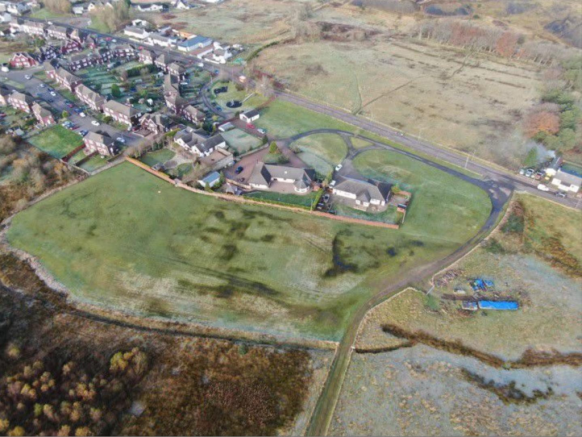
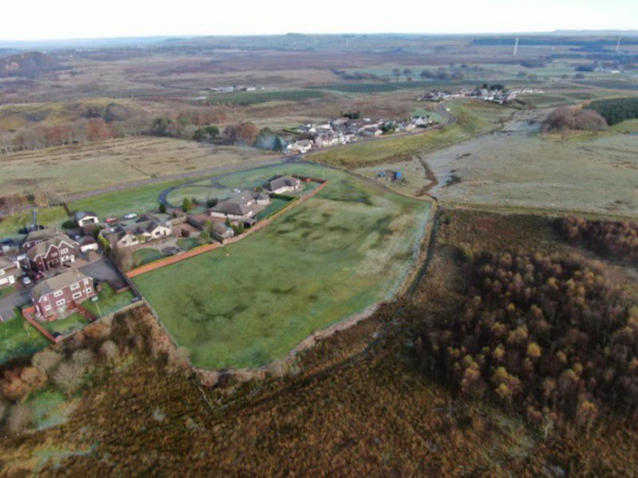
The site at Bellfield Road set on the periphery of Coalburn village and is within close proximity to the M74 motorway.
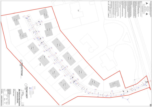
Full details can be found on the South Lanarkshire Planning portal along with the completed section 75 with planning reference P/19/0884.
To register your interest or arrange a site visit then please contact our Hamilton office on .
Coalburn is a small village set on the outskirts of Lesmahagow. The village offers several local amenities including a primary school, shop and pub as well as Coalburn Leisure centre, whilst Lesmahagow offers a wider range of amenities including a Tesco Superstore, fuel stations, post office and a wide variety of additional professional services. There are also two primary schools and the recently constructed Lesmahagow High School which hosts the Lesmahagow Sports Facility, which is a multipurpose sports and leisure centre.
An excellent opportunity to acquire a development site with planning permission having been granted for 21 houses made up of a mixture of 4 bedroomed detached villas and 3 and 4 bedroomed semi-detached homes.
Brochures
Brochure - plot, Bellfield Rod.pdfBrochureBellfield Road, Coalburn, Lanark

NEAREST STATIONS
Distances are straight line measurements from the centre of the postcode- Lanark Station7.0 miles

Notes
Disclaimer - Property reference 33674585. The information displayed about this property comprises a property advertisement. Rightmove.co.uk makes no warranty as to the accuracy or completeness of the advertisement or any linked or associated information, and Rightmove has no control over the content. This property advertisement does not constitute property particulars. The information is provided and maintained by Residence Estate Agents, Hamilton. Please contact the selling agent or developer directly to obtain any information which may be available under the terms of The Energy Performance of Buildings (Certificates and Inspections) (England and Wales) Regulations 2007 or the Home Report if in relation to a residential property in Scotland.