HR6 9JA
- PROPERTY TYPE
Farm Land
- SIZE
167,270 sq ft
15,540 sq m
Key features
- EXCELLENT AREA OF AMENITY LAND
- STABLES
- 3.84 ACRES
- FOR SALE BY INFORMAL TENDER
Description
A DESIRABLE BLOCK OF AMENITY LAND
WITH THE BENEFIT OF A STABLE BLOCK
at
THE OAKS
MARSTON
PEMBRIDGE
HEREFORDSHIRE
HR6 9JA
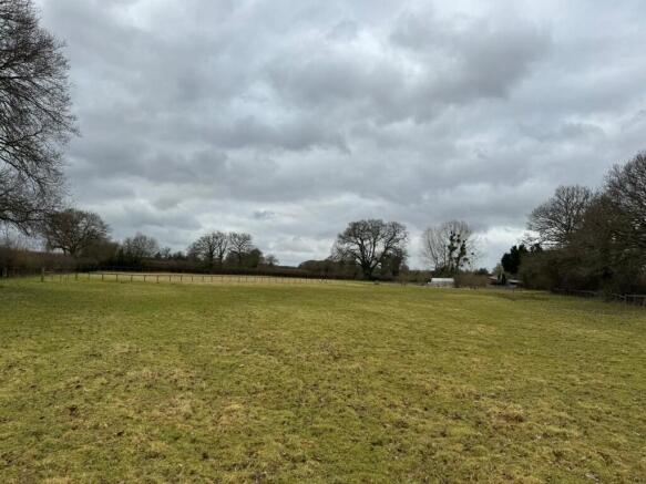
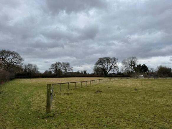
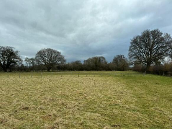
The Oaks is a desirable block of amenity land with the benefit of a stable block. The property is contained within a ring fence and is accessed by a stone trackway leading off Marston Lane.
The property benefits from a useful area of hardstanding that surrounds the stable block.
The stable block was built in 2004 and finished to a high standard.
The stable block comprises:
5 Loose Horse Boxes and Storage Area constructed of brick and timber panel elevations, concrete floor under a profile sheet roof.
Overall the building extends to 972 sq ft approx. The land extends to some 3.84 Acres and is contained within one enclosure. The land is cropped in a productive pasture ley.
AGENTS NOTE
* Superb rural location and excellent position just 2.4 miles from the village of Pembridge
* 3.84 Acres of Productive Pasture Land
* Stable Block comprising 5 loose boxes and storage area (972 sq ft approx.)
* Very accessible to the towns of Presteigne and Leominster
* Offered for Sale by Informal Tender
* Freehold with Vacant Possession
SITUATION
The property enjoys an excellent accessible location just 2.4 miles from the popular village of Pembridge. The property has excellent roadside frontage off Marston Lane and is accessed from a private entrance drive leading off Marston Lane.
The village of Pembridge is well accessed on the A44 road and offers an excellent range of local amenities including Pembridge CE Primary School, Village Hall, Ye Old Steppes Convenience Store, together with the popular Kings Arms providing drinking and dining.
DIRECTIONS
From Leominster
From the A44 in the centre of Leominster, follow the road west bound for 1.1 miles, then turn left onto Monkland Road and keep following the A44. After 8 miles turn right onto Marston Lane and after 1/3 of a mile the property is on the right.
POST CODE
HR6 9JA.
TENURE
The property is freehold and offered with vacant possession upon completion.
SERVICES
No services are connected to the property, however connections are available in close proximity.
OUTGOINGS
None disclosed.
LOCAL AUTHORITY
Herefordshire Council
Plough Lane, Hereford, HR4 0LE. Tel: .
RIGHTS OF WAY, EASEMENTS, ETC
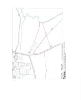
The property is sold subject to and with the benefit of all rights of way, wayleaves, access, water, light, drainage and other easements, quasi-easements, covenants, restrictions, orders etc, as may exist over the same or for the benefit of the same, whether mentioned in these particulars or not. There is a footpath as shown on the plan.
TOWN AND COUNTRY PLANNING
The property notwithstanding any description contained in these particulars, is sold subject to any Development Plan, Tree Preservation Order, Town Planning Scheme, Resolution or Notice which may or may not come to be in force and also subject to any statutory permission or byelaws without any obligation on the part of the Vendor to specify them.
IMPORTANT NOTICE
These particulars are set out as a guideline only. They are intended to give a fair description of the property but may not be relied upon as a statement or representation of fact. Photographs (and any artist's impression) show only certain parts of the property at the time they were taken. Any areas, measurements, or distances are approximate only and should not be relied on as a statement of fact. Any reference to alterations to or use of any part of the property, is not a statement that any necessary planning, building regulations or other consent has been obtained. Descriptions of a property are inevitably subjective and those contained herein are made in good faith as an opinion and not by way of a statement of fact.
VIEWING
Viewing may be undertaken at any reasonable time with a copy of these particulars.
SOLE AGENTS
Further information is available from the Agents: RG and RB Williams, Ross Auction Centre, Netherton Road, Ross on Wye, Herefordshire, HR9 7QQ. Tel .
MODE OF SALE
The property is offered by informal tender.
The attached tender form is to be submitted to the Agents Office to arrive by Friday 11th April
2025 at 12 Noon. Tenders are to be in sealed envelopes marked "Shobdon Land Tender".
Brochures
BrochureHR6 9JA

NEAREST STATIONS
Distances are straight line measurements from the centre of the postcode- Leominster Station8.5 miles
About RG & RB Williams, Ross-On-Wye
Ross Auction Centre, Netherton Road, Overross, Ross-On-Wye, HR9 7QQ

Notes
Disclaimer - Property reference PEMBRIDGE. The information displayed about this property comprises a property advertisement. Rightmove.co.uk makes no warranty as to the accuracy or completeness of the advertisement or any linked or associated information, and Rightmove has no control over the content. This property advertisement does not constitute property particulars. The information is provided and maintained by RG & RB Williams, Ross-On-Wye. Please contact the selling agent or developer directly to obtain any information which may be available under the terms of The Energy Performance of Buildings (Certificates and Inspections) (England and Wales) Regulations 2007 or the Home Report if in relation to a residential property in Scotland.
Auction Fees: The purchase of this property may include associated fees not listed here, as it is to be sold via auction. To find out more about the fees associated with this property please call RG & RB Williams, Ross-On-Wye on 01989 557009.
*Guide Price: An indication of a seller's minimum expectation at auction and given as a “Guide Price” or a range of “Guide Prices”. This is not necessarily the figure a property will sell for and is subject to change prior to the auction.
Reserve Price: Each auction property will be subject to a “Reserve Price” below which the property cannot be sold at auction. Normally the “Reserve Price” will be set within the range of “Guide Prices” or no more than 10% above a single “Guide Price.”
Map data ©OpenStreetMap contributors.