Strategic Land , The Paddock, Lower Road , Chilton, Didcot, Oxfordshire , OX11

- SIZE AVAILABLE
268,330 sq ft
24,929 sq m
- SECTOR
Commercial development for sale
Description
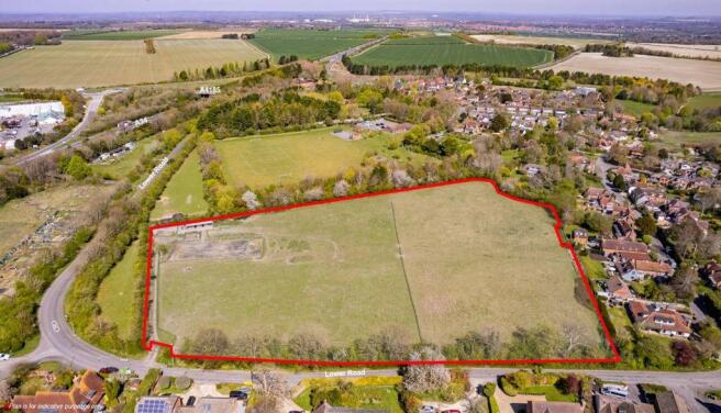
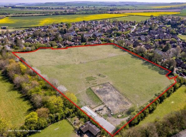
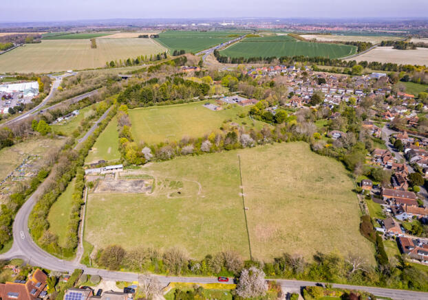
The site extends to approximately 6.16 acres (2.49 ha) and comprises a broadly rectangular field which is divided into a number of horse-grazed paddocks with a barn and stables located in the north western corner. There is also a menage of approx. 30m x 20m which is situated in front of the stables. The site falls from a high in the west to a low in the east. On a north-south axis, the site falls to the centre of the the site forming a distinctive valley-like depression. The site is bound to the east by residential properties which form the current settlement boundary, with Lower Road running along the southern boundary, beyond which are more residential properties. To the west of the site is a thin sliver of pasture which sits between the site and Lower Road leading up to Hagbourne Hill. Immediately to the north of the site is Chilton village hall and Chilton recreation ground.
Access to the site is currently provided via an existing gateway on the southern boundary off Lower Road.
Housing and Economic Land Availability Assessment (HELAA) - The site has previously been submitted and assessed under the HELAA 2017 as two parcels; The Paddock Lower Road (1) ref: V078 and The Paddock Lower Road (2) ref: V078. Both sites were considered to be suitable for further consideration as available and achievable.
The site is available for sale. Offers are invited for the freehold on an unconditional basis. Offers should be sent to Bruton Knowles by Noon on Wednesday 4th June 2025 via email to Harry Breakwell: harry.
Viewings - The site can be viewed from the gateway on Lower Road, however on-site viewings are strictly by prior appointment only with Bruton Knowles.
Brochures
Strategic Land , The Paddock, Lower Road , Chilton, Didcot, Oxfordshire , OX11

NEAREST STATIONS
Distances are straight line measurements from the centre of the postcode- Didcot Parkway Station3.9 miles
Notes
Disclaimer - Property reference 12221FH. The information displayed about this property comprises a property advertisement. Rightmove.co.uk makes no warranty as to the accuracy or completeness of the advertisement or any linked or associated information, and Rightmove has no control over the content. This property advertisement does not constitute property particulars. The information is provided and maintained by Bruton Knowles, Gloucester. Please contact the selling agent or developer directly to obtain any information which may be available under the terms of The Energy Performance of Buildings (Certificates and Inspections) (England and Wales) Regulations 2007 or the Home Report if in relation to a residential property in Scotland.
Map data ©OpenStreetMap contributors.