
LOT 2 - Land At Long Sutton, Langport, Somerset, TA10
- PROPERTY TYPE
Land
- SIZE
872,071 sq ft
81,018 sq m
Key features
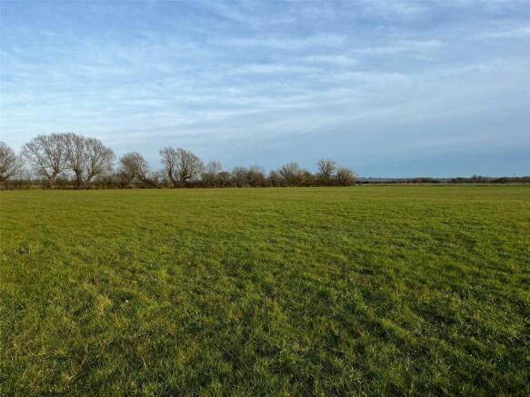
- Permanent pasture
- Single large enclosure
- Level lying
Description
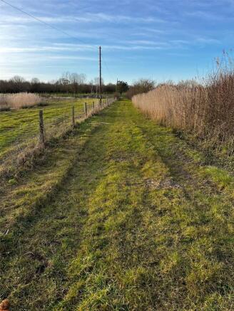
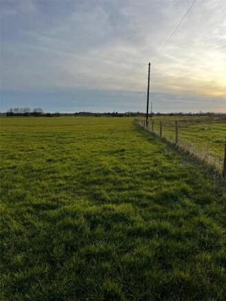
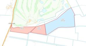
Lot 2, as shaded in blue on the site plan, comprises approximately 20.02 acres of pasture contained within a single enclosure. The land is predominately enclosed with ditch and some mature hedgerow boundaries with stock proof fencing in part.
The land is sold with a right of access, at all times and for all purposes from the gate, over land edged yellow on the plan, off Ilchester Lane to access the land to the south.
We understand that the land is classified as being Grade 4 on the Land Classification maps.
The land is in areas of medium and high risk from river or sea flooding and low, medium and high risk from surface water flooding. (Gov.uk)
The land is situated south of the popular village Long Sutton. The villages of Long Sutton and Long Load are located within less than a 1.5km radius and offer basic services and amenities. The land lies adjacent to the B3165, providing convenient access to the town of Yeovil, approximately 12km to the south.
Brochures
ParticularsLOT 2 - Land At Long Sutton, Langport, Somerset, TA10

NEAREST STATIONS
Distances are straight line measurements from the centre of the postcode- Yeovil Pen Mill Station7.7 miles


Notes
Disclaimer - Property reference CHG250036. The information displayed about this property comprises a property advertisement. Rightmove.co.uk makes no warranty as to the accuracy or completeness of the advertisement or any linked or associated information, and Rightmove has no control over the content. This property advertisement does not constitute property particulars. The information is provided and maintained by Greenslade Taylor Hunt, Chard. Please contact the selling agent or developer directly to obtain any information which may be available under the terms of The Energy Performance of Buildings (Certificates and Inspections) (England and Wales) Regulations 2007 or the Home Report if in relation to a residential property in Scotland.
Map data ©OpenStreetMap contributors.