
St Mary's Road, Dymchurch, Romney Marsh, Kent, TN29

- PROPERTY TYPE
Land
- SIZE
222,592 sq ft
20,679 sq m
Key features
- For Sale by Informal Tender
- Grade II arable and
- Rural location
- Country lane
Description
#TheGardenOfEngland
For sale by Informal Tender closing at 12pm on Friday 13th June 2025.
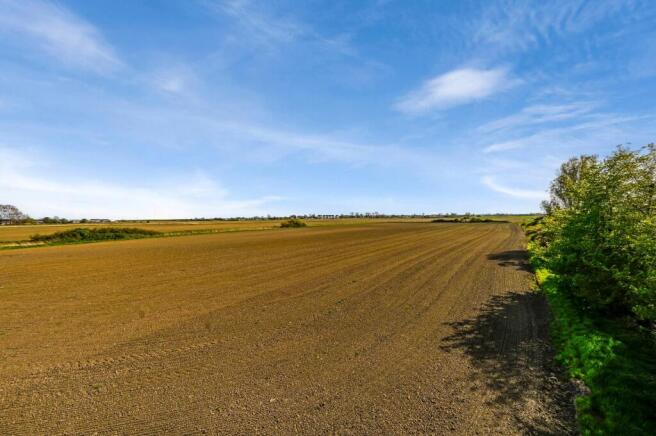
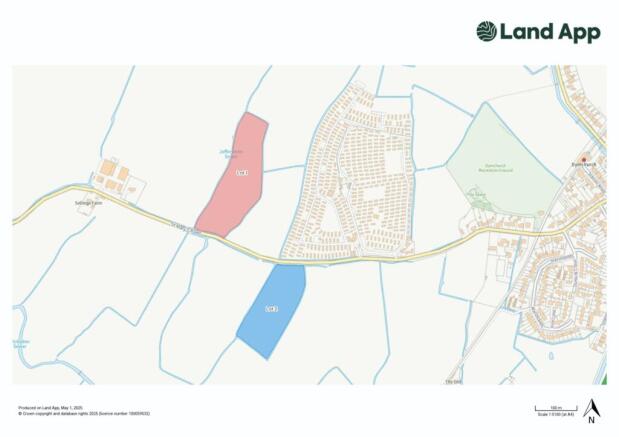
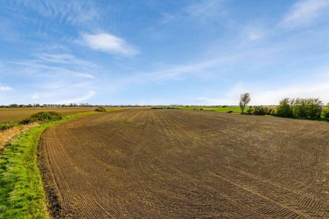
An opportunity to purchase two parcels of Grade II land in a rural location on a country lane on the edge of Dymchurch, Romney Marsh. Each parcel has lane frontage and single entrance gateways onto St Marys Road. Both parcels are enclosed by open ditches with mature hedgerows defining the road boundary.
Both parcels of land are currently let to local farmers who are scheduled to vacate the land in the Autumn. Viewers are requested to not leave gates open when they view.
Lot 1 – Polehampton Field – Pastureland (coloured red - about 6.37 acres)
Lot 2 – Rookery Field - Arable land (coloured blue -about 5.11 acres)
Guide Prices:
Lot 1 (red on plan): £70,000 to £80,000
Lot 2 (blue on plan): £60,000 to £70,000
Method of Sale
The property is offered for sale by Informal Tender closing at 12.00pm on 13th June 2025. Your offer must represent your “best and final offer” and only offers submitted on the fully completed tender form attached and accompanied by ALL the information requested will be considered.
Tenancies
Both parcels are currently let to 2 local farmers on Farm Business Tenancy agreements. Notices have been served and the tenants will vacate on the 28th September 2025 (Polehampton Field) and 10th October 2025 (Rookery Field).
Drainage Rates
We understand that a small annual land drainage payment is payable in respect of both fields to the Romney Marshes Area Internal Drainage Board ((
Footpaths
There are no footpaths or public rights of way crossing or affecting the land.
Plans/Boundaries & Acreages
The plan on these sales particulars and the acreage quoted are based on the latest Ordnance Survey mapping and therefore are strictly for identification and guidance only. Interested parties are reminded that the land is sold in accordance with the owners Land Registry Title plan/s, and they must satisfy themselves as to the accuracy of boundaries and the quantity of land being purchased.
Planning/Local Authority
All planning enquiries relating to any future use of the land should be directed to the planning department at Folkestone & Hythe Borough Council (folkestone-hythe.gov.uk).
Services
There are no mains services connected.
Viewings/Health & Safety
Viewings are to take place on an unaccompanied basis during daylight hours, but these are strictly by appointment through Hobbs Parker Estate Agents. Viewers are asked to contact Hobbs Parker at or on with their full address, contact details & vehicle registration number informing us of when you intend to view.
Viewers are asked to exercise extreme caution when viewing, especially when climbing over the locked gates, and must have regard for their own safety during their inspection. The vendors and their agents do not accept any responsibility for any accident or injury because of your inspection of the property.
Our Ref: AEA250031
Brochures
ParticularsSt Mary's Road, Dymchurch, Romney Marsh, Kent, TN29

NEAREST STATIONS
Distances are straight line measurements from the centre of the postcode- Sandling Station6.0 miles

About Hobbs Parker Estate Agents, Ashford
Romney House Monument Way, Orbital Park, Ashford, TN24 0HB


Notes
Disclaimer - Property reference AEA250031. The information displayed about this property comprises a property advertisement. Rightmove.co.uk makes no warranty as to the accuracy or completeness of the advertisement or any linked or associated information, and Rightmove has no control over the content. This property advertisement does not constitute property particulars. The information is provided and maintained by Hobbs Parker Estate Agents, Ashford. Please contact the selling agent or developer directly to obtain any information which may be available under the terms of The Energy Performance of Buildings (Certificates and Inspections) (England and Wales) Regulations 2007 or the Home Report if in relation to a residential property in Scotland.
Map data ©OpenStreetMap contributors.