Lot 1 Wickhurst Farm
- PROPERTY TYPE
Farm Land
- SIZE
4,793,778 sq ft
445,357 sq m
Key features
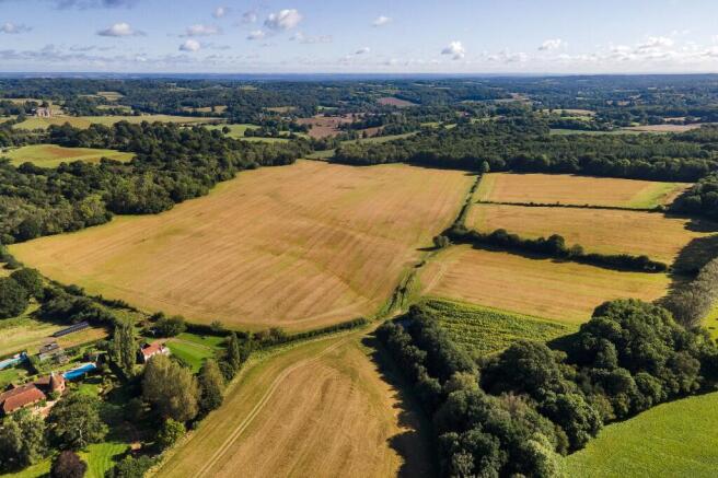
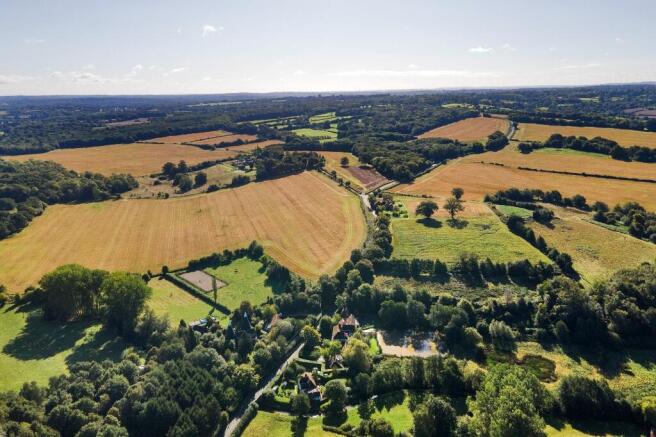
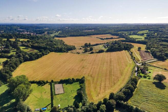
- Arable & Grass Land extending to 110.05 acres
- Arable - 101.61 acres
- Grass - 8.44 acres
- River frontage
- Good working field sizes
Description
Wickhurst Farm North comprises various parcels of arable and grass land extending to 110.05 acres. The arable land extends to 101.61 acres with a single parcel of permanent grass central to the parcel that extends to 8.44 acres. There is river frontage to the north and the fields are of a good working size.
The land in its entirety is classified as Grade III on the Agricultural Land Classification Plan for England & Wales. Soil types are relatively free draining, typical of this part of the High Weald locality. The woodland at Wickhurst is made up of natural broadleaved species and used by a shoot under the terms of a verbal arrangement. There is potential for the farm in Biodiversity Net Gain as well as nitrate neutrality along the river frontage.
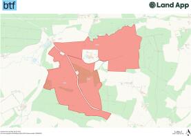
Please see the boundary plan showing the extent of the land and buildings included within their own lots.
Brochures
Brochure 1Lot 1 Wickhurst Farm

NEAREST STATIONS
Distances are straight line measurements from the centre of the postcode- Wadhurst Station1.9 miles
- Frant Station2.0 miles
- Tunbridge Wells Station4.1 miles
Notes
Disclaimer - Property reference Lot1WickhurstR12834AC. The information displayed about this property comprises a property advertisement. Rightmove.co.uk makes no warranty as to the accuracy or completeness of the advertisement or any linked or associated information, and Rightmove has no control over the content. This property advertisement does not constitute property particulars. The information is provided and maintained by BTF Partnership, Heathfield. Please contact the selling agent or developer directly to obtain any information which may be available under the terms of The Energy Performance of Buildings (Certificates and Inspections) (England and Wales) Regulations 2007 or the Home Report if in relation to a residential property in Scotland.
Map data ©OpenStreetMap contributors.