
Willian, Letchworth, Hertfordshire
Letting details
- Let available date:
- Ask agent
- PROPERTY TYPE
Land
- SIZE
92,967,930 sq ft
8,637,011 sq m
Description
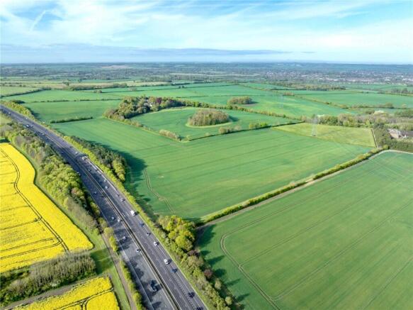
Manor Farm is located in semi-contiguous blocks around Letchworth Garden City. It is easily accessible from both the A505 and the A1(M) Junction 9, which the holding adjoins.
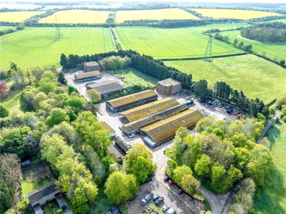
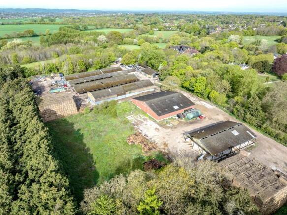
Lot 1 of the holding comprises 2,134.25 acres, a range of farm buildings at Manor Farm, Willian and a grain store at Nortonbury
The principal block of land, including the yard and buildings at Manor Farm, Willian, extends south from Baldock and along the southern boundary of Letchworth Garden City toward Gt Wymondley. Two further blocks are located to the north of Letchworth Garden City.
The land is classified as Grade 2 and Grade 3 as recorded in the Soil Survey for England and Wales. The majority of the land is arable.
Lot 1 totals 2,134.25 acres comprised of 2,005.27 acres arable land, 64.36 acres pasture and 64.62 acres woodland.
Two three-bedroom cottages are available as accommodation for farm workers, if required.
The holding is available for a term of up to 10 years
SG6 2AH is a nearby postcode
Brochures
ParticularsWillian, Letchworth, Hertfordshire

NEAREST STATIONS
Distances are straight line measurements from the centre of the postcode- Letchworth Station1.8 miles
- Hitchin Station1.6 miles
- Baldock Station3.1 miles


Notes
Disclaimer - Property reference RUR250126_L. The information displayed about this property comprises a property advertisement. Rightmove.co.uk makes no warranty as to the accuracy or completeness of the advertisement or any linked or associated information, and Rightmove has no control over the content. This property advertisement does not constitute property particulars. The information is provided and maintained by Bidwells, Cambridge. Please contact the selling agent or developer directly to obtain any information which may be available under the terms of The Energy Performance of Buildings (Certificates and Inspections) (England and Wales) Regulations 2007 or the Home Report if in relation to a residential property in Scotland.
Map data ©OpenStreetMap contributors.