Land at Flamstead, Hertfordshire
£0.23 per sq ft
Business rates & charges may apply
- SIZE AVAILABLE
12,771,792 sq ft
1,186,539 sq m
- SECTOR
Land for sale
Description
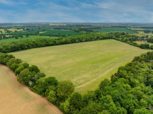
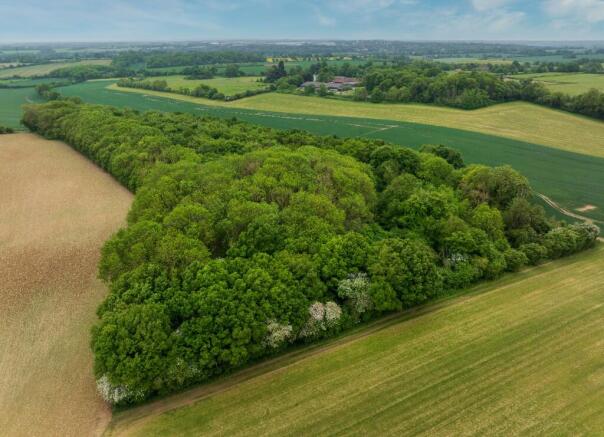
LOT 2 6.70 acres (2.71 ha) of woodland and 5.61 acres (2.27 ha) of arable land - Guide Price £150,000 - Sold
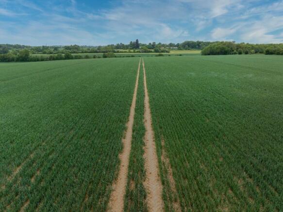
LOT 3 29.80 acres (12.06 ha) of arable land - Guide Price £300,000 - Under Offer
LOT 4 26.96 acres (10.92 ha) of arable, pasture and woodland Guide - Price £250,000
Offers in the region of 2,900,000
The property is offered for sale by Private Treaty as a whole or in up to four lots.
LOCATION & ACCESS
The land is located across two distinct blocks in a very accessible, but rural area to the south and west of the picturesque village of Flamstead in Hertfordshire. The property lies approximately five miles west of Harpenden, one mile east of the M1 motorway, and just 24 miles from Central London. The land benefits from excellent transport links while maintaining its rural character.
The land to the south lies in a single block, between the village of Flamstead and the hamlet of Gaddesden Row. Access is available from Puddephats Lane and Green Lane on its northern boundary.
The western block is situated just north of Gaddesden Row and to the east of the hamlet of Jockey End, with access being available from Beechwood Lane to the north and Puddephats Lane to the east.
The closest postcode to the southern block is AL3 8BL.
What3Words: ///warmers.pacifist.drones
The closest postcode to the western block is AL3 8AU.
What3Words: ///talked.putts.tribes
ENVIRONMENTAL SCHEMES
The property is subject to a Countryside Stewardship and Mid-Tier agreement, which expires on 31/12/2028. Further details available from the Vendor's agent.
METHOD OF SALE
The land is offered for sale as a whole or in up to 4 Lots by private treaty
TENURE & POSSESSION
The property is offered freehold with vacant possession available at Michaelmas 2025.
SPORTING, TIMBER & MINERAL RIGHTS
All sporting, timber and mineral rights are included within the sale in so far as they
are owned.
EARLY ENTRY
The purchasers will be granted the right of early entry on harvested fields after exchange of contracts, for cultivation and crop establishment for the 2026 harvest subject to payment of an additional 10% deposit.
EASEMENTS, WAYLEAVES & RIGHTS OF WAY
The property is sold subject to and with the benefit of all rights including rights of way, whether public or private, light, support, drainage, water and electricity supplies and any other rights and obligations, easements and quasi-easements, restrictive covenants, and all existing and proposed wayleaves for masts, pylons, stays, cables, drains, water and gas and other pipes, whether referred to in these particulars or not.
BOUNDARIES
The purchaser(s) will be deemed to have full knowledge of all boundaries and neither the vendor nor the vendor's agents will be responsible for defining the boundaries or ownership thereof.
LOCAL AUTHORITY
Dacorum Borough Council The Forum, Marlowes, Hemel Hempstead, HP1 1DN
VIEWINGS
Strictly by appointment with the selling agents. Interested parties are requested to contact the agents to arrange a viewing.
Brochures
Land at Flamstead, Hertfordshire

NEAREST STATIONS
Distances are straight line measurements from the centre of the postcode- Harpenden Station4.9 miles
- Hemel Hempstead Station4.6 miles
- Luton Parkway Station5.5 miles
About Ceres Property LLP, Saffron Walden
Ceres Property, Council Offices, London Road, Saffron Walden, CB11 4ERNotes
Disclaimer - Property reference LandatFlamstead. The information displayed about this property comprises a property advertisement. Rightmove.co.uk makes no warranty as to the accuracy or completeness of the advertisement or any linked or associated information, and Rightmove has no control over the content. This property advertisement does not constitute property particulars. The information is provided and maintained by Ceres Property LLP, Saffron Walden. Please contact the selling agent or developer directly to obtain any information which may be available under the terms of The Energy Performance of Buildings (Certificates and Inspections) (England and Wales) Regulations 2007 or the Home Report if in relation to a residential property in Scotland.