Horsham Road, Handcross
- PROPERTY TYPE
Land
- SIZE
1,568,160 sq ft
145,687 sq m
Key features
- Excellent block of mixed mature woodland
- Convenient semi-rural position
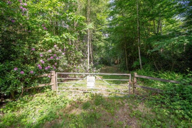
- Gated vehicular access and parking area
- Flooded with bluebells in the spring
- Natural water course flowing through it
- In total approximately 36 acres
Description
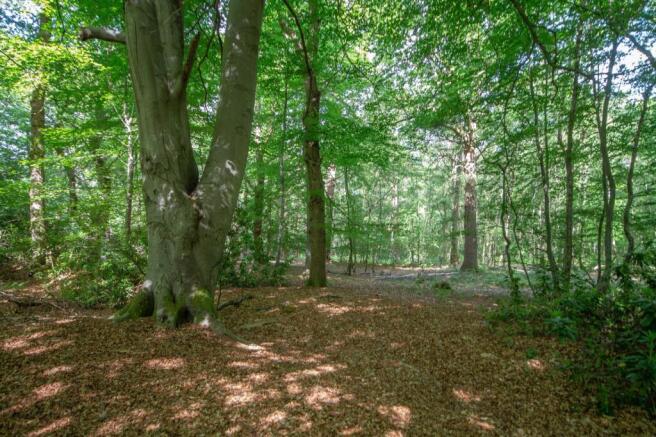
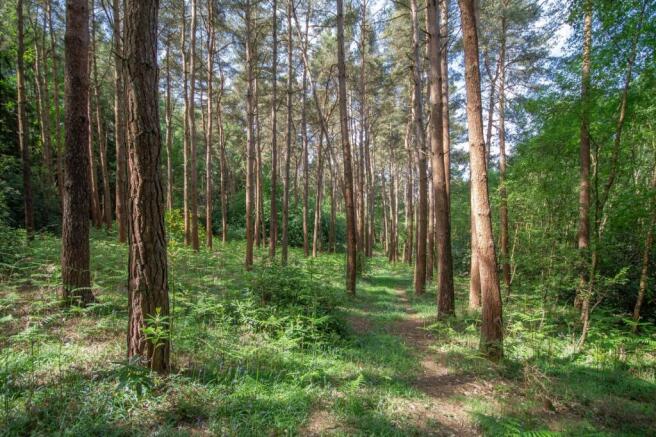
An excellent block of mixed mature woodland located in a semi-rural position in between the villages of Handcross and Lower Beeding, with gated vehicular access. In total approximately 36 acres.
DESCRIPTION
A rare opportunity to acquire this block of mixed mature woodland lying in a semirural
position in between Handcross and Lower Beeding. The land has a wonderful array of mature broad leaf and evergreen standing timber from oaks, beech, larch, pine and horse chestnut and is fl ooded with bluebells in the spring. There is a natural water course fl owing through it and a gated entrance from Handcross Road. And
interesting feature in the woods is a World War II bunker which is located on the northern border. The land is gently undulating and would appeal to a wide range of potential owners.
Brochures
ParticularsHorsham Road, Handcross

NEAREST STATIONS
Distances are straight line measurements from the centre of the postcode- Faygate Station3.8 miles
- Littlehaven Station4.1 miles
- Balcombe Station3.8 miles
About Batcheller Monkhouse, Haywards Heath
67-69 The Broadway, Haywards Heath, RH16 3AS


Notes
Disclaimer - Property reference HAY250111. The information displayed about this property comprises a property advertisement. Rightmove.co.uk makes no warranty as to the accuracy or completeness of the advertisement or any linked or associated information, and Rightmove has no control over the content. This property advertisement does not constitute property particulars. The information is provided and maintained by Batcheller Monkhouse, Haywards Heath. Please contact the selling agent or developer directly to obtain any information which may be available under the terms of The Energy Performance of Buildings (Certificates and Inspections) (England and Wales) Regulations 2007 or the Home Report if in relation to a residential property in Scotland.
Map data ©OpenStreetMap contributors.