
Cotleigh, Honiton
- PROPERTY TYPE
Farm Land
- SIZE
Ask agent
Key features
- Commercial stand
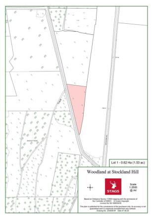
- 1.53 acres (0.62ha)
- No covenants
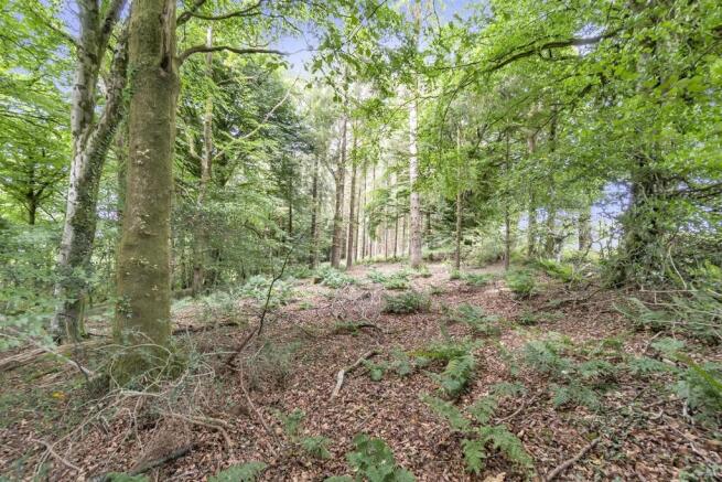
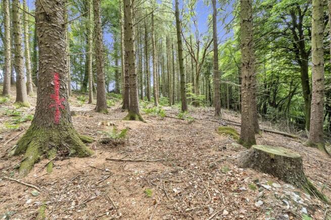
- Recently thinned
- Freehold
- No council tax/ business rates.
- Mature Sitka Spruce
Description
Situation - Positioned just off Stockland Hill (Seven mile straight) the woodland has access of a quiet country lane leading down to the village of Cotleigh.
Set within the Blackdown Hills National Landscape (formerly known as AONB), the woodland is part way between the A30/A303 to the north and A35 to the South, providing easy access to the nearby towns of Honiton, Axminster and Taunton.
Woodland - Extending to 1.53 acres (0.62 acres) this commercial stand of Sitka Spruce has recently been thinned by the current owner providing more space to the existing trees to fully mature. Forming the southern point of a larger area of woodland this opportunity is offered for sale by private treaty.
Viewings - With details in hand after calling Stags
Boundaries - The plan enclosed is for identification purposes only. There are natural boundaries to the east and west with trees marked forming the northern boundary.
What 3 Words Location - ///sprinter.walls.stumpy
Brochures
Cotleigh, HonitonCotleigh, Honiton

NEAREST STATIONS
Distances are straight line measurements from the centre of the postcode- Honiton Station3.6 miles
- Axminster Station5.3 miles


Notes
Disclaimer - Property reference 34166821. The information displayed about this property comprises a property advertisement. Rightmove.co.uk makes no warranty as to the accuracy or completeness of the advertisement or any linked or associated information, and Rightmove has no control over the content. This property advertisement does not constitute property particulars. The information is provided and maintained by Stags, Honiton. Please contact the selling agent or developer directly to obtain any information which may be available under the terms of The Energy Performance of Buildings (Certificates and Inspections) (England and Wales) Regulations 2007 or the Home Report if in relation to a residential property in Scotland.